![]()

![]()
This is the DEA Notebooks and DEA Tools repository of Digital Earth Australia. These can be viewed on the DEA Knowledge Hub or run on the DEA Sandbox or the National Computational Infrastructure (NCI).
Contribute — DEA Notebooks is open-source and we would love your contribution! Learn how to contribute below.
License — The code in this repository is licensed under the Apache License, Version 2.0. DEA data is licensed under the Creative Commons by Attribution 4.0 license.
Documentation — See the DEA Notebooks Wiki.
Contact — For assistance with any of these notebooks and tools,
please ask a question on our Open Data Cube Slack
channel or on the GIS Stack
Exchange
using the open-data-cube tag. You can also report an issue on this
repository.
Citation — If you use this repository in your work, please reference it with the following citation.
Krause, C., Dunn, B., Bishop-Taylor, R., Adams, C., Burton, C., Alger, M., Chua, S., Phillips, C., Newey, V., Kouzoubov, K., Leith, A., Ayers, D., Hicks, A., DEA Notebooks contributors 2021. Digital Earth Australia notebooks and tools repository. Geoscience Australia, Canberra. https://doi.org/10.26186/145234
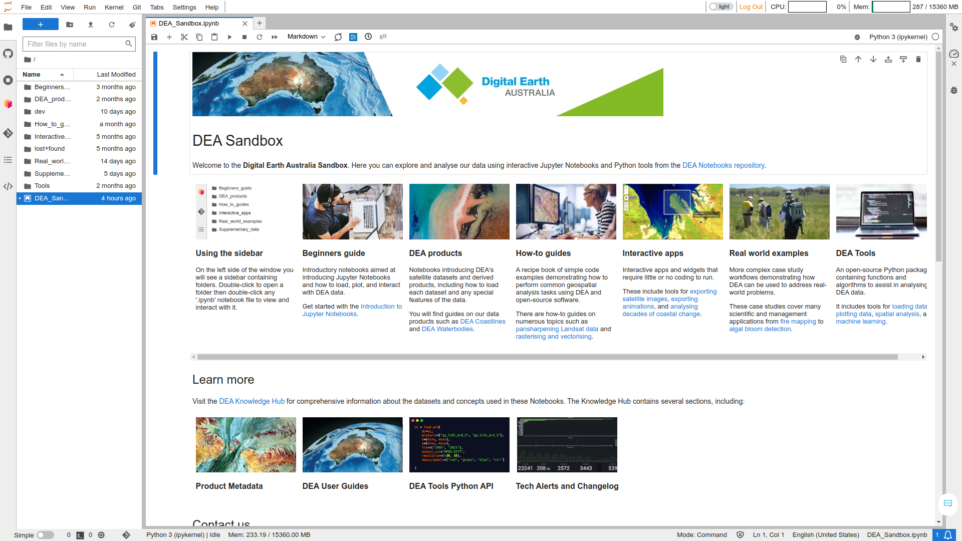
The Jupyter Notebooks and Python tools in this repository are for analysing DEA's satellite data products. The notebooks are designed to demonstrate how to use the DEA data and tools to conduct a broad range of geospatial analyses. They also demonstrate how to integrate with other open-source software such as Open Data Cube and xarray. You can see examples of use cases on the USAGE page.
The DEA Knowledge Hub is where you can easily view the notebooks and read DEA Tools documentation. You can browse the following sections.
- Beginner’s guide — Introductory notebooks aimed at introducing Jupyter Notebooks and how to load, plot, and interact with DEA data.
- DEA products — Notebooks introducing DEA's satellite datasets and derived products, including how to load each dataset and any special features of the data.
- How-to guides — A recipe book of simple code examples demonstrating how to perform common geospatial analysis tasks using DEA and open-source software.
- Interactive apps — Interactive apps and widgets that require little or no coding to run.
- Real-world examples — More complex case study workflows demonstrating how DEA can be used to address real-world problems.
- DEA Tools Package — An open-source Python package containing functions and algorithms to assist in analysing DEA data.
The DEA Sandbox is a free virtual environment for interacting with the notebooks and tools from your web browser. You can use the Sandbox to conduct geospatial analysis without installing anything on your computer. Learn how to use the DEA Sandbox.
The National Computational Infrastructure is a supercomputer environment available to Australian researchers, academics, and other users by negotiation. The NCI can be used for high-performance geospatial analysis. Learn how to use the NCI.
To get started, see these articles in the wiki.
We would also appreciate it if you could add your a citation to our USAGE page.