Skip to content

GitHub Stars GitHub Forks PyPI PyPI license: EUPL v1.2 Documentation Status DOI

What's New: GemPy 2024.1 (a.k.a GemPy v3) Release!

Welcome to the era of GemPy v3! We are thrilled to announce the release of the latest version, a product of meticulous planning, redesign, and rigorous testing. While the core essence remains intact, v3 brings significant enhancements and novelties that promise to revolutionize your geomodeling experience.

Delve into the exciting new features in the What's New in GemPy v3.

The journey from GemPy v2 to v3 has been transformative. To ensure that our users don't lose out on any previous functionalities, we've shifted v2 to a package named gempy_legacy. While the core team will not develop any new features for this version, we'll continue maintaining it based on community requests.

Overview

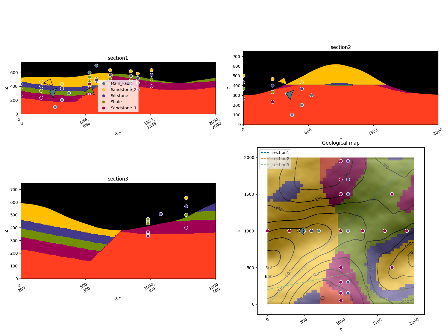
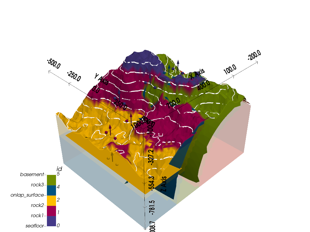
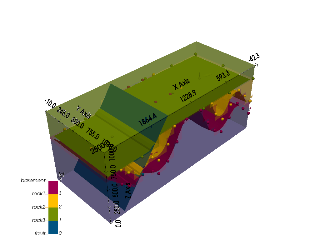
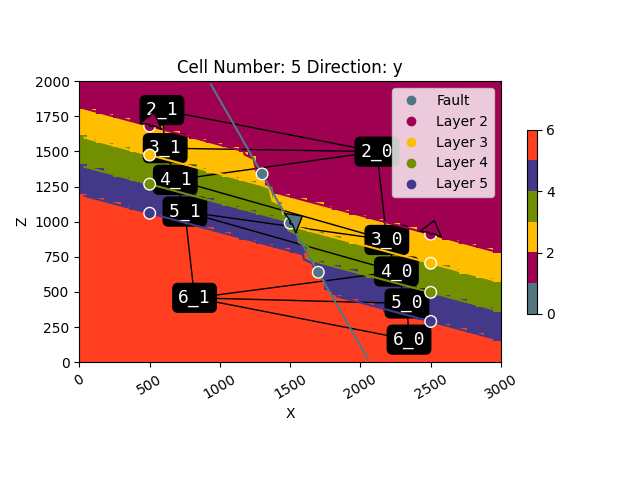
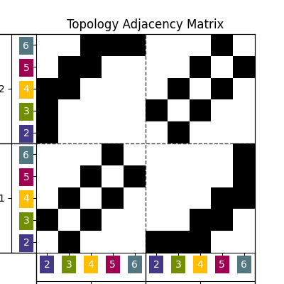
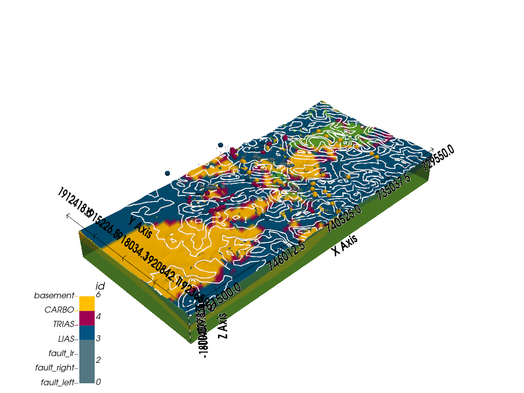
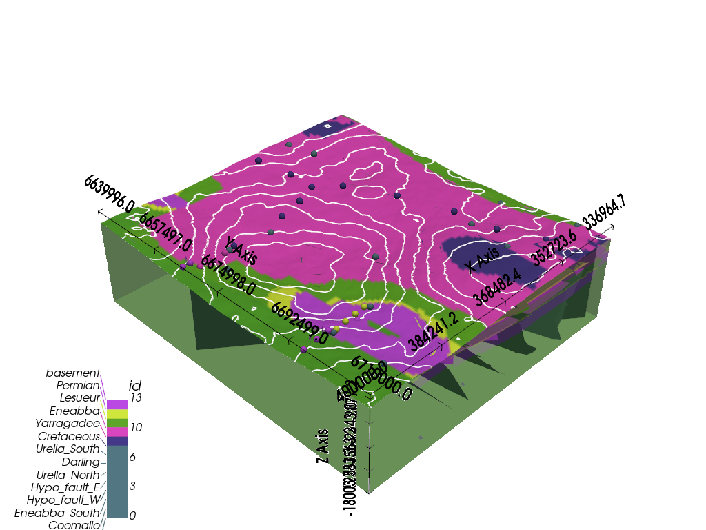
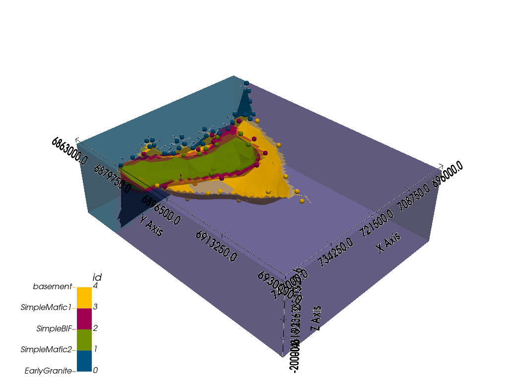
GemPy is a Python-based, open-source geomodeling library. It is capable of constructing complex 3D geological models of folded structures, fault networks and unconformities, based on the underlying powerful implicit representation approach.

Installation

We provide the latest release version of GemPy via PyPi package services. We highly recommend using PyPi,

$ pip install gempy[base]

Resources

After installation, you can either check the notebook tutorials or the video introduction to get started.

Go to the documentation site for further information and enjoy the tutorials and examples.

For questions and support, please use discussions.

If you find a bug or have a feature request, create an issue.

Follow these guidelines to contribute to GemPy.

Gallery

Geometries

colormapped image plot thumbnail colormapped image plot thumbnail colormapped image plot thumbnail

Features

colormapped image plot thumbnail colormapped image plot thumbnail colormapped image plot thumbnail

Case studies

colormapped image plot thumbnail colormapped image plot thumbnail colormapped image plot thumbnail

Pinned Loading

  1. gempy_engine Public

    Python 2 1

  2. gempy Public

    GemPy is an open-source, Python-based 3-D structural geological modeling software, which allows the implicit (i.e. automatic) creation of complex geological models from interface and orientation da…

    Python 1.1k 243

Repositories

Showing 10 of 14 repositories
  • gempy_engine Public
    Python 2 EUPL-1.2 1 2 2 Updated Mar 23, 2025
  • gempy Public

    GemPy is an open-source, Python-based 3-D structural geological modeling software, which allows the implicit (i.e. automatic) creation of complex geological models from interface and orientation data. It also offers support for stochastic modeling to address parameter and model uncertainties.

    Python 1,066 EUPL-1.2 243 17 2 Updated Mar 23, 2025
  • gempy_viewer Public
    Python 0 EUPL-1.2 1 2 0 Updated Mar 23, 2025
  • .github Public
    0 0 0 0 Updated Mar 16, 2025
  • Python 0 EUPL-1.2 0 1 0 Updated Sep 16, 2024
  • gempy_plugins Public
    Python 0 EUPL-1.2 2 1 0 Updated Jun 9, 2024
  • gempy-geotop Public Forked from terranigma-solutions/gempy-geotop-pilot

    Modeling areas of Netherlands using GemPy

    Python 1 EUPL-1.2 1 0 0 Updated Jun 9, 2024
  • subsurface_welly Public archive Forked from agilescientific/welly

    Fork maintained by the gempy-project to ensure compatibility with subsurface and other libraries of the ecosystem

    Python 0 Apache-2.0 137 0 0 Updated Apr 22, 2024
  • Python 3 EUPL-1.2 2 0 1 Updated Mar 18, 2024
  • temp_gp3_docs Public
    HTML 0 0 0 0 Updated Nov 22, 2023

Sponsors

  • @amalonso90
  • @agzimmerman
  • @Leguark

Top languages

Loading…

Most used topics

Loading…