Add ISMIP6 Antarctic ocean regions #160
Conversation
|
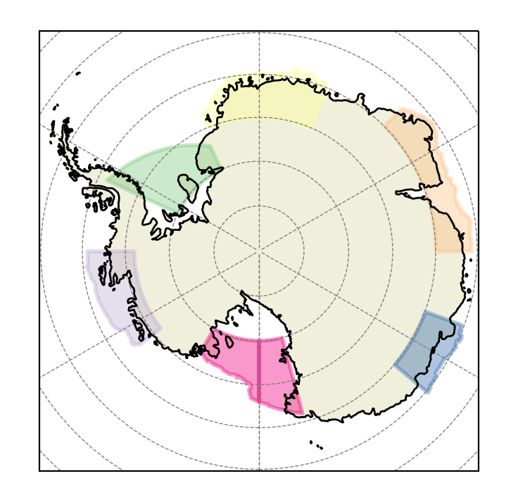
@alicebarthel, this PR adds the features we discussed to For now, I would like you to take a careful look at each of these 6 (just on GitHub is fine) and make sure they make sense: The Ross is divided into 2 halves because it crosses the date line (antemeridian). That's just a weird requirement of geojson files. Here's a polar stereographic image for reference:
The other feedback I need from you is what zmin and zmax should be. Currently, they're -1000 and -200, but that's just because that happened to be what we used for the shelf in our previous Antarctic shelf regions. |
feature_creation_scripts/ismip6_antarctic_ocean_regions/ismip6_antarctic_ocean_regions.py
Outdated
Show resolved
Hide resolved
|
Xylar, the regions look good. Maybe some marginal differences but I reckon due to the plotting and topo, as the values shown in the raw geojson files correspond to the ones I have given. Please just clarify the continental shelf threshold when you can (it should be 1500m). |
feature_creation_scripts/ismip6_antarctic_ocean_regions/ismip6_antarctic_ocean_regions.py
Show resolved
Hide resolved
feature_creation_scripts/ismip6_antarctic_ocean_regions/ismip6_antarctic_ocean_regions.py
Show resolved
Hide resolved
And fix a random typo...
4bce5c6 to
b59d5e3
Compare
|
@alicebarthel, thanks for the review! I'm going to do a test to make sure this works in MPAS-Analysis before I merge this PR and make the release. It's a lot of work if I find out later that I made a mistake... |
b59d5e3 to
3ce5d30
Compare
|
Merging based on testing in MPAS-Dev/MPAS-Analysis#777 |
These features are the ones used to select CMIP5/6 models for ocean forcing in the ISMIP6 project. They will be used for analysis in a paper that is in progress.
This merge also adds a creation script for these features.