Use RegionSimplify to simplify your regions like that:

NEW: Multi processor computation + support for SHP, GeoPackage and GeoJSON formats.
- Download regionsimplify.zip and unzip somewhere.
- Run:
java -jar RegionSimplify.jar -i pathTo/myRegions.gpkgwherepathTo/myRegions.gpkgis the path to the input regions. You can alternativelly edit and execute RegionSimplify.bat (or RegionSimplify.sh for Linux users).
Java 1.9 or higher is required. The java version installed, if any, can be found with java --version command. Recent versions of Java can be installed from here.
- Input data must be a set of polygonal or multipolygonal features with no overlap between them.
- GeoPackage, Shapefile and GeoJSON formats are supported. For other formats, use a converter such as GDAL or QGIS.
- The projection of the input file must be specified. Both geographical and cartographic projections are supported.
- Some valid test datasets are provided in test_data folder.
The help is displayed with java -jar RegionSimplify.jar -h command.
| Parameter | Required | Description | Default value |
|---|---|---|---|
| -h | Show the help message | ||
| -i, --inputFile file | * | Input file. The supported formats are GeoPackage (.gpkg extension), SHP (.shp extension) and GeoJSON (*.geojson extension). | |
| -o, --outputFile file | Output file (format: GPKG, GeoJSON or SHP). | out.gpkg | |
| -s, --scaleDenominator double | The scale denominator for the target data. For a simplification to scale 1:1'000'000, the value should be 1000000. For a correspondance between zoom level and scale, see here. | 50000 | |
| -p, --parallel int | Set to 1 to use multiple processors in parallel. Set to 0 otherwise. | 1 | |
| -inb, --roundNb int | Number of iterations of the process. A small value returns a result faster, while a high value returns better quality result. | 10 | |
| -mcn, --maxCoordinatesNumber int | The maximum number of vertices of the input dataset. Above this value, the simplification will be applied automatically on a decomposition. See section below for more info. | 1000000 | |
| -omcn, --objMaxCoordinateNumber int | The maximum number of vertices of each region dataset. Above this value, the simplification will be applied automatically on a decomposition of the input dataset. See section below for more info. | 1000 |
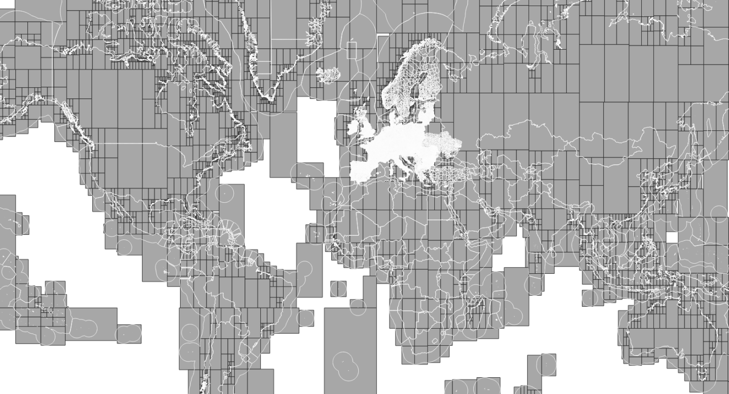
RegionSimplify can handle large datasets thanks to an automatic partionning mechanism. The principle is to decompose recursivelly the input dataset if it is too large, apply the simplification to the parts (possibly in parallel), and finally recompose the results. The partitionning is based on a quadtree structure as illustrated on the image below.
To use RegionSimplify on large datasets, you should thus:
- Increase the memory allocated to the program with Xmx and Xms parameters, such as:
java -Xmx12g -Xms4g -jar RegionSimplify.jar -i pathTo/myRegions.shp - Ajust the parameters -mcn and -omcn described in the table above. Low value mean intensive decomposition but fast simplifications. High values mean little decomposition but potentially time-consuming simplifications.
- Use parallel computation, for multi-processor computers. For that, ensure the parameter -p is set to 1 (which is the case by default).
RegionSimplify is used at Eurostat-GISCO for the production of statistical and administrative unit datasets at different scales, such as the NUTS dataset. For more information, see here.
Here are few comparison examples with MapShaper:
Feel free to ask support, fork the project or simply star it (it's always a pleasure). The source code is currently stored as part of JGiscoTools repository. It is mainly based on GeoTools and JTS Topology Suite.