Currently, heatmaps are created by using the point density, which is useful in most scenarios. However, it can't be used when we can't add the values of each point, such as elevation, average precipitations or temperature.
As we can't add temperature we would need to build the heatmap using an interpolation between the data we have, while it is not affected by two close points.
Example:
https://mgimond.github.io/Spatial/spatial-interpolation.html
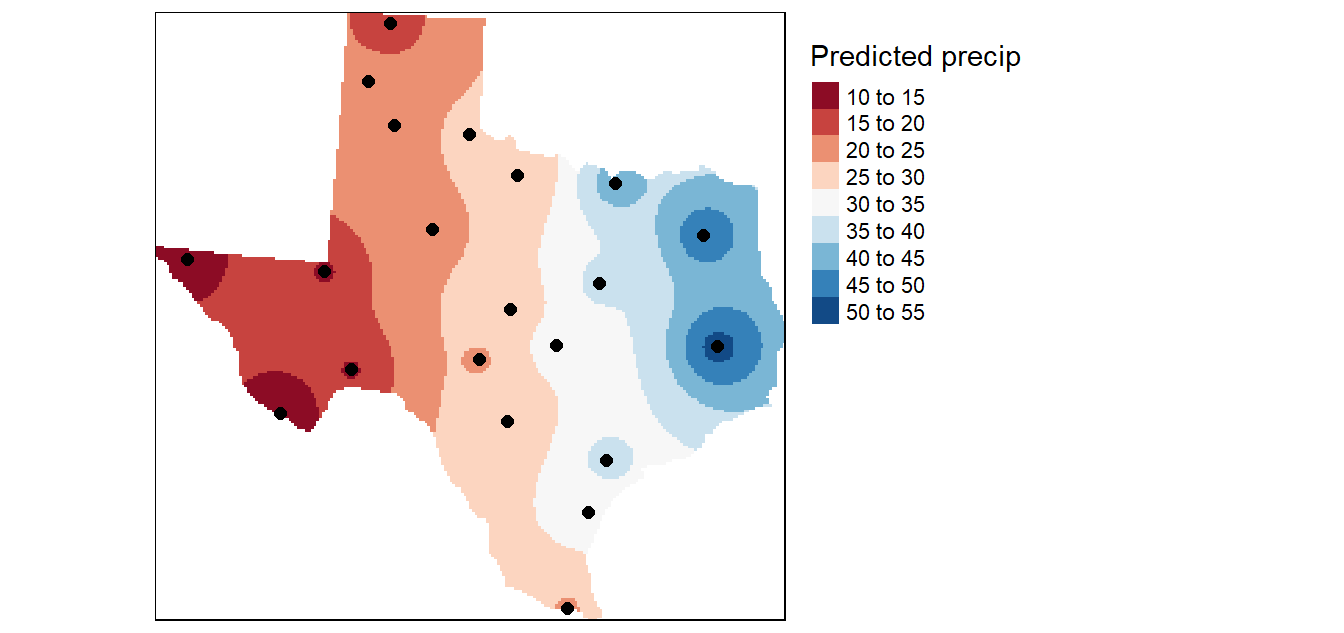
Source:

Possible result:
Currently, heatmaps are created by using the point density, which is useful in most scenarios. However, it can't be used when we can't add the values of each point, such as elevation, average precipitations or temperature.
As we can't add temperature we would need to build the heatmap using an interpolation between the data we have, while it is not affected by two close points.
Example:
https://mgimond.github.io/Spatial/spatial-interpolation.html
Source:
Possible result: