Label distance incorrect for labels below a line #24420
Comments
|
Author Name: Nyall Dawson (@nyalldawson) I can't reproduce (on master). Are you able to attach a sample project which demonstrates this issue? It may only show up when combined with some other combination of label settings.
|
|
Author Name: Nathan Perry (Nathan Perry) Yes. I should note that with this project, the issue seems to affect the polygon layer as well as the line layer.
|
|
Author Name: Nyall Dawson (@nyalldawson) I can't reproduce on 2.18.7. Try updating? |
|
Author Name: Nathan Perry (Nathan Perry) I have the most current version available, 2.18.2-1 for Mac OS. |
|
Author Name: Giovanni Manghi (@gioman) Nathan Perry wrote:
I have also seen it on 2.18.2 on macOS. If I find some time I will try to install 2.18.7 on the same platform and test also there.
|
|
Author Name: Nathan Perry (Nathan Perry) 2.18.7 is now released for Mac, and I can confirm the issue remains.
|
|
Author Name: Nathan Perry (Nathan Perry) And by way of update, still occurring in version 3.0.
|
|
Author Name: Giovanni Manghi (@gioman) End of life notice: QGIS 2.18 LTR Source: QGIS 3.4 has recently become our new Long Term Release (LTR) version. This is a major step in our history – a long term release version based on the massive updates, library upgrades and improvements that we carried out in the course of the 2.x to 3x upgrade cycle. We strongly encourage all users who are currently using QGIS 2.18 LTR as their preferred QGIS release to migrate to QGIS 3.4. This new LTR version will receive regular bugfixes for at least one year. It also includes hundreds of new functions, usability improvements, bugfixes, and other goodies. See the relevant changelogs for a good sampling of all the new features that have gone into version 3.4 Most plugins have been either migrated or incorporated into the core QGIS code base. We strongly discourage the continued use of QGIS 2.18 LTR as it is now officially unsupported, which means we’ll not provide any bug fix releases for it. You should also note that we intend to close all bug tickets referring to the now obsolete LTR version. Original reporters will receive a notification of the ticket closure and are encouraged to check whether the issue persists in the new LTR, in which case they should reopen the ticket. If you would like to better understand the QGIS release roadmap, check out our roadmap page! It outlines the schedule for upcoming releases and will help you plan your deployment of QGIS into an operational environment. The development of QGIS 3.4 LTR has been made possible by the work of hundreds of volunteers, by the investments of companies, professionals, and administrations, and by continuous donations and financial support from many of you. We sincerely thank you all and encourage you to collaborate and support the project even more, for the long term improvement and sustainability of the QGIS project.
|
Author Name: Nathan Perry (Nathan Perry)
Original Redmine Issue: 16514
Affected QGIS version: 2.18.2
Redmine category:labelling
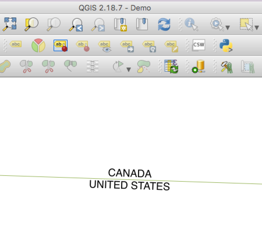
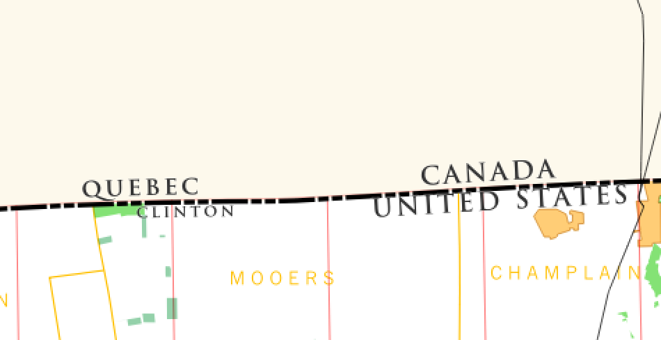
When placing labels along a polyline feature, setting the label distance does not have the correct effect for labels located beneath the line (i.e., when the top of the label is against the line).
To reproduce:
Labels that are located beneath the line will be closer to it than those that are above it. (See attached image, where all label distances are set to 0.5 mm.) By comparison, labels set by perimeter in a polygon feature appear to be located correctly.

The text was updated successfully, but these errors were encountered: