This is an implementation of the Uganda Example in Python, using Mesa and Mesa-Geo.
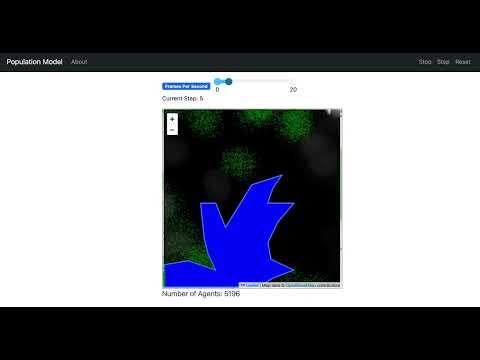
The GeoSpace consists of both a raster and a vector layer. The raster layer contains population data for each cell, and it is this data that is used for model initialisation, in the sense creating the agents. The vector layer shown in blue color represents a lake in Uganda. It overlays with the raster layer to mask out the cells that agents cannot move into.
The GeoAgents are people, created based on the population data. As this is a simple example model, the agents only move randomly to neighboring cells at each time step. To make the simulation more realistic and visually appealing, the agents in the same cell have a randomized position within the cell, so that they don’t stand on top of each other at exactly the same coordinate.
To run the model interactively, run solara run app.py in this directory. e.g.
solara run app.pyThen open your browser to http://127.0.0.1:8765/ and press the play button ▶.
The data is from the Uganda Example and is licensed under the Creative Commons Attribution-ShareAlike 4.0 International License.