- Call for Agenda Items
- Scheduling for the Islandora GIS Interest Group
- Presence of the Islandora GIS Interest Group at the Islandora Conference 1. Call for Volunteers
- Next Meeting 1. August 14, 2015
- Status of the Vagrant Environments
- Capturing feedback
- Intersection with the DevOps Interest Group
- Fedora Commons 4 and the Portland Common Data Model
- Identifying deliverables for the community 1. Conceptual data models? 2. The status of the Islandora 2.x code base
- Capturing use cases on GitHub
- Discussing Object metadata within the context of Fedora 4.x
- James Griffin (Lafayette College Libraries)
- Kim Pham (University of Toronto Scarborough Library)
- Peter MacDonald (Hamilton College)
@kimpham54 structured and submitted the following use cases:
@jrgriffiniii will implement integration tests covering both of these test cases
Regarding component B. of Issue #12, @jrgriffiniii has been parsing embedded metadata from GeoTIFF's using the ExifTool
This data has been structured within dc:coverage elements in compliance with the DCMI Point Scheme
Please see line islandora_gis.module
Addressing the issue of data modeling for Fedora Commons 4 within Islandora 2.x Islandora 2.x Node bundle fields should properly map to Hydra Model attributes (in order to maintain some basic degree of parity) @jrgriffiniii has created an issue in relation to this topic
Much of these bundle fields should be generated using metadata elements specified within the FGDC or ISO 19139 standards Ideally, the same fields would also be indexed by Apache Solr in both those cases for GeoBlacklight and Islandora 2.x/apache_solr
@jrgriffiniii has made more progress with the Puppet/Vagrant solutions for the Fedora Commons and Fedora Generic Search environments Feedback for these solutions has been captured within the following thread on the "islandora-dev" mailing list:
As a consequence of this progress, the Islandora Puppet/Vagrant solution should be relatively straightforward to implement
This solution serves to integrate the SIMILE Timeline widget Provides the ability to link "Event" attributes in relation to geospatial features on a geovisualization interface
http://sites.lafayette.edu/dss/files/2014/10/Screen-Shot-2014-11-07-at-11.09.48-AM.png
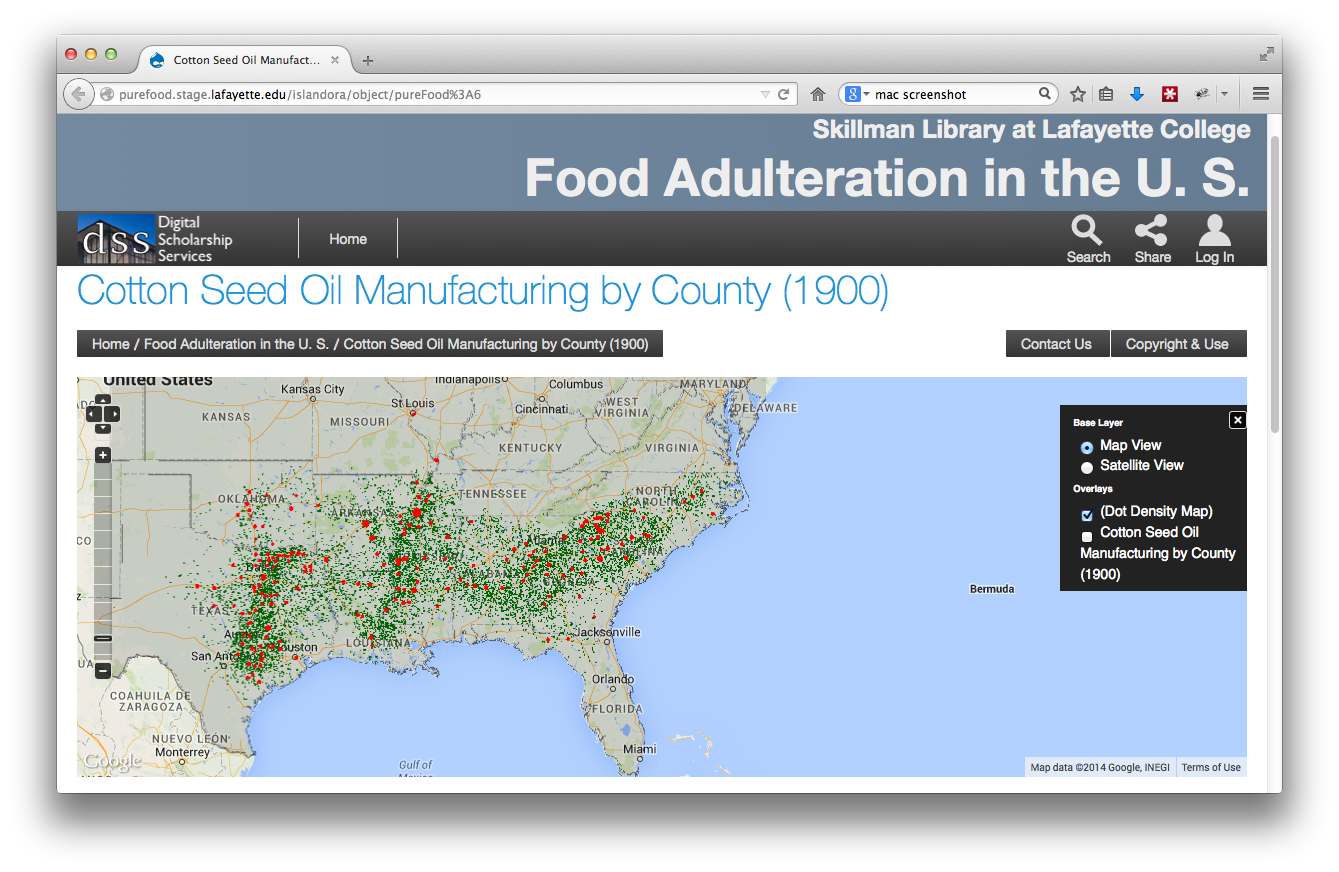
@jrgriffiniii outlined a number of more complex use cases dealing with the problems involving extensive symbolization logic One such case (a dot density plot) required that the PDF of a specific random distribution be utilized to dynamically calculate the location of and render additional vector points on a given map using certain Shapefile attribute values This, unfortunately, is not only a feature which is not offered by OpenLayers, but consumes significant browser resources The response in this case was to perform the visualization using a propriety desktop application, and to then generate a raster layer for the visualization
@jrgriffiniii also outlined the requests for a "crowdsourcing" solution for the Lafayette College Libraries In response to these requests, functionality enabling the "geotagging" of Islandora Objects (e. g. GeoTIFF's) using a mapping interface must be implemented Additionally, the ability to structure these "geotag" data sets as Shapefiles, and then ingest these into Islandora for persistent has been requested This is at the very early stages of development, and other issues shall likely become higher priorities