The UK has many different geographical boundaries and they are complex!
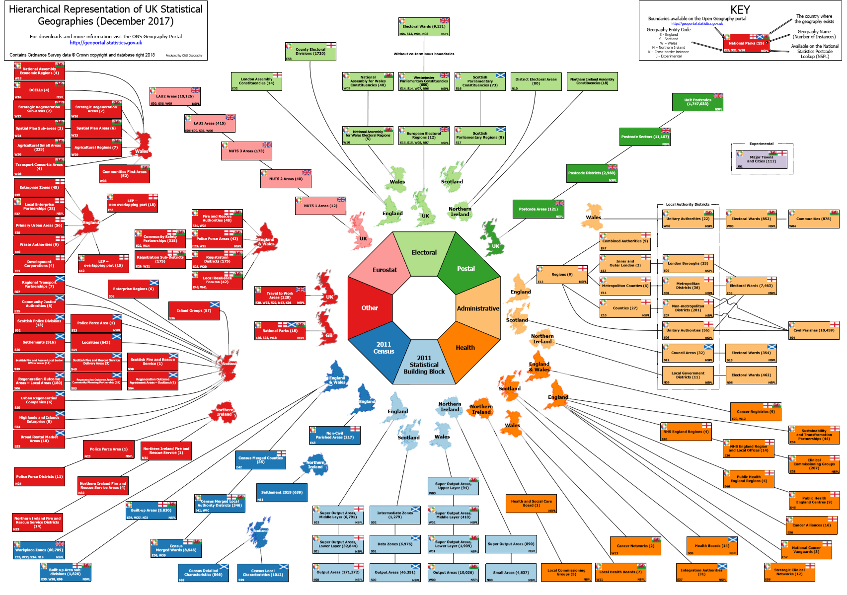
Many of these are available to download at the Office for National Statistics Geoportal
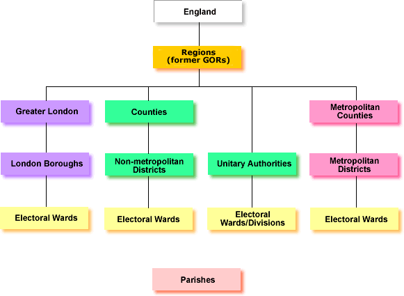
Libraries in the UK are administered by a mix of County Councils, Metropolitan districts, London boroughs, and Unitary authorities.
These are some common geographies used when profiling areas.
| Area type | Description |
|---|---|
| Census | Base unit areas called 'Output Areas' make up the ONS statistical 'Super Output Areas' released at two hierarchichal levels: Lower (contain ~1500 people) and Medium (contain ~7500 people). These are designed to fit within administrative, ward, and parish boundaries and are very useful for local government. Statistical data are released for these areas such as deprivation, age ranges, and ethnicity. |
| Postcode | Postcode geographies are at Area, District, Sector, and Unit level. For example, the Somerset Postcode Unit TA1 3XZ is in the TA Area, the TA1 District, and the TA1 3 Sector. |
So, what associated data can be gained from using these area definitions? A few are shown below.
| Data | Area | Description |
|---|---|---|
| Deprivation Indices | LSOA | Deprivation indices are comparative levels of deprivation for Lower Layer Super Output Areas (LSOAs). These are by deprivation type, for example health, education, and income. An index of multiple deprivation (IMD/WIMD) summarises all deprivation types to produce an overall ranking. |
| Estimated population | LSOA | Annual mid-year population estimates are released by the ONS, broken down by age and gender and released at Lower Super Output Level. |
| Rural/Urban | Output Area | There are classifications of each area of 'rurality' ranging from 'Major Conurbation' to 'Hamlets and Isolated Dwellings in a Sparse Setting' |