#elevation maps
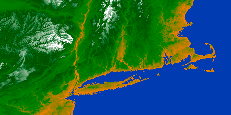
.DEM: (GTOPO30) USGS Worldwide 30 Arc-Second Elevation Data (more info: https://lta.cr.usgs.gov/GTOPO30)
- crop tiles
- convert between latitude/longitude and byte offset
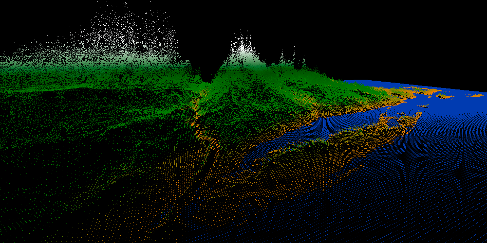
- point cloud mesh, triangle mesh
- elevation-based color array
download tiles: ftp://edcftp.cr.usgs.gov/data/gtopo30

#methods
 // mallocs GL_POINTS (x,y,z), stored in "points" with size of width*height
void elevationPointCloud(char *directory, char *filename, float latitude, float longitude, unsigned int width, unsigned int height, float** points, float** colors, unsigned int *numPoints);

void elevationTriangles(char *directory, char *filename, float latitude, float longitude, unsigned int width, unsigned int height, float **points, uint32_t **indices, float **colors, unsigned int *numPoints, unsigned int *numIndices);- lat/lon mark the center of the plate
- width and height are in km
- filename without extension: will read .DEM and .HDR (header)
// points
elevationPointCloud("~/Code/", "W100N90", 41.3110871, -72.8074902, 800, 400, &points, &colors, &numPoints);
//with
glVertexPointer(3, GL_FLOAT, 0, _points);
glColorPointer(3, GL_FLOAT, 0, _colors);
glDrawArrays(GL_POINTS, 0, _numPoints);
// filled triangles
elevationTriangles("~/Code/", "W100N90", 41.3110871, -72.8074902, 800, 400, &points, &indices, &colors, &numPoints, &numIndices);
//with
glVertexPointer(3, GL_FLOAT, 0, _points);
glColorPointer(3, GL_FLOAT, 0, _colors);
glDrawElements(GL_TRIANGLES, _numIndices, GL_UNSIGNED_INT, _indices);#scale
1 world coordinate = 1 km