A collection of Bash shell and Python scripts to scrape/collect weather data, web camera images, radar imagery, satellite views, etc. to display current weather information, time-lapse animations, and create an archive of weather observations. The goal of this project is to maintain a library of recent weather imagery focused on Kentucky and south-central region of Appalachia.
The scripts are used on Ubuntu 14 and requite a few packages to be installed on the server:
Web pages use Leaflet JS library to display current radar map overlays.
The primary script is make.sh which runs the other scripts in the proper order. You'll need to create a crontab to keep the weather data current.
# crontab example
# The source imagery and observations are downloaded every 30 minutes to conserve server storage.


*/30	*	*	* 	*	/bin/sh/	/path/to/weather/directory/make.sh
The scripts have a few goals:
- Pull down weather imagery and data with
wgetorcurl. - Process the imagery with
convertandmontageto make thumbnails, add date stamps, and optimize for web viewing - Scrape text data with
sed,awk, andpcregrepto format and serve on a web page. - Create animated gifs for national park webcams and archive the imagery with a unique URL every day.
- Create a raster tileset for the latest doppler radar for the Daniel Boone National Forest and serve on a slippy map.
- GOES-16 slippy map (https://www.outragegis.com/weather/goes16)
- Great Smoky Mountains National Park live weather (https://www.outragegis.com/weather/grsm/)
- Archive of time-lapse imagery for the Great Smoky Mountains (https://www.outragegis.com/weather/img/animation/)
- Cumberland Gap National Historical Park live weather (https://www.outragegis.com/weather/gap)
- Latest radar for the Daniel Boone country (https://www.sheltoweetrace.com/hike/radar.html)
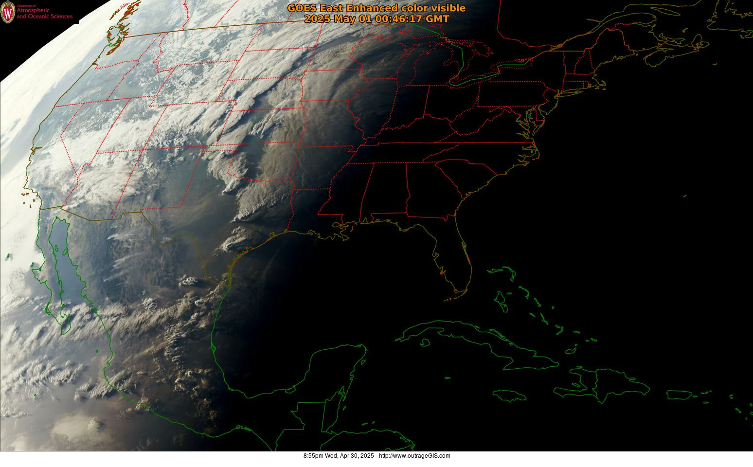
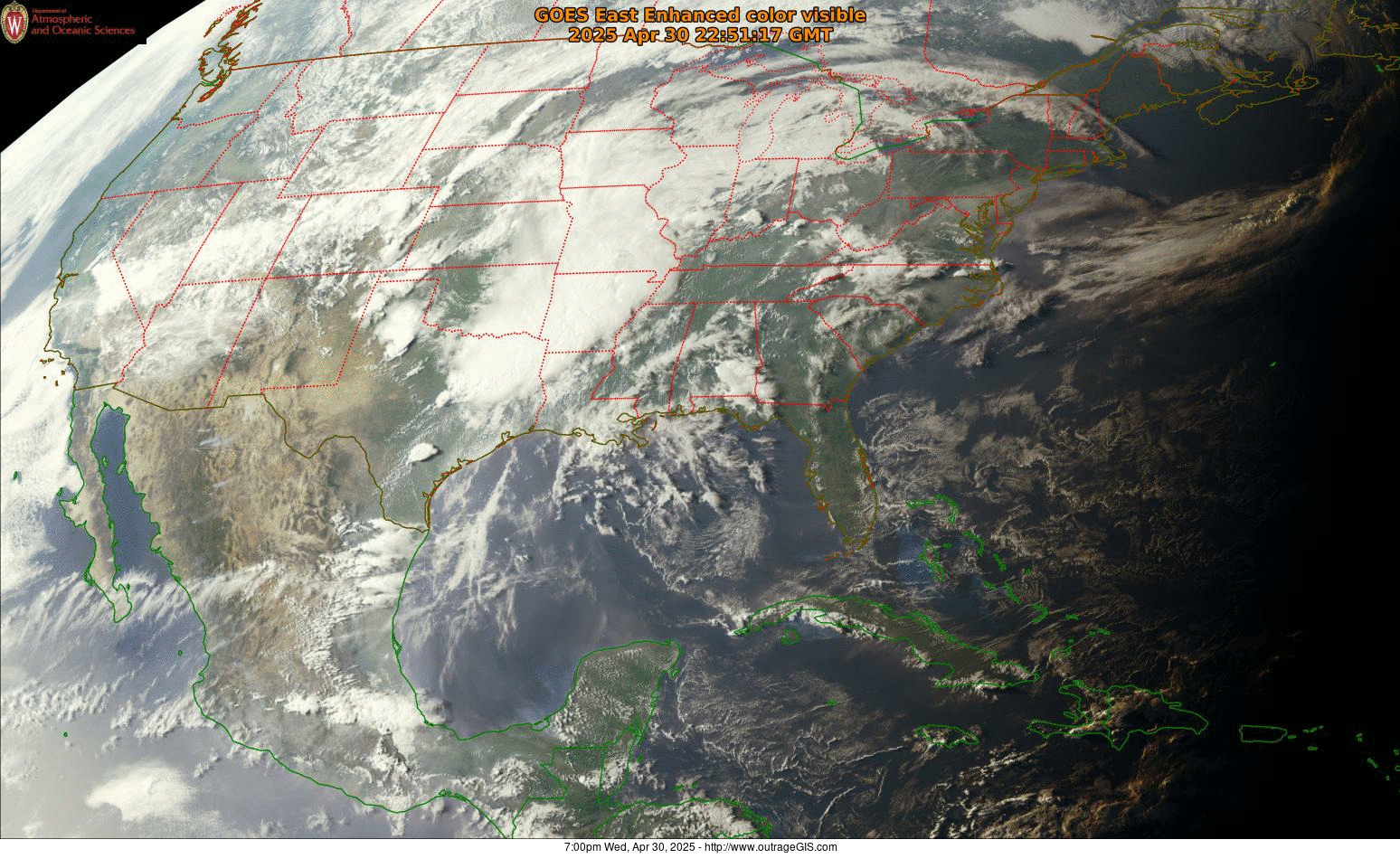
- GOES-16 imagery, satellite view (https://www.outragegis.com/weather/goes16/current.jpg)
- Past two-hour animation: https://www.outragegis.com/weather/goes16/animation.gif
- Yesterday's animation: https://www.outragegis.com/weather/goes16/yesterday.gif
The source data primarily comes from the National Weather Service and various NOAA agencies. The exact URLs are shown in the get-webobv.sh and get-img.sh scripts. Also using/exploring the Dark Sky API for hyperlocal data. The Weather Underground API for RSS feeds has also been used in the past. Imagery for the GOES-16 satellite is downloaded from GOES on AWS and, in the past, the UW-Madison Department of Atmospheric and Oceanic Sciences, https://www.aos.wisc.edu/.
outrageGIS mapping makes trails maps to carry into the backcountry. Knowing the weather is pretty helpful.
The first use of the scripts was in June, 2007.