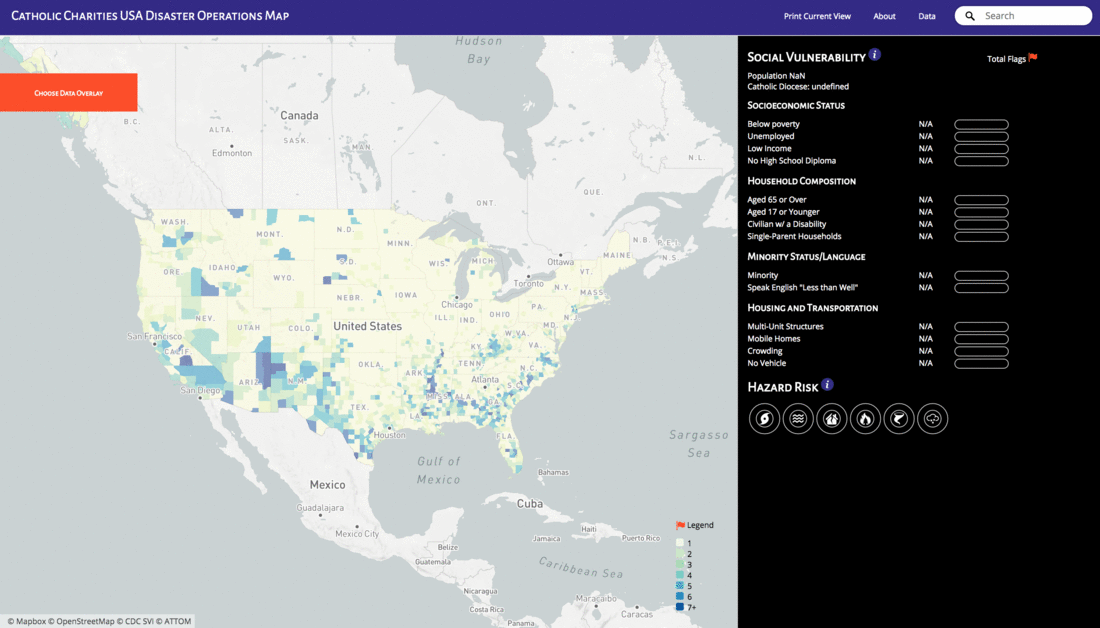
CCUSA wanted to create a map to better target mitigation, preparedness, relief, and recovery projects in order to best serve communities that are both at greatest risk for disasters and most overlooked or outright excluded from federal assistance during disasters. Specifically, they wanted to see the presence of acutely vulnerable populations such as uninsured (homeowners or renters), homeless, or subsidized renters at the local level.
This map can be used to strategically allocate resources to prepare for disasters, as well as identifying where vulnerable populations live within an area affected by a disaster.
Interested in helping? Issues or pull requests are welcome! Join the DataKind DC meetup group to find out about work sessions and new projects.
This map uses data from the CDC’s Social Vulnerability Index and a proprietary dataset which maps disaster risk that we were given permission to use.
From the CDC’s website, social vulnerability refers to the resilience of communities when confronted by external stresses on human health, stresses such as natural or human-caused disasters, or disease outbreaks. Reducing social vulnerability can decrease both human suffering and economic loss. ATSDR's Social Vulnerability Index uses U.S. census variables at tract level to help local officials identify communities that may need support in preparing for hazards, or recovering from disaster.
The proprietary dataset shows risk of six types of natural disasters: floods, earthquakes, hurricanes, tornados, wildfires, and hail. It uses data from FEMA, USGS, and NOAA.
The data was converted from a shape file into vector tiles, due to the size of the data. Please see the ShapefileCreation file to view how the file was converted.
The tiles are hosted on a MapBox server. Please visit this hackpad for more information.