render golf course features
License
hholzgra/Mapnik-golf-overlay
This commit does not belong to any branch on this repository, and may belong to a fork outside of the repository.
Folders and files
| Name | Name | Last commit message | Last commit date | |
|---|---|---|---|---|
Repository files navigation
### add directional cut marks to fairways 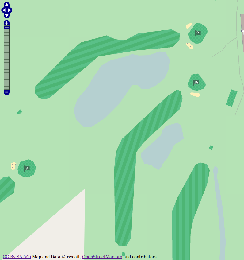 Mapnik-golf-overlay - a style sheet for rendering golf course objects Copyright (C) 2012 Richard Weait This program is free software: you can redistribute it and/or modify it under the terms of the GNU Affero General Public License as published by the Free Software Foundation, either version 3 of the License, or (at your option) any later version. This program is distributed in the hope that it will be useful, but WITHOUT ANY WARRANTY; without even the implied warranty of MERCHANTABILITY or FITNESS FOR A PARTICULAR PURPOSE. See the GNU Affero General Public License for more details. You should have received a copy of the GNU Affero General Public License along with this program. If not, see <http://www.gnu.org/licenses/>. #: A mapnik2 overlay layer for golf courses #: Renders tee, fairway, cartpath and bunkers #: Renders greens pin/flag with hole number To install: 1) have a working mapnik2 2) add golf tags to osm2pgsql configuration and reimport planet # add this line to osm2pgsql/default.style node,way golf text polygon # golf course stuff 3) enable golf.xml in renderd # add lines to enable golf layer in renderd.conf # correct the username and hostname [golf] URI=/golf/ XML=/home/mapnik/stylesheets/golf.xml HOST=tile.example.com 4) Golf-related rendering images are un-tarred to symbols/golf/* by default. 5) Add the golf overlay to your favourite base layer in Open Layers. 6) Enjoy.
About
render golf course features
Topics
Resources
License
Stars
Watchers
Forks
Releases
No releases published
Packages 0
No packages published