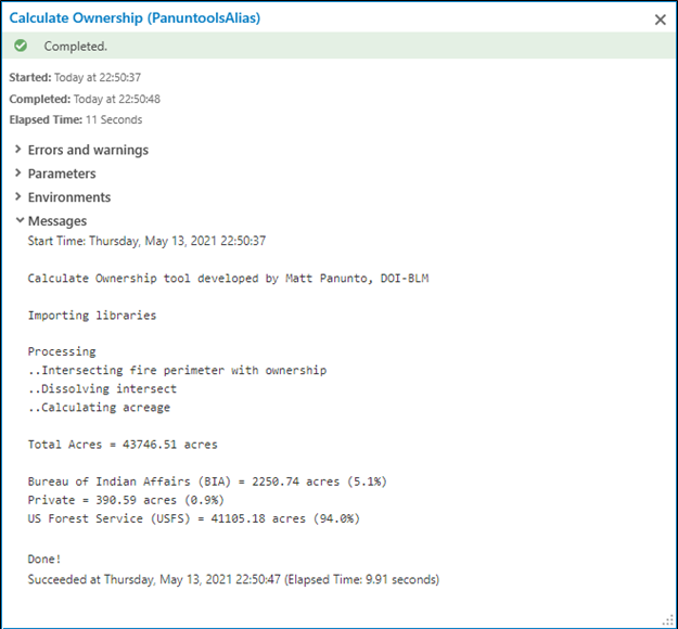
Tool that automates the Intersect & Dissolve process to obtain acres burned by ownership.
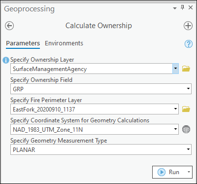
- Specify Ownership layer
- Field that defines ownership
- Specify Fire Perimeter layer
- Coordinate system to perform acreage calculations
- Geometry measurement type
This tool doesn't generate any outputs. The calculations are provided to the user in the Geoprocessing Messages: