该库包含与谷歌位置相关的所有实用程序。例如,获取经纬度、地址和位置设置对话框、绘制路线等
-
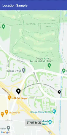
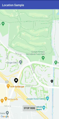
弧线绘制
a. 简单的
b. 动画.
-
在起点和终点之间绘制弧线路线
-
现在,Dev 可以动态更改参数,例如起点、航点等
-
获取arrayList和HashMap中的折线详细信息类
-
使用 TAG 为弧形和航路点折线清除折线
-
修复重大崩溃
-
在示例文件夹中创建了一个曲目演示以供更多使用帮助

- Android 16
all projects {
        repositories {
            ...
            maven { url 'https://jitpack.io' }
        }
    }
        dependencies {
            implementation 'com.github.prabhat1707:EasyWayLocation:2.4'
        }
android {
    compileOptions {
        sourceCompatibility 1.8
        targetCompatibility 1.8
    }
}
为了优越的位置 (GPS location), 在您的添加以下权限 AndroidManifest.xml:
<uses-permission android:name="android.permission.ACCESS_FINE_LOCATION" />
For coarse location (network location), add the following permission in your AndroidManifest.xml:
<uses-permission android:name="android.permission.ACCESS_COARSE_LOCATION" />
public class MainActivity extends AppCompatActivity implements Listener {
    EasyWayLocation easyWayLocation;
    private TextView location, latLong, diff;
    private Double lati, longi;

    @Override
    protected void onCreate(Bundle savedInstanceState) {
        super.onCreate(savedInstanceState);
        setContentView(R.layout.activity_main);
        //--
        easyWayLocation = new EasyWayLocation(this, false,false,this);
    }

    @Override
    public void locationOn() {
        Toast.makeText(this, "Location ON", Toast.LENGTH_SHORT).show();
    }

   @Override
    public void currentLocation(Location location) {
        StringBuilder data = new StringBuilder();
        data.append(location.getLatitude());
        data.append(" , ");
        data.append(location.getLongitude());
        latLong.setText(data);
        getLocationDetail.getAddress(location.getLatitude(), location.getLongitude(), "xyz");
    }

    @Override
    public void locationCancelled() {
         Toast.makeText(this, "Location Cancelled", Toast.LENGTH_SHORT).show();
    }

    @Override
    protected void onActivityResult(int requestCode, int resultCode, Intent data) {
        super.onActivityResult(requestCode, resultCode, data);
        switch (requestCode) {
            case LOCATION_SETTING_REQUEST_CODE:
                easyWayLocation.onActivityResult(resultCode);
                break;
        }
    }

    @Override
    protected void onResume() {
        super.onResume();
        easyWayLocation.startLocation();
    }

    @Override
    protected void onPause() {
        super.onPause();
        easyWayLocation.endUpdates();

    }
}
@Override
    public void locationOn() {
        Toast.makeText(this, "Location ON", Toast.LENGTH_SHORT).show();

    }

    @Override
    public void  currentLocation(Location location){
       // give lat and long at every interval
    }

    @Override
    public void locationCancelled() {
        // location not on
    }
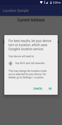
- 如果您只想要最后一个位置,则将其传递为 true,如果为 false,则根据默认位置请求为您提供位置更新。
- 如果您不通过,则它需要默认位置请求,或者您也可以通过您的位置请求(参见构造函数 2nd)。
Context context = this;
boolean requireFineGranularity = false;
new EasyWayLocation(this, requireLastLocation = false,isDebuggable = true/false,listner = this);

or

request = new LocationRequest();
request.setInterval(10000);
request.setPriority(LocationRequest.PRIORITY_BALANCED_POWER_ACCURACY);

new EasyWayLocation(this,locationRequest = request ,  requireLastLocation = false,isDebuggable = true/false,listner = this);
double startLatitude = 59.95;
double startLongitude = 30.3;
double endLatitude = 44.84;
double endLongitude = -0.58;
location.calculateDistance(startLatitude, startLongitude, endLatitude, endLongitude);

// or

Point startPoint = new EasyWayLocation.Point(59.95, 30.3);
Point endPoint = new EasyWayLocation.Point(44.84, -0.58);
location.calculateDistance(startPoint, endPoint);
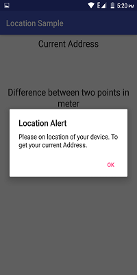
- if you want an address from the current location then you need to pass key and context.
- why I want key here if android already provides Geocoder because in some cases or some devices geocoder not work well and throws Exception, so in that case, I use google geocode API for fetch address.
- For this, you need to implement Callback, LocationData.AddressCallBack
GetLocationDetail getLocationDetail = new GetLocationDetail(callback = this, context = this);

getLocationDetail.getAddress(location.getLatitude(), location.getLongitude(), key = "xyz");
wayPoints.add(LatLng(37.423669, -122.090168))
        wayPoints.add(LatLng(37.420930, -122.085362))
                val directionUtil = DirectionUtil.Builder()
                .setDirectionKey("xyz")
                        .setOrigin(LatLng(37.421481, -122.092156))
                        .setWayPoints(wayPoints)
                        .setGoogleMap(mMap)
                        .setPolyLinePrimaryColor(R.color.black)
                        .setPolyLineWidth(5)
                        .setPathAnimation(true)
                        .setCallback(this)
                        .setPolylineTag(WAY_POINT_TAG)
                        .setDestination(LatLng(37.421519, -122.086809))
                        .build()
directionUtil.initPath()
directionUtil.drawPath(WAY_POINT_TAG)
directionUtil.serOrigin(LatLng(driverCurrentLocation.latitude,driverCurrentLocation.longitude),wayPoints)
directionUtil.drawArcDirection(LatLng(37.421481, -122.092156),LatLng(37.421519, -122.086809),0.5,ARC_POINT_TAG)
directionUtil.clearPolyline(WAY_POINT_TAG)
- 像优步这样的动画
- 没有动画。
1.带动画
- setPathAnimation = true

2.没有动画
- setPathAnimation = false
- change its color by, setPolyLinePrimaryColor() property

override fun pathFindFinish(polyLineDetails: HashMap<String, PolyLineDataBean>) {
       for (i in polyLineDetails.keys){
           Log.v("sample",polyLineDetails[i]?.time)
       }
    }
here, polyLineDetails contain each polyline or route detail as time, distance and road summary.
发现错误?缺少什么?反馈是改进项目的重要组成部分,所以,请 open an issue
版权所有 (c) <prabhat.rai1707@gmail.com>

根据 Apache 许可证 2.0 版(“许可证”)获得许可;
除非遵守许可,否则您不得使用此文件。
您可以在以下网址获取许可证的副本

  http://www.apache.org/licenses/LICENSE-2.0

除非适用法律要求
w 或书面同意,软件
根据许可分发是在“原样”基础上分发的,
没有任何明示或暗示的保证或条件。
请参阅许可以了解特定语言的管理权限和
许可证下的限制。