Georeferencer: Wrong negative coordinates #16436
Comments
|
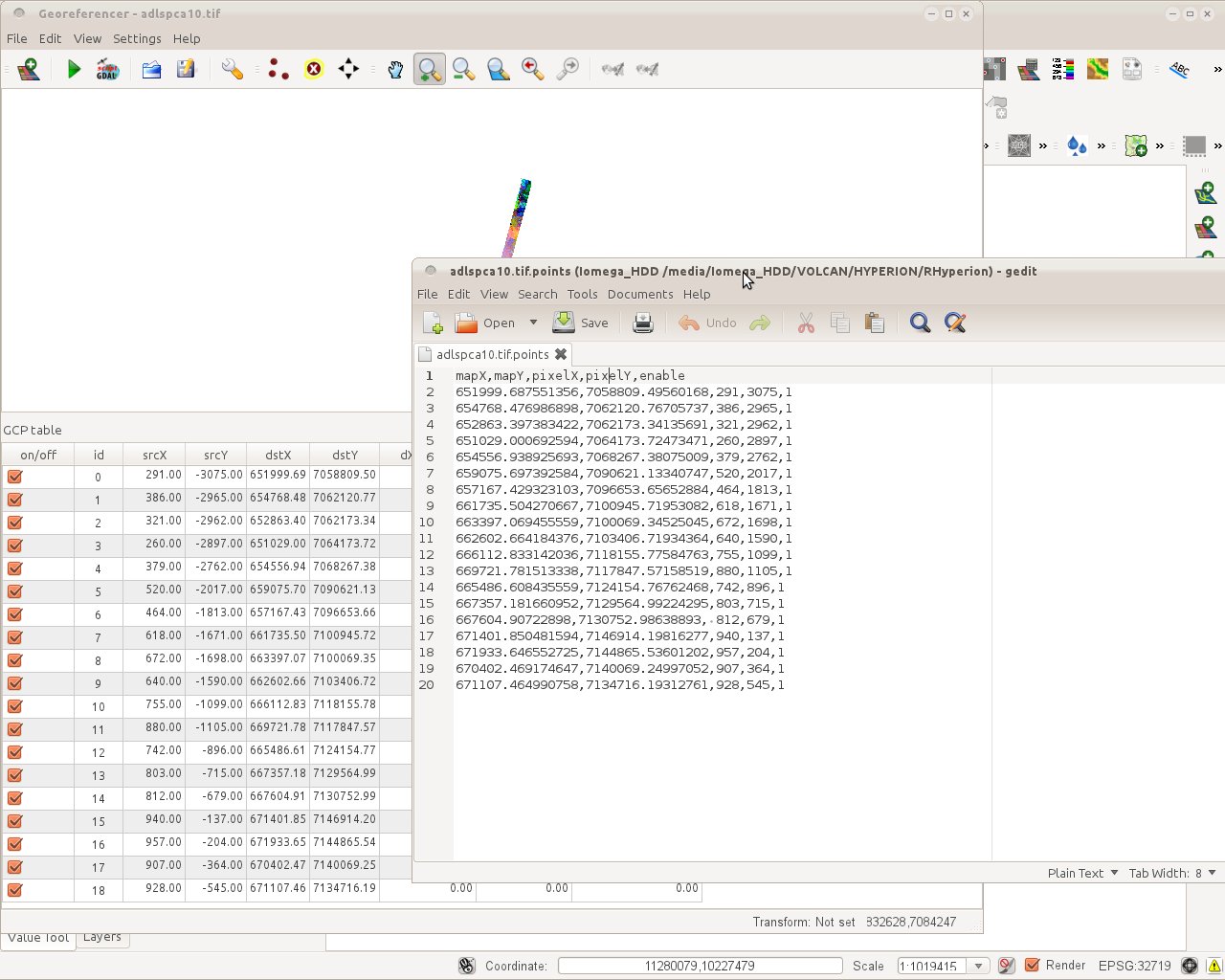
Author Name: alobo - (alobo -) The example was not appropriate because the gdal gcp assume image coordinates are The same problem of negative coordinates is shown in georefpix.jpeg. I also attach the points file. I've successfully warped the image with those gcp and the following 2 gdal commands (similar to but not identical to the script generated by the plugin): gdal_translate -of Float32 GTiff -a_srs EPSG:32719 -gcp 291 3075 652000 7.05881e+06 -gcp 386 2965 654768 7.06212e+06 ... "/media/Iomega_HDD/VOLCAN/HYPERION/RHyperion/adlspca10.tif" "/tmp/adlspca10.tif" (note: deleted gcp in ...) gdalwarp -ot Float32 -wt Float32 -r bilinear -order 2 -co COMPRESS=NONE -tr 30.000000 -30.000000 "/tmp/adlspca10.tif" "/media/Iomega_HDD/VOLCAN/HYPERION/RHyperion/adlspca10_corrbilin.tif" Agus
|
|
Author Name: Radim Blazek (@blazek) Can you describe exactly the steps to reproduce it? I tried to
but the points are loaded with positive srcY. Could it be that it only happens when QGIS is run on a computer physically located on southern hemisphere? Have you tried to turn your computer upside down?
|
|
Author Name: alobo - (alobo -) Works on 1.9 master on Mac Agus |
|
Author Name: Radim Blazek (@blazek)
|
|
Author Name: Giovanni Manghi (@gioman) alobo - wrote:
if it works on master this can be closed, I guess. |
|
Author Name: Paolo Cavallini (@pcav)
|
Author Name: alobo - (alobo -)
Original Redmine Issue: 7484
Affected QGIS version: 1.8.0
Redmine category:rasters
Assignee: Radim Blazek
srcY cooordinates are taken as negative once the points file
is read in the plugin, while coordinates are correct
in the points file. probably a wrong interpretation of
the position in the Southern hemisphere
epsg 32719 (wgs84 utm19S)
See georef.jpeg
(also, please keep the same column order and names in
both the plugin and the points file).
Agus
The text was updated successfully, but these errors were encountered: