Zooming results in parts of features disappearing when spatial indexes SBN/SBX from ESRI are present #18566
Comments
|
Author Name: Maxim Dubinin (@simgislab) wrong after link: Also, there is no such problem in QGIS 2.1 |
|
Author Name: Maxim Dubinin (@simgislab) figured it out. New QGIS is built agains GDAL 1.10 which now takes into account spatial indexes SBN/SBX from ESRI tribe. Removing those fixes everything. Still, I think we need to do something about it, either GDAL is incorrectly reading those indices and QGIS should ignore them or something else is going on. |
|
Author Name: Eric Brelsford (Eric Brelsford) Also seeing this, in QGIS version 2.6 on Ubuntu 14.10. Deleting SBN and SBX fixed it. I see it with all of these files: http://www.nyc.gov/html/dcp/html/bytes/dwn_pluto_mappluto.shtml#mappluto If I save the layer as a new shapefile in QGIS and open it, it works fine. Presumably because it doesn't create the SBN or SBX files. |
|
Author Name: Giovanni Manghi (@gioman) this should be closed because seems a gdal issue not a qgis one.
|
|
Author Name: Jukka Rahkonen (Jukka Rahkonen) Wouldn't it be better to create a GDAL issue and link it here but keep this issue open until it is fixed on GDAL side? |
|
Author Name: Giovanni Manghi (@gioman)
|
|
Author Name: Andy Harfoot (Andy Harfoot) Just adding another observation that may be a particular subset of a wider issue with GDAL's support for SBN / SBX indexes. The GDAL support is read only, so whilst the indexes are used without problems in QGIS in a dataset that is unmodified from the point of export from ArcGIS, as soon as edits are made that alter the order or number of features in the dataset, the ESRI spatial index will not be updated and therefore become corrupt, causing features to disappear when the spatial index is consulted. Building a QIX index fixes this, as does deleting the SBN / SBX files. This isn't a GDAL issue, GDAL is working as intended, instead QGIS is making incorrect assumptions about GDAL's capabilities. Tested on Win 7 x64 QGIS 2.8.2 x64 Standalone and 2.10 x64 OSGeo4W
|
|
Author Name: Andy Harfoot (Andy Harfoot) According to the comment in "GDAL !#15412":https://trac.osgeo.org/gdal/ticket/6042 GDAL should delete ESRI indexes when a shapefile is edited to prevent them from becoming out of sync. Does QGIS use GDAL to edit shapefiles? If so, why is this behaviour not observed? |
|
Author Name: Giovanni Manghi (@gioman)
|
|
Author Name: Giovanni Manghi (@gioman)
|
|
Author Name: Giovanni Manghi (@gioman) End of life notice: QGIS 2.18 LTR Source:
|
Author Name: Maxim Dubinin (@simgislab)
Original Redmine Issue: 10098
Affected QGIS version: 2.6.0
Redmine category:vectors
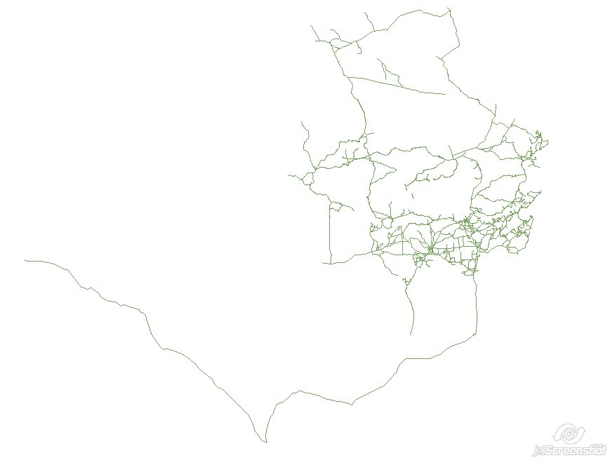
Before:
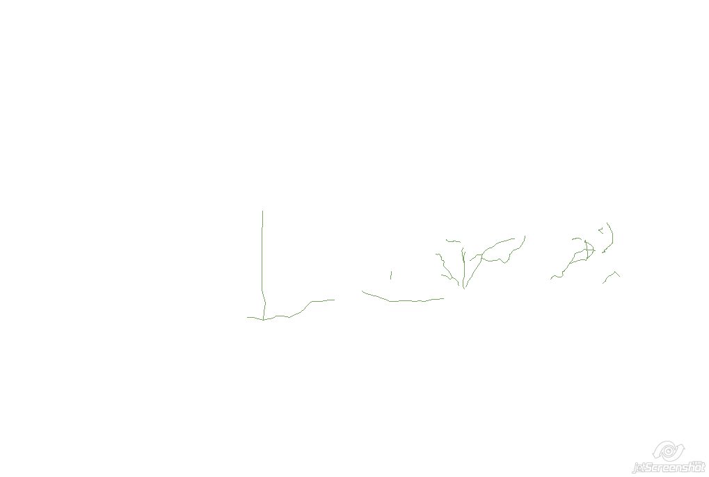
After:
QGIS Win7, 32bit, 2e6927f (today nightly)
It seems like there is no such problem under Ubuntu.
The text was updated successfully, but these errors were encountered: