Announcements of photos in the background #20328
Comments
|
Author Name: Nathan Woodrow (@NathanW2) I'm sorry I don't follow what you mean. You try to explain it a different way. |
|
Author Name: Angelika Schloesser (Angelika Schloesser) Ok, next try ;-) : I open a new project in which 19 photos should be in the background. If I load them as grid data, a white surface, instead of the photos appears in about one third. Repeated updating leads only to the fact that other photos turn white, but the photos are never all shown properly. Is it because of the large size of all the photos? The problem seams to be only the display, all 19 photos are shown in the legend... |
|
Author Name: Giovanni Manghi (@gioman) Angelika Schloesser wrote:
Hi Angelika, it is also not very clear to me. Anyway for what I have understand it could be very well an issue with your data, probably a coordinate reference system one. Please attach sample data to allow us check.
|
|
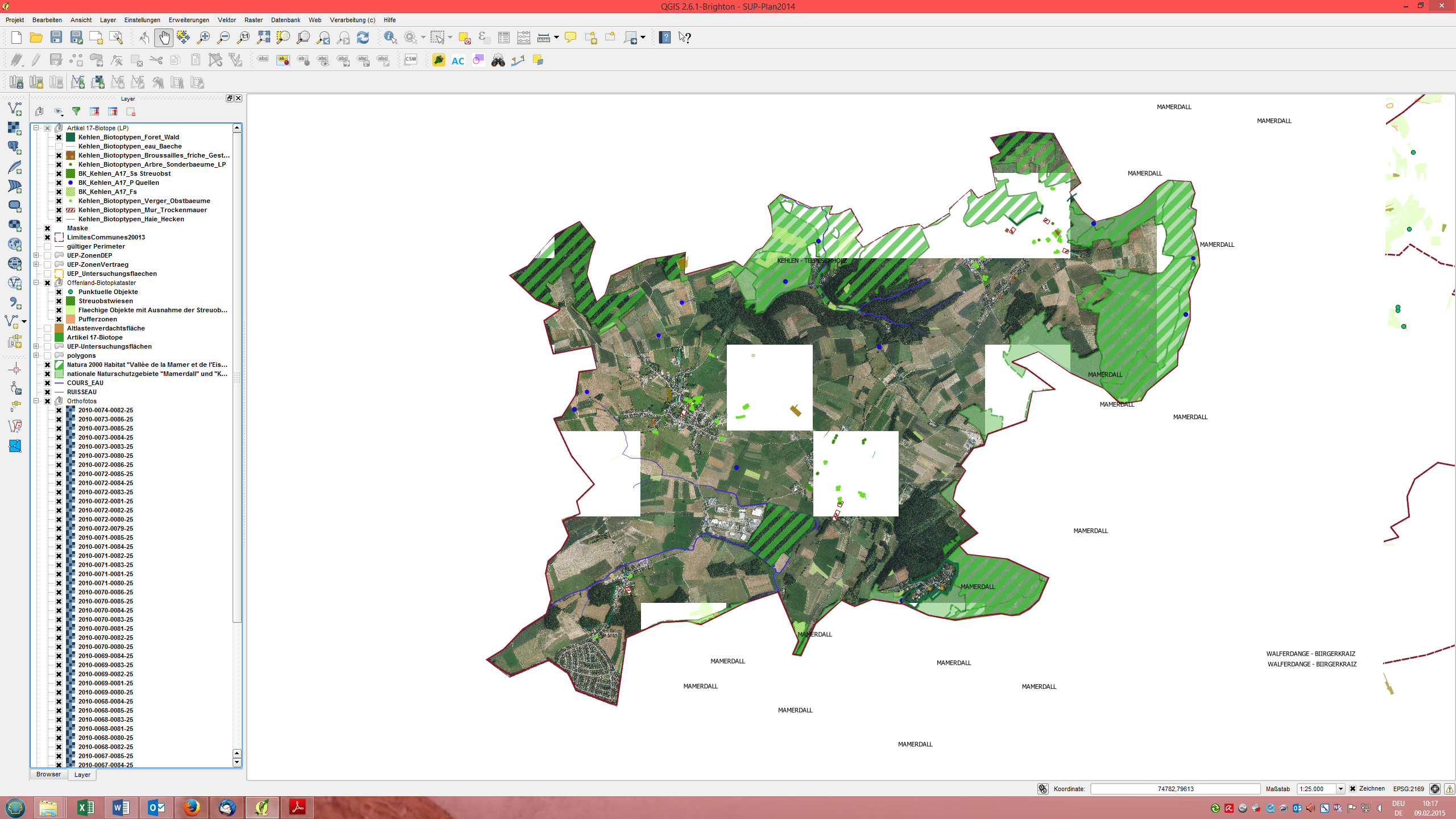
Author Name: Angelika Schloesser (Angelika Schloesser) You can find two screenshots of my project attached. It includes about 30 orthophotos, which should be all shown in the print composer to create a pdf. But (how it is seen in the screenshots) never all photos are shown, instead, there are white surfaces. The second screenshot was taken a few minutes later after updating the project. Every orthophto has a size about 45 MB. The selected coordinate reference system is correct.
|
|
Author Name: Giovanni Manghi (@gioman) Angelika Schloesser wrote:
without a sample of 1 image that do show and 1 that does not it would be hard to tell if is a local issue, a data issue, a crs issue or a qgis issue. If you cannot share this sample then run the "info" tool in the raster menu on two images, ones that show and one that doesn't, and post/check the results. Do the coordinate of origin of the image that does not show make sense? |
|
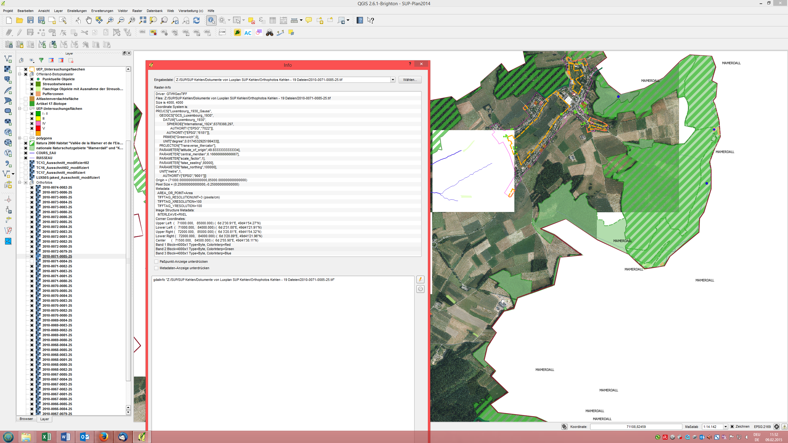
Author Name: Angelika Schloesser (Angelika Schloesser) I have run the "info" tool and compared the results from one image, that was once shown, and once not. Information was always same (e.g. in the screenshot attached). In Version 1.8 the problem does not exist and all orthophotos are shown. But I want to draw the maps in the newest version. :-(
|
|
Author Name: Giovanni Manghi (@gioman) Angelika Schloesser wrote:
please have a look at the "corners coordinates" part of the infos that the show about the two images, the one that will show and the one that don't. The corner coordinates of the image that does not show do make any sense (relatively to the coordinate reference system and the geographic area you are using)?. Thanks. |
|
Author Name: Angelika Schloesser (Angelika Schloesser) Not shown image: Corner Coordinates: Ok, here's the problem. Comparing this project with another similar one showed that the data between the second brackets is too much. As coordinate reference system I have chosen Luxembourg 1930 / Gauss. This needs just the information between the first brackets... But how can I change this? |
|
Author Name: Giovanni Manghi (@gioman) Angelika Schloesser wrote:
so this probably means that you should have issues with your data. If the image corner coordinates in degrees does not make sense then the value in meters probably does not correspond to the coordinate reference system you think the images have been given. Anyway this does not seems a qgis issue and to receive further assistance you should attach/link one of the problematic images (along with a good one). |
|
Author Name: Angelika Schloesser (Angelika Schloesser) That's right. It was a problem with my data. Some tfw's have lacked. Sorry, that I've not noted it before and thanks a lot for your help!
|
|
Author Name: Giovanni Manghi (@gioman)
|
Author Name: Angelika Schloesser (Angelika Schloesser)
Original Redmine Issue: 12134
Affected QGIS version: 2.6.1
Redmine category:rasters
Storing large amounts of background photos (scenery, Orthofotos), they are partially not indicated, so that one cannot work with it. In my case these are photos by a size of about 2. 5 GB.
In version 1.8 this is no problem, but in the newer ones. Is there a solution??
The text was updated successfully, but these errors were encountered: