Open discussion: Reducing OSM sidewalk-clutter #17
Comments
|
One idea is to not display sidewalks at all. These separate-way sidewalks are usually tagged with
|
|
This would make roads where lanes are mapped as own ways (like this) also more clear. We are used to, from the base map and other maps, that the "road importance", which often comes down to the number of lanes, is indicated by a different color. Most important roads are red, then through yellow down to white. But well, how about a different approach: Have the same color, but make broader roads actually broader (but only as broad as they really are). |
AFAIK both mapping styles are widespread and there is no consensus what is better and what is preferred depends on location (from your reaction it is clear that in Germany it is discouraged, there was a recent discussion on Polish forum with a clear support for that tagging style).
footway=sidewalk property is exposed, at least on some zoom levels - to check that open map style in https://mapzen.com/tangram/play/?scene=https://raw.githubusercontent.com/ENT8R/streetcomplete-mapstyle/master/style.yaml enable inspect (top-right) and click on a displayed object. pop-up with list of properties should appear |
lanes tag appears to not be present, tracked as low-priority idea on tilezen/vector-datasource#1021 |
|
In case of strong interest of using lane tag - in my experience vector-datasource is great at reviewing and merging PRs, but new versions are rarely deployed (I am still waiting for my surface and access changes to be deployed). |
|
Okay, I think @matkoniecz is currently the expert on tangram map styles. I will create tickets based on his proposals here and close this. |
|
Some clutter will be fixed by #9 |
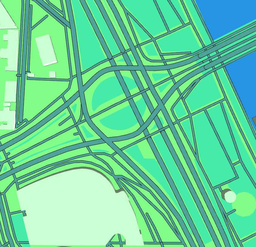
Have a look at this: https://mapzen.com/tangram/play/?#18.50000/50.05670/19.94529
This is basically just an intersection of a big road with a small road (with a tram in the middle). See https://binged.it/2gIFXou Ignore the tram for now, there is another ticket for that.
I would like to reduce the clutter there, because it is
Of course, mapping sidewalks as separate ways when they are actually only separated by a curb is not really approved by the community, but that doesn't matter for us here, because this kind of sidewalk-mapping is widely used and the style needs to make do what is found "in the wild".
Now, this is a bit of a problem to solve, that is why I labeled this as an open discussion to collect and discuss ideas.
The text was updated successfully, but these errors were encountered: