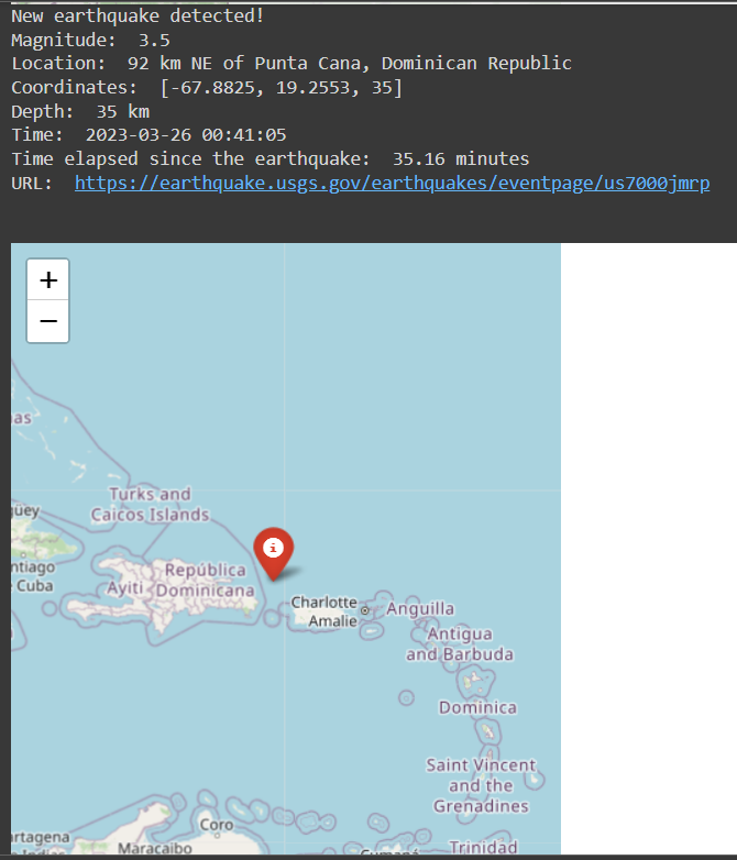
This script tracks the latest earthquakes with a magnitude of 2.5 or greater that have occurred in the past hour. It uses the USGS Earthquake Hazards Program API to get the earthquake data in GeoJSON format, and then displays the location of the latest earthquake on a map using the Folium library. The location is also printed to the console along with other relevant details.
- Install the required libraries using pip:
pip install requests folium termcolor geopy- Run the script in a Python environment.
python earthquake_tracker.py- The script will continuously check for new earthquakes every minute and print out the details of the latest one detected. A map of the earthquake location will also be displayed.
requests time folium IPython.display termcolor datetime geopy
This project is licensed under the MIT License - see the LICENSE.md file for details.