Merging National Weather Service radar images, Stamen Toner maps, and OpenWeather data, the Weather Radar! is a Raspberry Pi and Blinka powered weather radar viewer housed in a funky analog meter case I found in the shed!
You can find out more about the project on Hackaday!
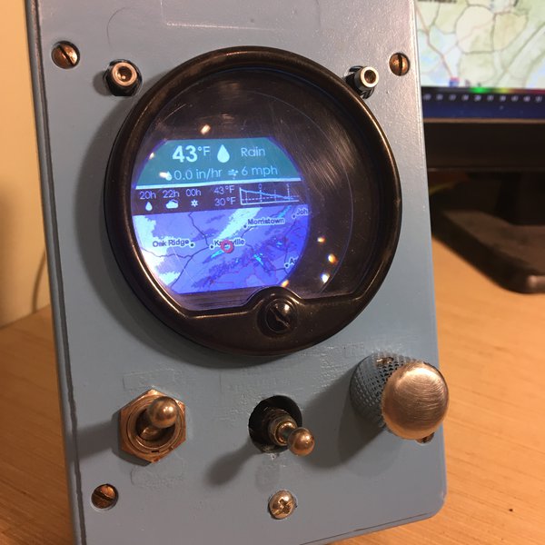
For a given latitude and longitude in the USA, the Weather Radar:
- Obtains the nearest radar station ID (using the Weather API service)
- Uses the radar station ID (e.g. KJAX) to obtain metadata and times for previous radar layers.
- Generates a tiled base map using the GeoTiler library (using a given zoom level, map size, and map centre).
- Uses all of this information to make a WMS request and download the last 5 - 10 radar images.
- For each time frame, combines the base map, radar image, and other layers and annotations using the Pillow imaging library.
- Displays the combined image for each time frame, to make a looping animation.
- Uses the latitude and longitude to get OpenWeather data for some extra forecasting jazz.