Cartographic stylesheets for use with OS Vector Tile API which is available from the OS Data Hub.
As OS Vector Tile API is available in two projections, EPSG:27700 and EPSG:3857, which have different zoom levels, we provide a seperate stylesheet for both.
This code example will help you integrate these stylesheets into your application with options for various web mapping libraries.
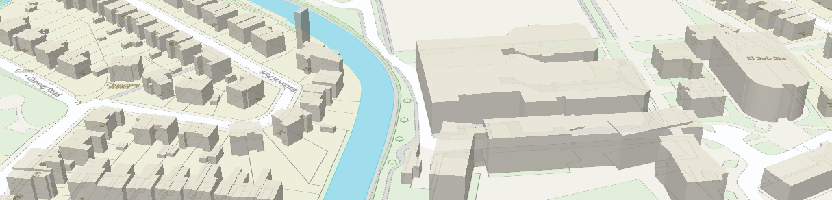 Use this style to add 3D building extrusions to your map.
This style uses the building height attributes (RelHMax) on OS MasterMap Topography Layer buildings to show the maximum height of each building footprint.
Use this style to add 3D building extrusions to your map.
This style uses the building height attributes (RelHMax) on OS MasterMap Topography Layer buildings to show the maximum height of each building footprint.
OS_VTS_3857_3D.json and OS_VTS_27700_3D.json
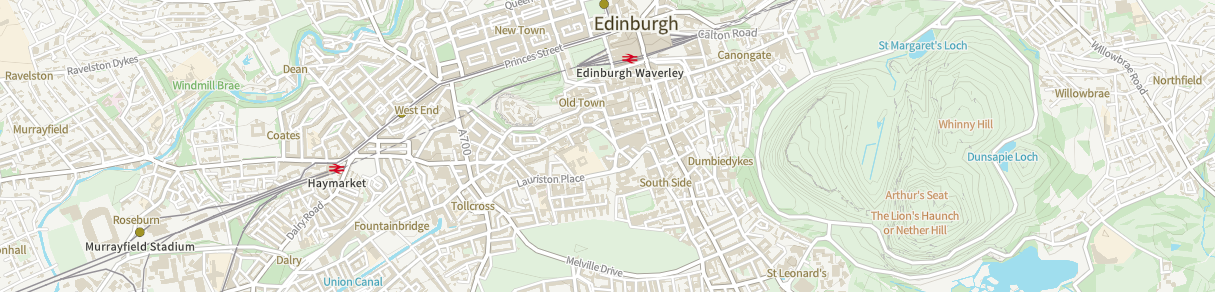 Use this version of the Outdoor style with ArcGIS API for JavaScript.
Our labelling rules for OS MasterMap Topography Layer Cartographic Text use some elements of the Mapbox Style Specification that aren't supported by ESRI. These styles have been designed to be fully compatible with ArcGIS API for JavaScript.
Use this version of the Outdoor style with ArcGIS API for JavaScript.
Our labelling rules for OS MasterMap Topography Layer Cartographic Text use some elements of the Mapbox Style Specification that aren't supported by ESRI. These styles have been designed to be fully compatible with ArcGIS API for JavaScript.
OS_VTS_3857_ESRI.json and OS_VTS_27700_ESRI.json
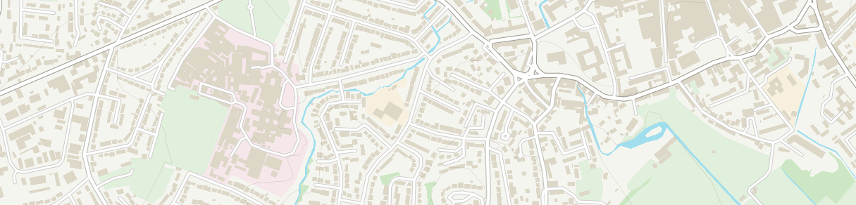 A stripped back map for when topography alone is all you need.
OS_VTS_3857_No_Labels.json and OS_VTS_27700_No_Labels.json
Outdoor style for OS OpenData.
NOTE: Only works with the OS OpenData but allows overzoom.
OS_VTS_3857_Open_Outdoor.json and OS_VTS_27700_Open_Outdoor.json
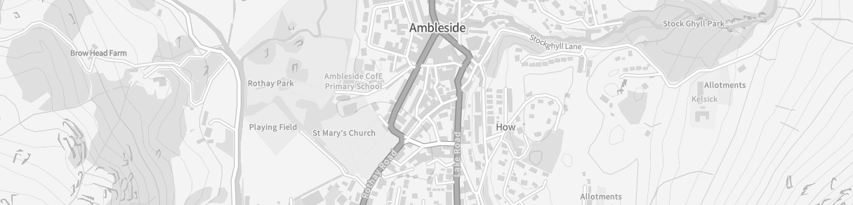 A simple greyscale style.
OS_VTS_3857_Greyscale.json and OS_VTS_27700_Greyscale.json
(OS OpenData with overzoom => OS_VTS_3857_Open_Greyscale.json and OS_VTS_27700_Open_Greyscale.json)
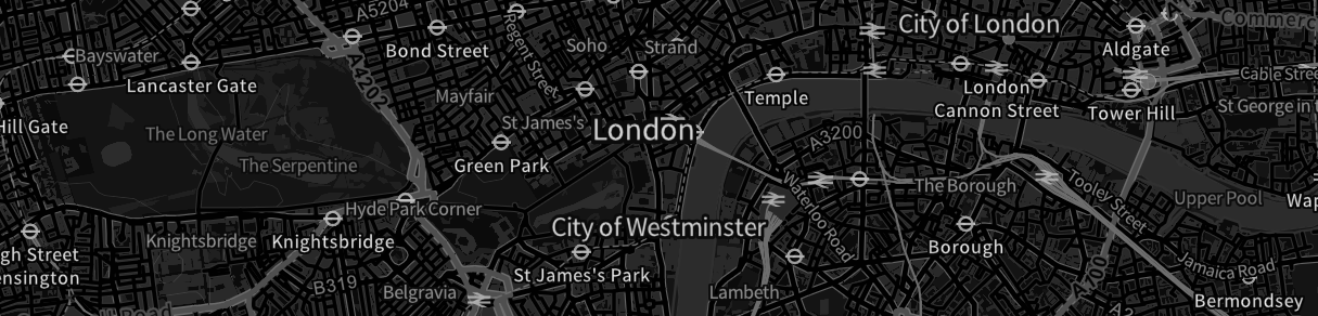 A simple dark (inverted greyscale) style.
Thanks to Mike Brondbjerg for the inspiration.
OS_VTS_3857_Dark.json and OS_VTS_27700_Dark.json
(OS OpenData with overzoom => OS_VTS_3857_Open_Dark.json and OS_VTS_27700_Open_Dark.json)
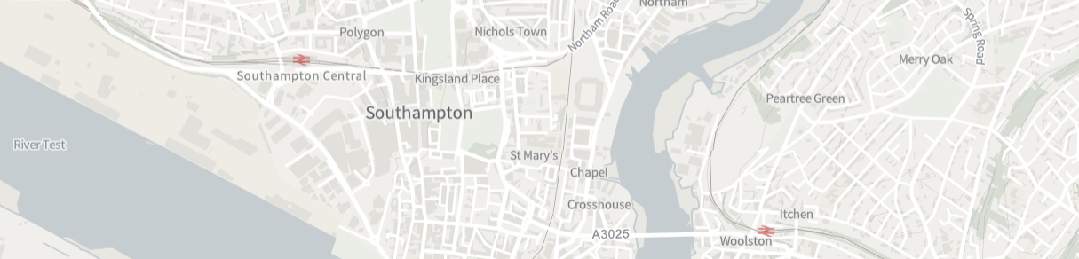 The OS Light style, perfect for backdrop mapping.
OS_VTS_3857_Light.json and OS_VTS_27700_Light.json
(OS OpenData with overzoom => OS_VTS_3857_Open_Light.json and OS_VTS_27700_Open_Light.json)
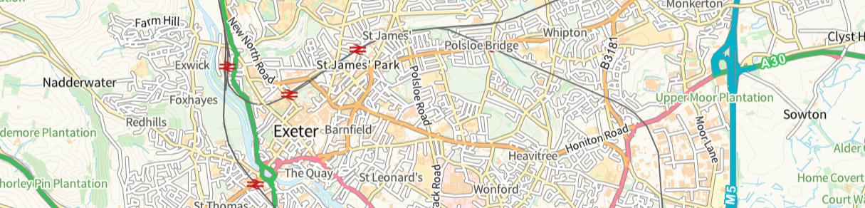 The OS Road style, a familiar style with a particular focus on the GB transport network.
OS_VTS_3857_Road.json and OS_VTS_27700_Road.json
(OS OpenData with overzoom => OS_VTS_3857_Open_Road.json and OS_VTS_27700_Open_Road.json)
The contents of this repository are licensed under the Open Government Licence 3.0.