Skip to content
New issue

Have a question about this project? Sign up for a free GitHub account to open an issue and contact its maintainers and the community.

By clicking “Sign up for GitHub”, you agree to our terms of service and privacy statement. We’ll occasionally send you account related emails.

Already on GitHub? Sign in to your account

something changed in interpolate.cross_section for curvilinear grids #1646

Closed
ahuang11 opened this issue Jan 4, 2021 · 19 comments
Closed

something changed in interpolate.cross_section for curvilinear grids #1646

ahuang11 opened this issue Jan 4, 2021 · 19 comments
Labels
Type: Bug Something is not working like it should

Comments

@ahuang11
Copy link
Contributor

ahuang11 commented Jan 4, 2021

Now it's returning all NaNs compared to metpy==0.12.2. Unfortunately I do not have a minimal reproducible example at the moment, but any ideas what might have changed since I don't think the release notes mentioned anything about that being changed? I suspect something to do with metpy.parse_cf() which now is yields a coordinate metpy_crs in my xr.Dataset but still testing.

**curvilinear grid as in 2D lon/lat, 1D x/y

example code

import metpy
from metpy import interpolate
start= [-59.2, 80]
end= [ -42.6, 80]
method = 'nearest'
ds = ds.metpy.parse_cf()
cross = interpolate.cross_section(
    ds, start, end, steps=25, interp_type=method
)
@ahuang11 ahuang11 added the Type: Bug Something is not working like it should label Jan 4, 2021
@ahuang11
Copy link
Contributor Author

ahuang11 commented Jan 5, 2021

I think it has to do with pyproj replacing cartopy.
e4946c6#diff-e0008605917b4b8fb769ea39351ec5161853d1cbe6beb190561b5baa18b555a9

@ahuang11
Copy link
Contributor Author

ahuang11 commented Jan 5, 2021

0.12.2 yields these x/y
image

1.0.0 yields these x/y
image

@jthielen
Copy link
Collaborator

jthielen commented Jan 5, 2021

Several changes occurred in MetPy 1.0 that could have caused this difference (using PyProj instead of cartopy, and more correctly handling globes/geods). What are the CF parameters for the grid mapping in your file? Based on the values you obtained both before and after, it looks like your points are rather far from your projection origin, which could result in high sensitivities to how the projection is handled. Using the geodesic constructor directly (metpy.interpolate.geodesic) may also help with troubleshooting.

@ahuang11
Copy link
Contributor Author

ahuang11 commented Jan 5, 2021

The geod differs in versions:
e4946c6#diff-e0008605917b4b8fb769ea39351ec5161853d1cbe6beb190561b5baa18b555a9R101-R106
print(g, p)
print(crs.proj4_init)

1.0.0

Geod('+a=6378137 +f=0.0033528106647475126')
proj=lcc lat_0=0 lon_0=70.127 lat_1=-30 lat_2=-60 x_0=0 y_0=0 datum=WGS84 units=m no_defs ellps=WGS84 towgs84=0,0,0

0.12.2

Geod(ellps='sphere')
+ellps=sphere +proj=lcc +lon_0=70.127 +lat_0=39.0 +x_0=0.0 +y_0=0.0 +lat_1=-30 +lat_2=-60 +no_defs

@ahuang11
Copy link
Contributor Author

ahuang11 commented Jan 5, 2021

I don't think the Geod is initialized properly. It's missing the proper standard parallels and central lons.

grid_mapping_name :
lambert_conformal_conic
standard_parallel :
[-30, -60]
central_longitude :
70.1273
longitude_of_central_meridian :
70.127
long_name :
coordinate reference system

@jthielen
Copy link
Collaborator

jthielen commented Jan 5, 2021

Hmm...so in the 1.0 verison, what is pyproj.Proj(ds.metpy.pyproj_crs)?

@ahuang11
Copy link
Contributor Author

ahuang11 commented Jan 5, 2021

Description: PROJ-based coordinate operation Area of Use: - undefined -

@ahuang11
Copy link
Contributor Author

ahuang11 commented Jan 5, 2021

Maybe my attrs are defined incorrectly compared to the example NARR:

grid_mapping_name :
lambert_conformal_conic
standard_parallel :
50.0
longitude_of_central_meridian :
-107.0
latitude_of_projection_origin :
50.0

Mine:

grid_mapping_name :
lambert_conformal_conic
standard_parallel :
[-30, -60]
central_longitude :
70.1273
longitude_of_central_meridian :
70.127
long_name :
coordinate reference system

Nevermind, it looks like it's properly named...

@jthielen
Copy link
Collaborator

jthielen commented Jan 5, 2021

It does look properly named...but now that you point it out, those values with the example NARR look suspiciously like the ones in #1646 (comment). Would you be able to verify that your script is not mistakenly associating the wrong dataset or wrong dataset's CRS?

@ahuang11
Copy link
Contributor Author

ahuang11 commented Jan 5, 2021

You're right, my bad; I am jumping around in my notebook; I updated my comment and lat_0 seems to be off.

Geod('+a=6378137 +f=0.0033528106647475126')
proj=lcc lat_0=0 lon_0=70.127 lat_1=-30 lat_2=-60 x_0=0 y_0=0 datum=WGS84 units=m no_defs ellps=WGS84 towgs84=0,0,0

@ahuang11
Copy link
Contributor Author

ahuang11 commented Jan 5, 2021

Okay I manually added
ds['crs'].attrs['latitude_of_projection_origin'] = 39.0
But still getting NaNs.

Geod('+a=6378137 +f=0.0033528106647475126')
proj=lcc lat_0=39 lon_0=70.127 lat_1=-30 lat_2=-60 x_0=0 y_0=0 datum=WGS84 units=m no_defs ellps=WGS84 towgs84=0,0,0

Is there a difference betwteen
ellps=WGS84
and
ellps=sphere

The only differences I see now are:

Geod(ellps='sphere')
ellps='sphere'

Geod('+a=6378137 +f=0.0033528106647475126')
datum=WGS84 towgs84=0,0,0 ellps=WGS84

@jthielen
Copy link
Collaborator

jthielen commented Jan 5, 2021

Yes, there is indeed a difference between the two, as WGS84 non-spherical (it has a flattening, meaning major and minor axes are different). How different are your x and y coordinates now (or the geodesic path constructed by metpy.interpolate.geodesic) after the addition of the origin latitude argument?

@ahuang11
Copy link
Contributor Author

ahuang11 commented Jan 5, 2021

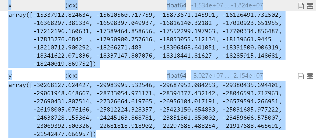
I added a few more attrs, but still off

ds['crs'].attrs['latitude_of_projection_origin'] = 39.0
ds['crs'].attrs['earth_shape'] = 'spherical'
ds['crs'].attrs['earth_radius'] = 6367470.21484375

1.0.0

Geod('+a=6367470.21484375 +f=0')
proj=lcc lat_0=39 lon_0=70.127 lat_1=-30 lat_2=-60 x_0=0 y_0=0 R=6367470.21484375 units=m no_defs

image

0.12.2
image

@ahuang11
Copy link
Contributor Author

ahuang11 commented Jan 5, 2021

Is there a way to force
ellps='sphere'

@jthielen
Copy link
Collaborator

jthielen commented Jan 5, 2021

I think the default radius for ellps='sphere' is 6370997, so would you be able to try that instead to replicate it? I'm not sure there is a way for force ellps='sphere' through pyproj.CRS.from_cf (which is all MetPy's using under-the-hood)

@ahuang11
Copy link
Contributor Author

ahuang11 commented Jan 5, 2021

Oh it matches now.
image

Ah off bounds. I was testing the wrong latitudes/longs

@ahuang11
Copy link
Contributor Author

ahuang11 commented Jan 5, 2021

Awesome thanks for helping me debug this! Apparently it's just my attributes too dependent on cartopy's defaults!

@ahuang11 ahuang11 closed this as completed Jan 5, 2021
@ahuang11
Copy link
Contributor Author

ahuang11 commented Jan 26, 2021

Hmm, if I set latitude_of_projection_origin, I get

da['metpy_crs'].item().to_cartopy()

    return ccrs.Mercator(globe=globe, **kwargs)
TypeError: __init__() got an unexpected keyword argument 'central_latitude'

@ahuang11 ahuang11 reopened this Jan 26, 2021
@ahuang11
Copy link
Contributor Author

Eh maybe I just have to pop the added kwarg if == mercator

Sign up for free to join this conversation on GitHub. Already have an account? Sign in to comment
Labels
Type: Bug Something is not working like it should
Projects
None yet
Development

No branches or pull requests

2 participants