Display minimum altitude on the map #84
Comments
albar965
added a commit
to albar965/atools
that referenced
this issue
Aug 13, 2018
DFD compiler now populates mora_grid table. albar965/littlenavmap#84
albar965
added a commit
to albar965/atools
that referenced
this issue
Aug 13, 2018
albar965
added a commit
that referenced
this issue
Aug 13, 2018
albar965
added a commit
to albar965/navdatareader
that referenced
this issue
Aug 13, 2018
albar965
added a commit
that referenced
this issue
Aug 15, 2018
Sign up for free
to join this conversation on GitHub.
Already have an account?
Sign in to comment
Offline data is available. Need functions to get max for a given area. Store these in an index and display MSA on the map. Display MEF or LSALT.
Will need offline elevation data: https://www.ngdc.noaa.gov/mgg/topo/globeget.htmlhttps://www.ngdc.noaa.gov/mgg/topo/report/globedocumentationmanual.pdf (11.D. Digital Elevation Data File Format)https://en.wikipedia.org/wiki/Maximum_elevation_figure
Alternative: Use MORA from Navigraph data.
Example:
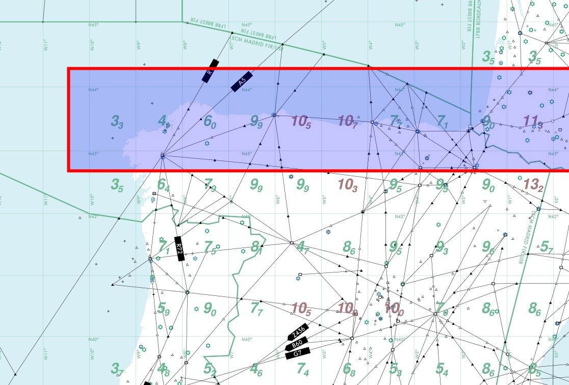
43 -30 010 010 010 010 010 010 010 010 010 010 010 010 010 010 010 010 010 010 010 010 033 041 060 099 105 107 077 071 090 113corresponds to the marked part of Spain:
The text was updated successfully, but these errors were encountered: