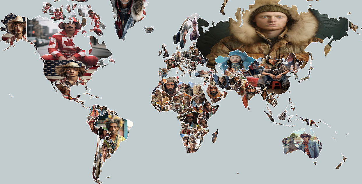
Once a month or so, I'm going to ask Midjourney to imagine something bound to geography and then visualize the results on a map.
Images below are preview of the results, but please do explore interactive versions as they provide more details with panning and zooming.

You can see them as a list too: https://anvaka.github.io/imaginary-map/architecture/List.html
Please be aware that:
- These images are not depictions of real individuals, and the AI was specifically prompted to generate stereotypical (or biased) images.
- The generated images are not representative of the diverse and complex populations of each country.
- This project is a product of curiosity about how a machine learning model might "view" the world.
Each image was created by manually entering a query for every country. The resulting high-definition images amounted to 900MB of disk space, which were then compressed using https://squoosh.app/
The map is rendered using maplibre and natural earth data.
Each image is loaded separately into the browser and then cropped to fit the shape of the respective country. As a result, initial loading times may be slightly prolonged, but navigation becomes significantly quicker once all countries are loaded.
Your feedback is invaluable to the improvement of this project. If you have any suggestions or comments, please feel free to leave them as an issue here, or contact me on Twitter at https://twitter.com/anvaka
- Imaginary faces
- Futuristic architecture - almost no discussion here
Please follow the comments trail to see what people think about it.
The source code in this project is licensed under MIT license.