Here is an end to end walkthrough showing how to process drone imagery into maps and then share it online, all using imagery we collected on a recent flight with the 3D Robotics team and their Aero drone.

The first step in creating a sharable map is stitching the images into one single image. Software like PhotoScan and Pix4D make this really easy for you. Here we are going to use Pix4d. Simply import images, select GeoTIFF as output option and let it run.

After Pix4D has completed processing the imagery, import the resulting GeoTiff into TileMill, our open source map design studio. In TileMill follow these steps to make sure your imagery looks great:
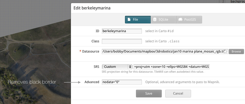
- To remove the black border from around the imagery, set
nodata=0. Usually this value is0but the value can vary and can be checked in QGIS - Increase the
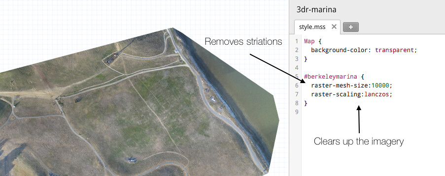
raster -mesh-size. This will make sure re-projection artifacts do not appear - Set
map-background:transparent. This will make the map look better when overlaid on other imagery - Set
raster-scaling:lanczos;. This will ensure your imagery is nice and clear. It will also increase your processing time, but it's worth it.
Once all TileMill parameters are set, upload the imagery to Mapbox.com by clicking Export ---> Upload.
Final Result on top of Mapbox Satellite once uploaded to Mapbox.com and styled with mapbox.js.
Once uploaded to Mapbox.com, you can optionally combine the imagery with Mapbox Streets, Mapbox Satellite or any other layer you have uploaded previously. From there it is easy to share the map either by its URL or as a Youtube-like embed code. To extend the map further use mapbox.js. For instance, the example above is a simple time line built with mapbox.js.