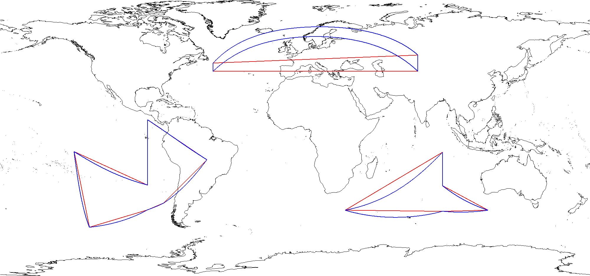
experimenting with connecting polygons on a geodesic surface
A polygon specifies vertices - but the manner of connecting them tends to be a straight line in whatever the coordinate system is. The projects instead assumes that the polygons should be shortest path on the earth lines. The images below show the same polygon in EPSG:4326 - with two methods of connecting the vertices
- Cartesian shortest distance (red)
- Geodetic shortest distance (blue)