This repo contain the code and information about the deep learning on various satellite imagery.
It contain following items,
- Building detection
For the building detection, I have tested on this dataset. The dataset is mainly for the building damage assessment but I tried it with the building detection.

- LULC classification
It has two sub-folders, one is for kaggle dataset and another is for numpy array format pre-processed dataset.
The input and the mask for the kaggle dataset looks like below image,

The inuput and the mask for numpy array dataset looks like below image,

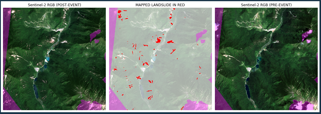
- Landslide mapping