This repository has been archived by the owner on Apr 4, 2023. It is now read-only.
Store the geopoint in three dimensions #424
Merged
Conversation
This file contains bidirectional Unicode text that may be interpreted or compiled differently than what appears below. To review, open the file in an editor that reveals hidden Unicode characters.
Learn more about bidirectional Unicode characters
|
My bad there are already changed unrelated to v0.25.0 on |
3 tasks
Kerollmops
approved these changes
Dec 14, 2021
Merged
Sign up for free
to subscribe to this conversation on GitHub.
Already have an account?
Sign in.
Add this suggestion to a batch that can be applied as a single commit.
This suggestion is invalid because no changes were made to the code.
Suggestions cannot be applied while the pull request is closed.
Suggestions cannot be applied while viewing a subset of changes.
Only one suggestion per line can be applied in a batch.
Add this suggestion to a batch that can be applied as a single commit.
Applying suggestions on deleted lines is not supported.
You must change the existing code in this line in order to create a valid suggestion.
Outdated suggestions cannot be applied.
This suggestion has been applied or marked resolved.
Suggestions cannot be applied from pending reviews.
Suggestions cannot be applied on multi-line comments.
Suggestions cannot be applied while the pull request is queued to merge.
Suggestion cannot be applied right now. Please check back later.
Related to this issue: meilisearch/meilisearch#1872
Fix the whole computation of distance for any “geo” operations (sort or filter). Now when you sort points they are returned to you in the right order.
And when you filter on a specific radius you only get points included in the radius.
This PR changes the way we store the geo points in the RTree.
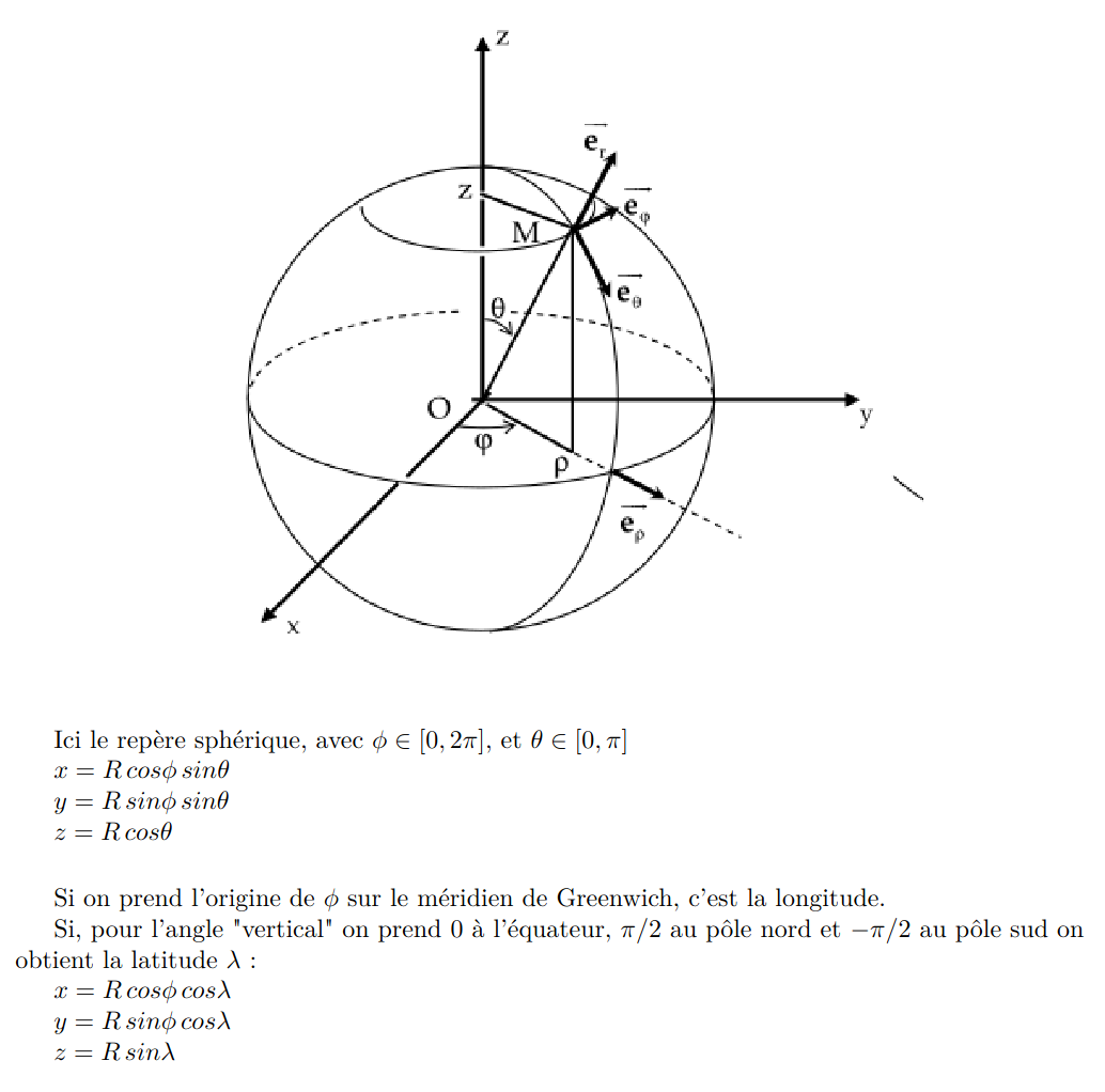
Instead of considering the latitude and longitude as orthogonal coordinates, we convert them to real orthogonal coordinates projected on a sphere with a radius of 1.
This is the conversion formulae.
Which, in rust, translate to this function:
Storing the points on a sphere is easier / faster to compute than storing the point on an approximation of the real earth shape.
But when we need to compute the distance between two points we still need to use the haversine distance which works with latitude and longitude.
So, to do the fewest search-time computation possible I'm now associating every point with its
DocIdand its lat/lng.