Add directional arrows to polylines #791
Comments
|
#611 related issue This is pretty cool! Testing now, i can see lots of use cases for aviation maps, vectors and waypoints, etc |
# Conflicts:
#	OpenStreetMapViewer/src/main/java/org/osmdroid/samplefragments/SampleFactory.java
…a bit more natural
Add directional arrows on polylines
|
Is it doable to have labels aligned to polylines? Something like: |

|
@pasniak I think this goes far beyond the "arrow" feature for many reasons, among them: what parametrized text should we display and how should we split the text if the segment zigzags? In comparison, for arrows we just always display the same small canvas.save();
canvas.rotate(orientation, centerX, centerY);
// here it's a bitmap, but you can put a text instead
canvas.drawBitmap(bitmap, centerX - bitmap.getWidth() / 2, centerY - bitmap.getHeight() / 2, null);
canvas.restore(); |
|
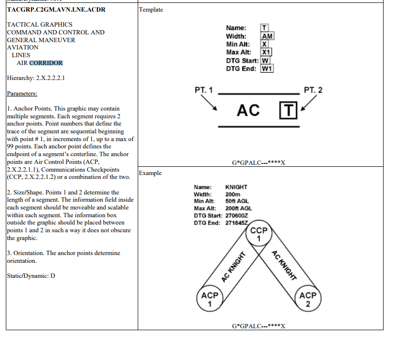
@pasniak one approach you could take is to look at the milstd2525 renderer. There's a standardized graphic for this. It looks a lot like an air space corridor or something like that. Your (developer) workflow would be:
the following is what it looks like in the spec (milstd2525c), which is in the ball park of what you're looking for. http://www.dtic.mil/doctrine/doctrine/other/ms_2525c.pdf for the full spec
of course, you could just build the polygons yourself. The text labels can be created on the fly too with the marker class |
Issue Type
[x] Improvement
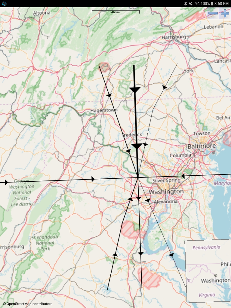
I needed to add directional arrows to the polylines for indicating direction between points and wanted to share the end result. Maybe someone else will find it useful.
For example,
The text was updated successfully, but these errors were encountered: