[Regression] Label/diagram placement on centroid is broken for multipolygons #21600
Comments
|
Author Name: Anita Graser (@anitagraser)
|
|
Author Name: Nyall Dawson (@nyalldawson)
|
|
Author Name: Anita Graser (@anitagraser)
|
|
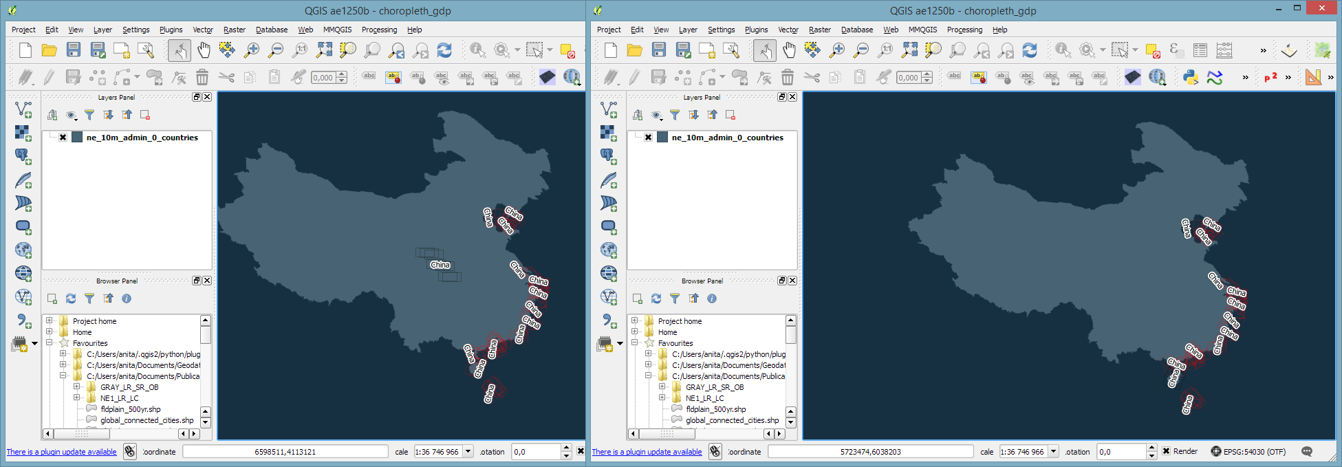
Author Name: Anita Graser (@anitagraser) Update info: If label all parts of multipart feature is enabled ... When the complete multipolygon is visible in the map view, there are no label candidates on the main land. They appear if the feature is moved partially outside the map view: !label-partial-feature.png!
|
|
Author Name: Nyall Dawson (@nyalldawson) Seems to be caused by the recent GEOS c++ changes (tolerance) - if I build without the geos c++ library set then the placement matches 2.10. Can also confirm that #2353 fixes this. |
|
Author Name: Nyall Dawson (@nyalldawson) Can you please re-test with current master? PR 2353 has been merged, which fixed the issue for me.
|
|
Author Name: Anita Graser (@anitagraser) Looks fine today. Thanks!
|
Author Name: Anita Graser (@anitagraser)
Original Redmine Issue: 13558
Affected QGIS version: master
Redmine category:labelling
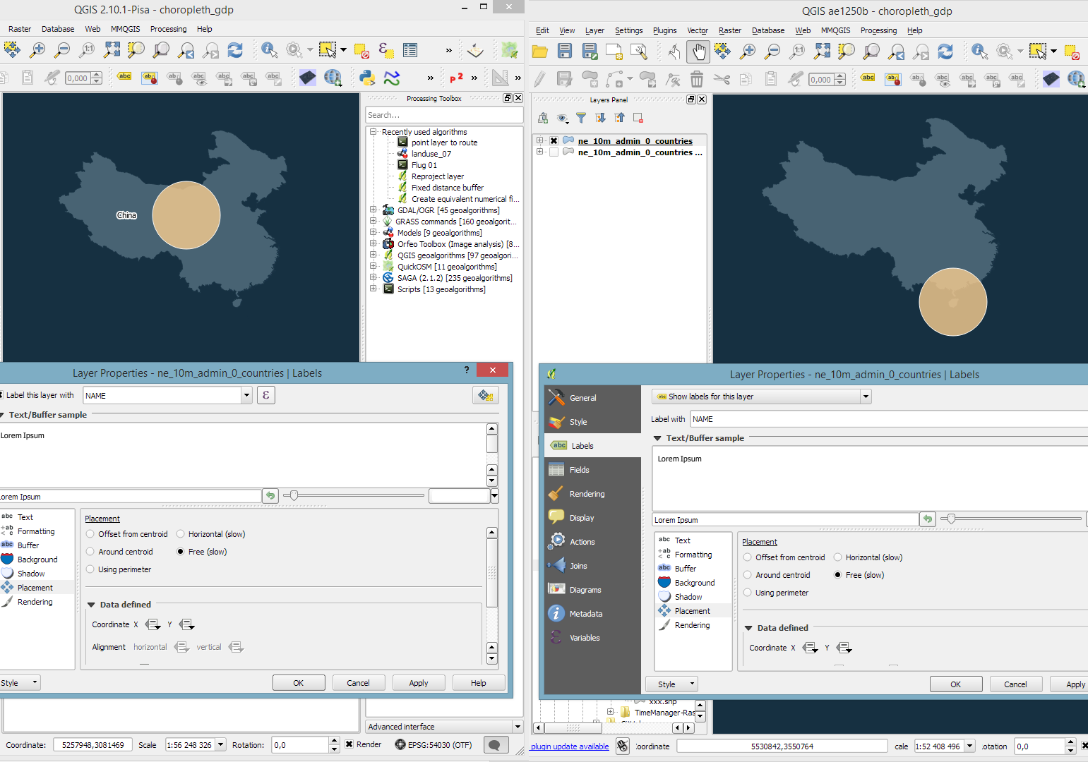
Label/diagram placement on centroid in master seems to be off compared to 2.10: for multipolygons, it seems to randomly chose the centroid of one part rather than the old behavior which seemed to use the whole multipart feature to compute the centroid.
In the following example the diagram is put on the centroid with high priority and the label settings are shown.
!210-vs-master.png!
Tested on nightly OSGeo4W
The text was updated successfully, but these errors were encountered: