ArcGISFeatureServer New Connection Not working. Cannot add a layer from service #24231
Comments
|
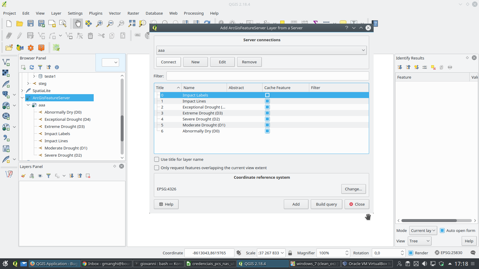
Author Name: Giovanni Manghi (@gioman) As for the mapservice ticket you just created I can't replicate, kind of. The connection works fine, the layer list is presented. In this case of the feature service of this specific service there is an error loading the layers. In the past I tested other feature services and worked fine. See attached images.
|
|
Author Name: Giovanni Manghi (@gioman)
|
|
Author Name: Dave Sampson (@samperd) Realated to #161321 |
|
Author Name: Dave Sampson (@samperd) OK, I think I found the issue. It has been a while since I have used QGIS in all its workflows so it took a while to determine the issue and worked with another user to narrow down the issue. The issue seems to be in one of the many potential paths to add a layer. So lets go through them:
So is seems the issue is with the browser panel within QGIS desktop. Can anyone confirm that this workflow also fails for them? |
|
Author Name: Sandro Mani (Sandro Mani) Confirmed, investigating.
|
|
Author Name: Sandro Mani (Sandro Mani) Fixed in #d6f4621b6622341e68dd966260384c2a4e1e793e
|
|
Author Name: Giovanni Manghi (@gioman)
|
Author Name: Dave Sampson (@samperd)
Original Redmine Issue: 16321
Affected QGIS version: 2.18.4
Redmine category:web_services_clients/arcgis
Assignee: Sandro Mani
As a QGIS user
I want to load a layer from an ArcGISFeatureServer
So that I can view the feature server layers on my map
Steps:
** No layer added to Layers panel
** No layer added to Browser panel
Notes:
** Service URL
*** http://www.agr.gc.ca/atlas/rest/services/app_cdm_ssc/canadian_drought_monitor_editing/FeatureServer
*** Present dialogue to select one or more layers to add
** Layer URL
*** http://www.agr.gc.ca/atlas/rest/services/app_cdm_ssc/canadian_drought_monitor_editing/FeatureServer/0
*** Present dialogue to select the one layer to add
*** Maybe show other possible layers within the service?
The text was updated successfully, but these errors were encountered: