Skip to content
New issue

Have a question about this project? Sign up for a free GitHub account to open an issue and contact its maintainers and the community.

By clicking “Sign up for GitHub”, you agree to our terms of service and privacy statement. We’ll occasionally send you account related emails.

Already on GitHub? Sign in to your account

v.net.path is not considering the #29784

Closed
qgib opened this issue May 1, 2019 · 9 comments
Closed

v.net.path is not considering the #29784

qgib opened this issue May 1, 2019 · 9 comments
Labels
Bug Either a bug report, or a bug fix. Let's hope for the latter! GRASS

Comments

@qgib
Copy link
Contributor

qgib commented May 1, 2019

Author Name: Sergio Antonio (Sergio Antonio)
Original Redmine Issue: 21969
Affected QGIS version: 3.4.6
Redmine category:grass


v.net.path is not considering the node cost variable.
QGIS 3.4.7


@qgib
Copy link
Contributor Author

qgib commented May 2, 2019

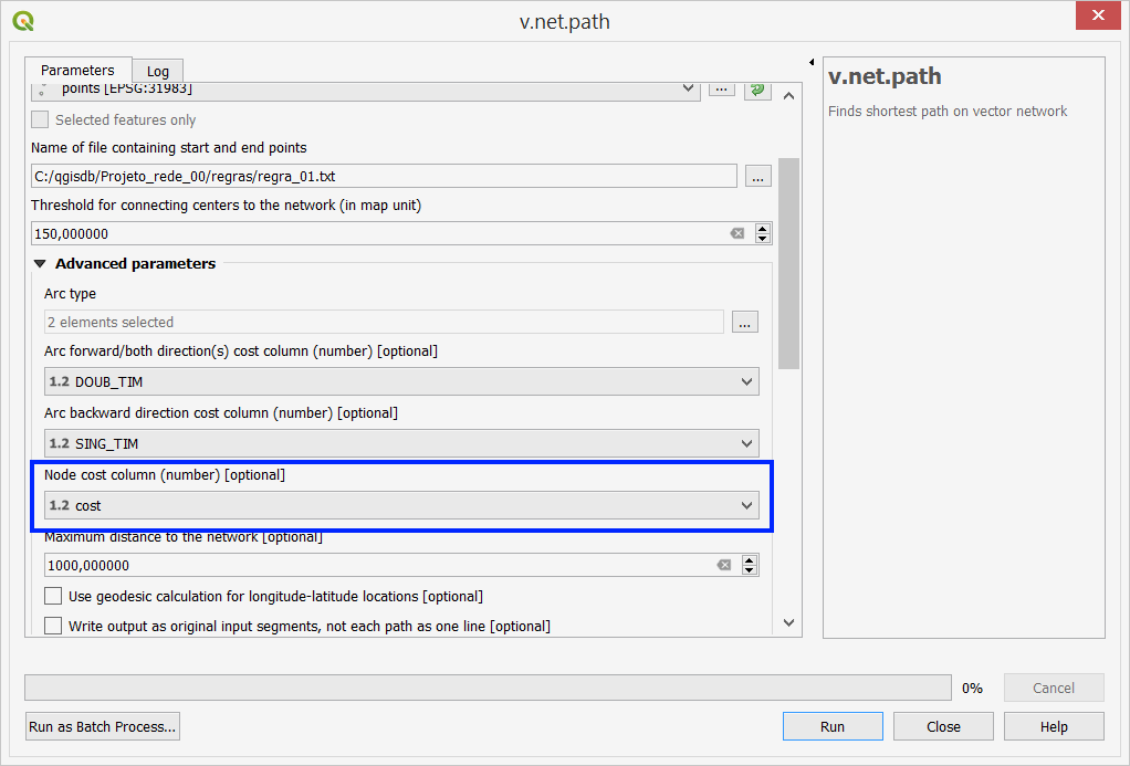
Author Name: Giovanni Manghi (@gioman)


Can you more specific? Is the parameter missing from the tool GUI? What is the exact parameter name("node cost variable" is not listed here https://grass.osgeo.org/grass76/manuals/v.net.path.html)?


  • subject was changed from v.net.path is not considering the node cost variable to v.net.path is not considering the
  • status_id was changed from Open to Feedback
  • easy_fix was changed from 1 to 0

@qgib
Copy link
Contributor Author

qgib commented May 2, 2019

Author Name: Sergio Antonio (Sergio Antonio)


Giovanni Manghi wrote:

Can you more specific? Is the parameter missing from the tool GUI? What is the exact parameter name("node cost variable" is not listed here https://grass.osgeo.org/grass76/manuals/v.net.path.html)?

This problem has been intermittent.
The given data complies with that requested by v.net.path tool (input vector line - arcs, center points, file containing star and end points, threshold for containing centers, arc forward/both directions, arc backward direction, node cost). Other fields: default value.
More details:
a) The tool works well when I do not use "node cost".
b) The tool has failed when a new point is added to the existing ones using QGIS vector editing. It does not consider the cost of the new point.
c) From time to time, QGIS informs you that an error has occurred and that it will close. But, when I click OK the QGIS does not close. The v.net.path tool terminates the calculations and creates the output file and layer.
d) Please note the figure.


  • 14878 was configured as node cost.png

@qgib
Copy link
Contributor Author

qgib commented May 2, 2019

Author Name: Giovanni Manghi (@gioman)


b) The tool has failed when a new point is added to the existing ones using QGIS vector editing. It does not consider the cost of the new point.

so if you load a layer, open v.net.path, use the layer as input it works,

if you load it, edit it, use it as input then the edited features are not taken into account,

correct?

@qgib
Copy link
Contributor Author

qgib commented May 2, 2019

Author Name: Sergio Antonio (Sergio Antonio)


Giovanni Manghi wrote:

b) The tool has failed when a new point is added to the existing ones using QGIS vector editing. It does not consider the cost of the new point.

so if you load a layer, open v.net.path, use the layer as input it works,

if you load it, edit it, use it as input then the edited features are not taken into account,

correct?

Yes. Correct.

@qgib
Copy link
Contributor Author

qgib commented May 2, 2019

Author Name: Giovanni Manghi (@gioman)


Yes. Correct.

what if you add to the project (again) the edited layer (and give it a different name) and use it in the tool?

@qgib
Copy link
Contributor Author

qgib commented May 2, 2019

Author Name: Sergio Antonio (Sergio Antonio)


Giovanni Manghi wrote:

Yes. Correct.

what if you add to the project (again) the edited layer (and give it a different name) and use it in the tool?

I followed your suggestions, but the results are inconclusive.
Sometimes it works well, but sometimes it does not.
Detail: All shape files (points and lines) were generated in QGIS 2.14.18.
Important: everything started working reasonably well when I created a NEW file (points.shp) in QGIS 3.4.7 to replace the original file from QGIS 2.14.18.

@qgib
Copy link
Contributor Author

qgib commented May 2, 2019

Author Name: Giovanni Manghi (@gioman)


Important: everything started working reasonably well when I created a NEW file (points.shp) in QGIS 3.4.7 to replace the original file from QGIS 2.14.18.

weird, but if true/confirmed (and I can't see why not) then it should really not be an issue of just this specific tool, maybe is a more general problem.

@qgib
Copy link
Contributor Author

qgib commented May 3, 2019

Author Name: Sergio Antonio (Sergio Antonio)


Giovanni Manghi wrote:

Important: everything started working reasonably well when I created a NEW file (points.shp) in QGIS 3.4.7 to replace the original file from QGIS 2.14.18.

weird, but if true/confirmed (and I can't see why not) then it should really not be an issue of just this specific tool, maybe is a more general problem.

Yes, very very strange, I have to admit.
On the other hand, version 3.x.x is getting very good, including the GRASS tools.
Please consider it resolved, at least for now. Thank you.

@qgib
Copy link
Contributor Author

qgib commented May 3, 2019

Author Name: Giovanni Manghi (@gioman)


  • resolution was changed from to not reproducable
  • status_id was changed from Feedback to Closed

@qgib qgib closed this as completed May 3, 2019
@qgib qgib added Bug Either a bug report, or a bug fix. Let's hope for the latter! GRASS labels May 25, 2019
Sign up for free to join this conversation on GitHub. Already have an account? Sign in to comment
Labels
Bug Either a bug report, or a bug fix. Let's hope for the latter! GRASS
Projects
None yet
Development

No branches or pull requests

1 participant