orient function should work on folded polygons #1705
Comments
|
Assuming that your import shapely
poly0 = shapely.Polygon(poly0)
poly1 = shapely.Polygon(poly1)then the problem here is that those are not "valid" Polygons: >>> poly0.is_valid
False
>>> poly1.is_valid
False
>>> shapely.is_valid_reason(poly0)
'Ring Self-intersection[-70 20]'
>>> shapely.is_valid_reason(poly1)
'Ring Self-intersection[-70 20]'And many of the shapely functions are not guaranteed to work fully correctly with non-valid geometries. If you want to represent such a polygon, you actually need a MultiPolygon: >>> shapely.make_valid(poly0).wkt
'MULTIPOLYGON (((-60 10, -70 10, -70 20, -60 20, -60 10)), ((-80 30, -70 30, -70 20, -81 20, -80 30)))' |
|
Try to embed this code in your example, it gives the same output with poly0 and poly1.
I don't know |
|
Thanks for your answer. I have tried this already in my real case. And it is not working. A lot of non valid polygons, I don't know how to correct them. in fact only 1, 2 and 11 cause trouble when filled. |
|
Hi @PBrockmann I'm not sure what's the correct output, but as @jorisvandenbossche pointed out - some of your polygons are not valid and you could try to make them valid before calling You might want to try to take some ideas from this code: |
|
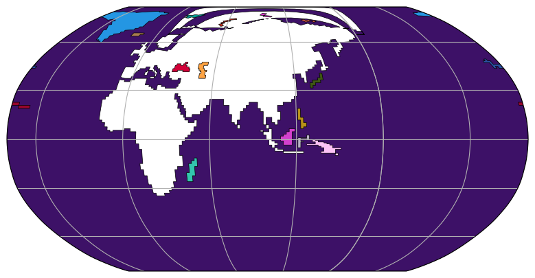
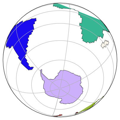
Thank you for your proposition but running the code I get a The correct output is as described in the StackOverflow question.
With an Antartica correctly filled. |

|
Back to a simpler test that does not work (filling incorrect) event with shapely.geometry.polygon.orient |
Oh, right, I've added support for this in #1690 |
Please apply #1690 and try this: |
|
Hummm no the poly0Code should be used to close properly the polygon (code 79) otherwise the filling is not correct. If If Conclusion I need to use Pffff. Quite hard problem. |
|
Hi, Tested again. Really confused in what to do. Your proposed code does not give a correct plot.
No the nearest good solution is: But polygons near borders are not filled correctly:
|
|
Hi @PBrockmann, I can suggest that for pinpointing the problem it might be helpful if you provided a minimal example that reproduces the issue (maybe like your first example, if that makes sense). |
|
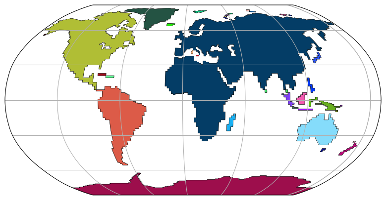
Yes, many thanks for being helpful in trying to resolve this issue. I have tried to simplify the problem. But I am confused in the use of different parameters such as closed=True for Path structure in Matplotlib. The big picture is to be able to draw continents and all islands with a filled color. Some polygons (extracted from a VTK process) have holes. The matplotlib Patches are the right structure to handle this I think. But I have to respect orientation and that seems non trial when you have islands connected only by a vertex. Making them valid from a shapely point of view leads to other problems (why so many different types of geometry once valid ?). So yes confusing for a request quite simple in fact. |
|
Hi, I have a small case extracted from my real polygons that explains the problem and that I cannot solve.
Inpecting the coordinates show the problem:
The polygon coordinates is folded. When it is fully describes anti-clockwise then the filling is correct. So how to do this ? Correct all polygons. |


If many of your polygons are not valid maybe it explains all the filling problems, so maybe run |
|
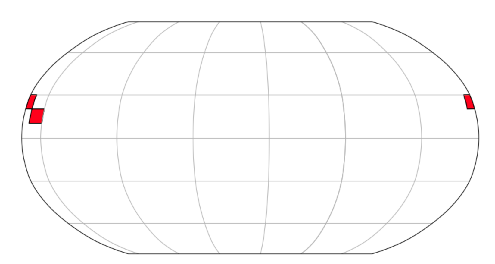
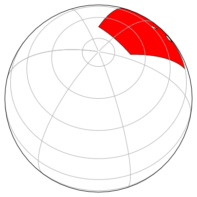
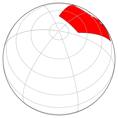
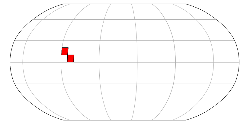
Hi, I come back on this issue. Because folded polygons cannot be drawn on a map. The first polygon is not drawn, the second is drawn.
The first one is folded and detected as oriented counter clock-wise. That is partially true. How can I repair this orientation ? |

|
Any news on this problem ?
polygon1 is not drawn. So how to correct polygon1 ? |
|
Here is a solution I have found. The strategy is to separate the folded polygon into multiple polygons, orient them correclty with shapely then build a patch matplotlib object. Here is the code to correct polygon1 that is a folded polygon. |
|
And to close this issue.
So same strategy. Separate the different self intersected polygons from their duplicate points into multiple polygons. |
I have encountered a problem with folded polygons that despite the use of ``shapely.geometry.polygon.orient``` are not describe fully oriented counter-clockwise.
I have described the problem from the cartopy project but this issue is in fact related to shapely.
See: SciTools/cartopy#2111
Initialy from: https://stackoverflow.com/questions/74710358/how-to-detect-inner-polygons-from-a-multipolygon-shapely-object
So my question is:
How to force the orientation of a folded polygon to be oriented counter-clockwise ?
The text was updated successfully, but these errors were encountered: