Bicycle overlay: bicycle=yes not visible #4669
Comments
|
That is intentional that |
|
Thanks, will be interested to see this comment.
In Germany the difference between those two is that with This leads to the inconsistency that I understand that it is not helpful to generelly color it blue for all highways where the default would be |
|
@matkoniecz You meant this comment, right? |
|
yes |
The overlay really is just about the physical situation, not about the signage. And this is the reason why The signage is a matter out of scope of this overlay that can be recorded separately, as explained in the cited comment - and by the way potentially a humongous amount of work, given the number of different legislation there is in the world and different signage there is in the world (and StreetComplete's aspiration to not confront users with the raw tags but present it with a WYSIWYG kind of UI) . Maybe iin the future, there could be a quest, limited to Germany (and/or other countries where not all cycle tracks are mandatory/not mandatory) that specifically asks about if there is a blue lollipop for this cycle track. |
|
Thank you for commenting. I understand the difficulty to apply per country rules that fit well here. As SC is supposed to be a WYSIWYG UI, what should the user select in the situation described by me?
What speaks against adding another option: |
|
Having this new option would imho even make it easier to review any situation where |
there is sign allowing it for cyclists (though yes, that may be not entirely clear) |
Didn't you read the cited comment in the code? How about this? Any clearer? - Not designated for cyclists (regardless of whether cycling is allowed or not)
+ Not designated for cyclists (regardless of whether cycling is explicitly allowed or not) |
I don't think so, unfortunately.
Yes, I read it before. My summary: I am only wondering if there would be any concrete problem to handle Making it a separate option (like suggested) would imho help not mixing it up with any other form of cycleway. |
|
By the way
This is already today not true for |
Hm, true.
To elaborate: Whether or not bicycles are allowed by default on a sidewalk and under what conditions (in Germany: always "no" unless otherwise signed.... as far as I know, that is) differs from country to country. In Poland, there is some rule like "if the sidewalk is broader than X meters and also some other criteria is given" it is allowed, otherwise prohibited. We can't expect surveyors to know these rules. But if we showed that information, we'd expect that from him, because otherwise he might re-tag that information incorrectly to "none allowed" (or "yes, allowed") because there is no sign and he just assumes that bicycles will be not allowed / be allowed there. |
It is more complex! It can be legal on sidewalk under default rules:
Cycling can be also banned by sign, in such case neither of this applies (so you cannot cycle on such sidewalk also in case of a bad weather and so on). But young children can still cycle as they are legally considered as pedestrians (not sure about people accompanying them...) |
|
Well okay, but most of this is not relevant for tagging in OSM |
ok. What about
This would allow to
|
I just wanted to give that as example of why
|
Translation issue? How is a footway on which bicycles are allowed "designated use" for cyclists? |
|
Maybe. My understanding of "designated" (German: "ausgewiesen", "bezeichnet") is that there is a sign. However translations "ernannt" and "vorgesehen" could mean any (non exclusive) dedication without a visible sign. Anyhow: What do you think about the suggestion using |
|
Well, as said, that shifts the responsibility to decide whether something is "legally" allowed or not onto the individual mapper. We do not do that in StreetComplete. For good reason. A little warning dialog will not better that situation. It is not only a matter of UI / design principle in StreetComplete to be easy for the average joe but also a question of data quality. If it is up to each individual mapper to decide if something is "legally" allowed or not, it will result in a hodgepodge of wrong and correct values, depending each on how much in detail the individual user is informed about the legal situation. (For example, are you actually sure that German law does not have similar rules and exceptions as the Polish law? There must be something in the law that in general allows bicycle traffic on just some path without any sign, but on the other hand forbids bicycle traffic on "straßenbegleitende" ways unless it is signed. Such details are important when one wants to tag Not to mention what happens if the legislation changes. The only way to escape this situation is to have a tag to denote whether the individual bicycle access restriction is derived from an actual sign or not, like |
|
Ok I see my proposal seems not suitable. I however still see a problem with the existing situation. Ethymological the word "designated" is related to "sign", same as in German "bezeichnet" is related to "Zeichen". Therefore "not designated for cyclists..." is wrong to me in case there is a sign. If "bicycle=yes" can mean there is a sign, this wording is incorrect for the cases where a sign is really present. I doubt however the usage of something like So what other solution can you think of?
|
|
I'm not a native English speaker. "dedicated"? |
|
Maybe there is a solution that would add another selectable option to distinguish at least between:
Whether this solves the angle you criticized I don't know, but at least paths in the forest etc. wouldn't be displayed in black (but probably similar to |
|
Thank you for asking in the osm community. Currently I dont have time to check this, but will do so some days later. |
|
I also asked in slack-us regarding "designated" and "dedicated" and will update the wording accordingly. |
|
That combination of DE:239 + DE:1022-10 implies a
Which is why the distinction is important to me, since I do not want a router to take these paths unless absolutely necessary. |
The German forest law specifically allows cycling on all visible paths in any forest, so any path in any forest (private or not) is automatically a shared foot and cycleway.
In any case, legalities per country should not concern SC. Only if the tagging is as such, with the per country default values for an otherwise untagged path. |
Yeah, so you choose the option "not designated for cyclists". Anyway, that example above... maybe in paper you may go only walk speed, but i bet even the people who put this sign weren't aware of that 🤷
No, it's a "path". Everything is allowed unless forbidden. |
yeh 🙄 🤷
Yes, but I wanted to give an example on where cycling access-tagging can be a result of a law many people do not know about. |
|
I like the improved situation in v 50.0:
Current situationHighlighted (shown as
Not highlighted (shown as
Suggestion
|
|
Hw=path is highlighted mainly because "some path" in the forest shouldn't look like you can't cycle there. Hw=path implies yes for both foot and bicycle. It is treated as such in the parser for the data (hence, no difference can be made between hw=path and hw=path+bicycle=yes). |
|
So for paths no difference between explicit and implicit Though you are highlighting them because cycle access is allowed there, while refraining from highlighting Current situation is inconsistant, as
I can attach examples if wanted. |
|
So, should maybe paths be highlighted in black, too? |
|
If you prefer to keep |
|
In addition we could think it the other way round, adding another highlight color for disallowed bicycle access ( |
|
Thanks, it's consistant now. I am thinking about opening a new issue to give all Now it is mostly clear and understandable and I like this. |
A line with
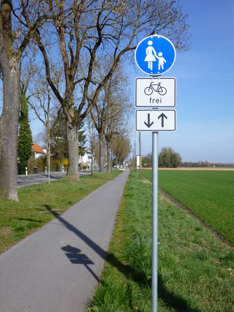
highway=footway,bicycle=yes(with or withoutsegregated=no) is not highlighted in the overlay.See https://www.openstreetmap.org/way/22931888
Expected Behavior
Should be highlighted in blue
Versions affected
v50.0-beta1
The text was updated successfully, but these errors were encountered: