Back (or double?) great circles drawn when used draw_grid from any position.
#3179
Comments
|
(I haven't yet tried what's in the original post.) I haven't been able to reproduce this issue when using a Map object from an actual file (with manually modifying the observer coordinate to be sure). No back-side grid lines appear. >>> import astropy.units as u
>>> import sunpy.data.sample
>>> from sunpy.map import Map
>>> m = Map(sunpy.data.sample.EIT_195_IMAGE)
>>> m.meta['hec_z'] *= 1000
>>> m.peek(clip_interval=[5, 99]*u.percent, draw_grid=True)
|

|
So in collaboration with @astrofrog I think this is something to do with how the coordinates round trip HGS -> pixel -> HGS. WCSAxes uses how that transform behaves (i.e. does input match output) to work out of the lines should be drawn. I have so far got this down to the following behaviour: A custom map:
I don't understand why the custom map returns NaNs for the last HPC -> HGS transform. Investigations continue. |
|
The culprit is |
|
Heh, the incredible shrinking Sun! |
|
Incidentally, the Sun's Schwarzschild radius is 3 km, so shrinking it by three orders of magnitude (to a radius a tenth of Earth's radius) still didn't turn it into a black hole. |
|
I am glad you provided that information as I was wondering. It is worth noting that this is a particularly weird |
Description
We get the lines behind the sun when using
draw_grid.Expected behavior
That only the front lines ares shown and the backs are not drawn! (or at least @Cadair said: weeeird, bug report time)
Actual behavior
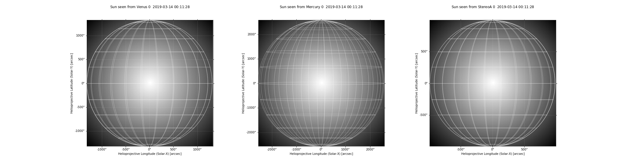
From SDO:

From other places:
Steps to Reproduce
draw_gridSystem Details
The text was updated successfully, but these errors were encountered: