Errors, missing information, unclear explanations in wiki #63
Comments
|
Welcome here, Thanks, 01 is fixed now |
|
Thanks, Nicolas. Here is my recommandations for step 02 02 - Quick start
|


If a style is provided it must be a SLD encoding.
|
|
I can't find the PostGIS discussion about it but it raised some concerns on several places:
Ideally, you should be able to name the geometry column as you want. It is functionnal right now. As it is a newcomer review, I made the suggestion. |
03 SQL functionsThis section details the fucntions used during the processing BR_EvalSource
BTW_EvalSourceNo comments BR_SpectrumRepartition
BTW_SpectrumRepartitionno comments BR_TriGrid
BR_TriGrid3DNo comments BR_PtGridNo list of returned columns BR_PtGrid3DNo list of returned columns General comments
|
04 Industrial sound sources applicationThere is not particular comments on that section just general ones.
|


The name of the geometry column "geom" or "the_geom" is just for conventional naming (recommendation). There is no constraint about that in the SQL standard. I think using a specific name for Noise function is good choise. The user is welcome to apply an alias to change on the fly the name of its column. @nicolas-f What do u think ? |
05 Ground effectno major concerns on this part as it is similar to the previous part.
|


06 Modelling barrier using digital elevation modelSame comments as before:
|
07 Horizontal noise mapCreate input data for demonstrationNo comments, working as expected Launch sound propagation and triangulationEncounter one issue with this line: Corrected with I'm stuck to the next line: Create contouring noise map
|
|
I think sql variable is predefined now in the OrbisGIS groovy console |
|
Ok, I deleted the line. Console says "Script1.groovy: 1: unable to resolve class TriangleNoiseMap " but TriangleNoiseMap seems to be at the right place. Plus I don't see where are created the functions parameters. |
|
This class has been edited. It expect only two arguments now. |
|
Maybe 7 is an outdated wiki article, and should be removed ? As it doesn't add anything compared to the other articles? |
|
I don't know, is it seems to be like 06 but with groovy code. |
08 Vertical noise mapI have hard time to understand what are the created objects:
Therefore, I have hard time to understand the output. It is a cross-section view ? The output I get is different as it seems that there is no mask for the hill or the building.
Does the graph represent the sound levels on the "propa_line" ? |

09 Using data from OpenStreetMapGeneral comments:
1. Export All open street map informations
2. Transfer osm file into OrbisGIS databaseNo comments on this part 3. Extract 2D buildings from tablesThis section could explain more where to change the projection in the code: ``ST_SETSRID(ST_MAKEPOLYGON(ST_MAKELINE(THE_GEOM)), 4326), 32630)` It could explain that the datasource is in WGS84 and it is corresponding to the 4326 code. There no indication that the indicated UTM 30N is great for a dataset from the west part of France for example. Note about the Coordinate System
4. Extract roads
5. Fake traffic
Compute noisemap
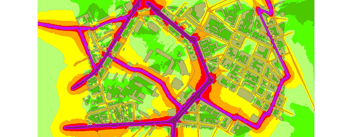
Extended noise propagationThis is nice to provide this informations for 3D noise propagation. I'm wondering if it can be made into a tutorial too (with provided dataset). Extra note: this is my output for the Lorient city center: |
10 Scripting with Groovy
I used this command (with orbisgis-dist-5.0.1-2015-01-30):
I got this error: |
|
thanks |
11 Scripting with Python
It appears I can't launch the H2 server, I get this error: I tried to install the H2 server with the officially recommended installer but got the same error. I'm using java8 on Windows10: |
12 Create a gain noise map
|
|
Correction on 02 - Quick Start
Correction on 03 SQL functions
Missing : Correction in 04 Industrial soun sources application
Correction in 05 Ground Effect
Correction in 06 Modelling barrier using digital elevation model
Correction in 08 Vertical noise map
Correction in 09 Using data from OpenStreetMap
Correction in 10 Scripting with Groovy
Correction in 11 Scripting with Python
|
This issue aims to provide insight from a new user about the project wiki.
It aims to list missing or broken links, non clear explanations and such.
01 Installation
The text was updated successfully, but these errors were encountered: