➡ Overview:
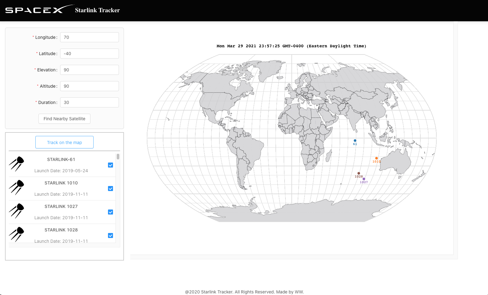 Users can provide geo location information in the form and submit to see a list of nearby satellites. Then they can select one or multiple satellites to track on the world map. During the tracking, users can abort the process at any time and revise the tracking request.
➡ Highlight:
• Achieved the core tracking functionality by fetching nearby satellites info and position prediction data through the N2YO API(s) to animate selected satellite paths on map.