Dean Koch 2023-11-09
rasterbc provides access to a collection of 100m resolution gridded
spatial ecological data on the province of British Columbia during the
period 2001-2018, including yearly rasterized Forest Insect and Disease
Survey (FIDS) pest damage polygons. Given a user-defined geographical
region (polygon), the package downloads and imports requested data
layers into R as SpatRaster objects. The goal is to improve access to a
number of publicly accessible datasets on BC forests and simplify data
ingress for modellers.
The available layers are:
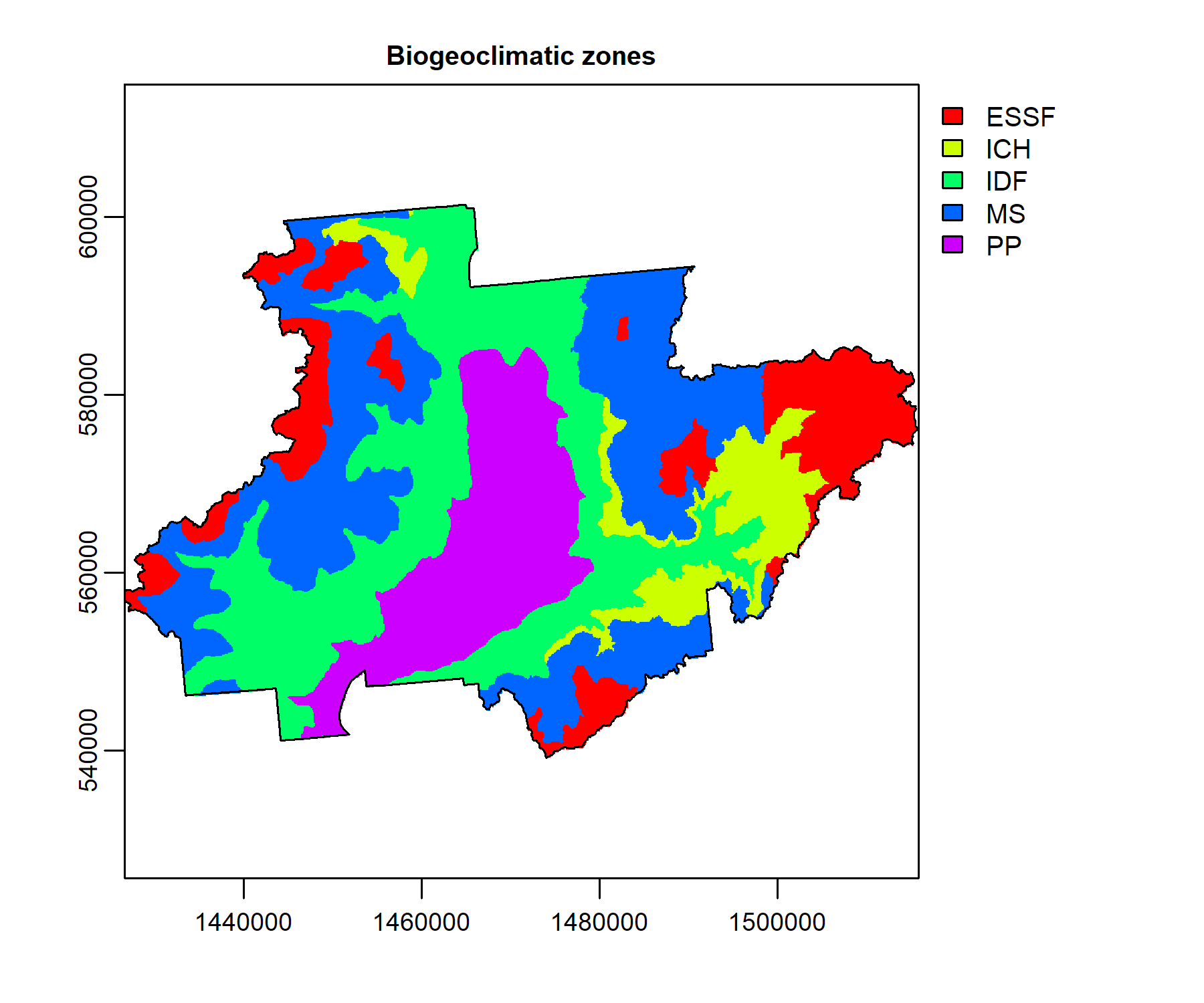
- BC biogeoclimatic zone (‘bgcz’), from the BC Ministry of Forests
- Geographical coordinates grid (‘borders’), from Natural Resources Canada
- Consolidated cutblocks, 2001-2018 (‘cutblocks’), from the BC Ministry of Forests
- Digital elevation model (‘dem’) from Natural Resources Canada
- Forest insect and disease survey, 2001-2018 (‘fids’), from the BC Ministry of Forests
- Forest extent and change, 2001-2019 (‘gfc’), from Hansen et al., (2013)
- Canadian national fire database, 2001-2018 (‘nfdb’), from Natural Resources Canada
- Interpolated forest attributes, 2001, 2011 (‘pine’) from Beaudoin et al. (2017)
All datasets were downloaded and processed in the years 2018-2020, then stored as raster tiles in the standard BC Albers projection, and hosted on FRDR. Follow the links in the list above for code and documentation on this process. The collection is published as a data publication for permanence and easy referencing.
See the introduction vignette for instructions on getting started with this package.
rasterbc is available on CRAN:
Install it in R using the command
install.packages('rasterbc')This will also install the dependencies sf and terra, if you don’t
have them already.
Note that FRDR’s direct download services may occasionally be unavailable, during which the download functionality of rasterbc will also be unavailable. If you are having trouble downloading data tiles with rasterbc, first check the FRDR homepage for news about maintenance downtime.
This project grew out of my doctoral thesis
project on modelling outbreaks of
the mountain pine beetle in central BC. Parts of of the rasterbc
collection can be found in research publications with professors Mark
Lewis and Subhash Lele on statistical methods for spatial
data, models for animal
dispersal, and an analysis of
MPB activity in the Merrit
TSA. We gratefully
acknowledge the support of NSERC, TRIA-Net, and the University of
Alberta Lewis Lab in this work.