![]()
georef-lrpt application can georeference images acquired via LRPT protocol. The result will be a .png file and a .vrt file. VRT file can be used by gdal to create GeoTIFF.
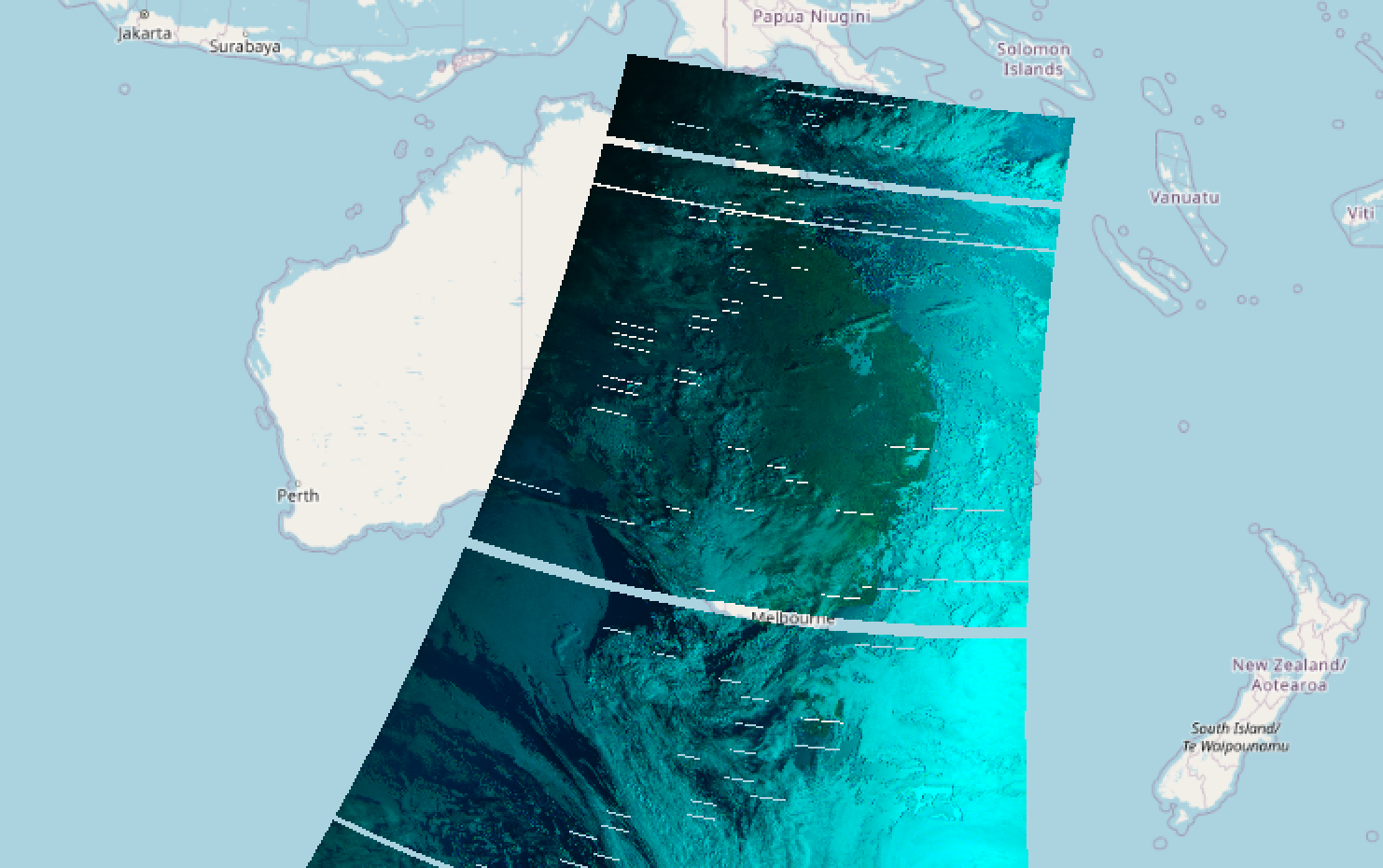
- Supported satellites: METEOR-M 2 (NORAD ID: 40069), METEOR-M 2-2 (NORAD ID: 44387)
- 3 channels + 1 alpha channel
- Alpha channel is generated for those regions where was no packets received for all 3 other channels
- Detect extents for manual split on anti-meridian
These files should contain VCDU (data link layer frame) as they were received from the satellite. Find examples of such files in the src/test/resources/ directory.
Note: VCDU frames can carry variable number of image packets. So better to have a single binary file with all VCDU sorted in the ascending order or several files with filenames in the ascending order.
TLE of the satellite. It should be in the 2-line or 3-line format.
Note: TLE should be generated for the same day as binary files for better alignment precision.
Get the help of all supported parameters using the command below:
java -jar georef-lrpt.jar --help
Example run:
java -jar georef-lrpt.jar --output-dir . --tle-file src/test/resources/2022-12-20.txt --vcdu-files "src/test/resources/*.vcdu"
The output will contain .png file and .vrt file.
Use gdal to convert .vrt into GeoTIFF:
gdalwarp -tps -overwrite -of GTIFF 2022_12_20_20_25_30_134_-14_162_-8.vrt 2022_12_20_20_25_30.tiff
The command above will create GeoTIFF file in the EPSG:4326 projection ( longlat WGS84 ). This projection can be further converted into epsg:3857 to use from online maps like Google maps and OpenStreetMap.
GDAL and QGIS cannot detect if image is wrapped around projection. Thus special handling is needed.
-
Extract geodetic coordinates from the .vrt filename. georef-lrpt will generate .vrt filenames according to the format:
<first .vcdu filename>_<minX>_<minY>_<maxX>_<maxY>.vrt. Please note that each coordinate can be negative. For example:2022_12_20_20_25_30_134_-14_162_-8.vrtHas longitude from 134 to 162 (west to east) and latitude from -14 to -8 (south to north). -
Generate 2 separate tiff files from the same .vrt using gdalwrap. For the filename
2022_12_20_18_44_50_142_-55_-173_-11.vrttwo commands need to be executedgdalwarp -tps -overwrite -te 142 -55 180 -11 -of GTiff 2022_12_20_18_44_50_142_-55_-173_-11.vrt 2022_12_20_18_44_50-left.tiffandgdalwarp -tps -overwrite -te -180 -55 -173 -11 -of GTiff 2022_12_20_18_44_50_142_-55_-173_-11.vrt 2022_12_20_18_44_50-right.tiff
Then left and right images can be added to the map. On the screenshot below the right image is drawn without alpha channel, just to highlight wrapped output.
