WIP 3D GIS simulation of UGM-133 Trident II D-5 ballistic missile MIRV payload detonation using Cesium in the very early state by Farhan Yusuf Nugroho
Shall we play a game? Click here to try it live!
This web app is using ArcGIS tiled elevation terrain by default for more accurate representation of Earth terrain.
It will incur very expensive performance cost on your hardware.
For more performance gain, use Cesium default world terrain by following these steps:
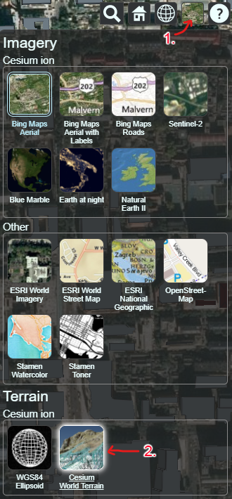
- Select "Base Layer Picker" button
- Select "Cesium World Terrain"
It is highly recommended to follow these steps if you are using a mobile device to prevent crash
This is my debut JavaScript web app and I aim to educate the public with this web app about the magnitude of a nuclear weapon effect, specifically from UGM-133 Trident II D-5 ballistic missile.
This is a Free and Open Source Software made in Indonesia as a gift to the Great Britain and the world in response to Great Britain's shift in its foreign policy and national security approach to increase cap on nuclear warheads from 180 to 260 for Global Britain in a Competitive Age.
At the moment, this simulation only models:
-
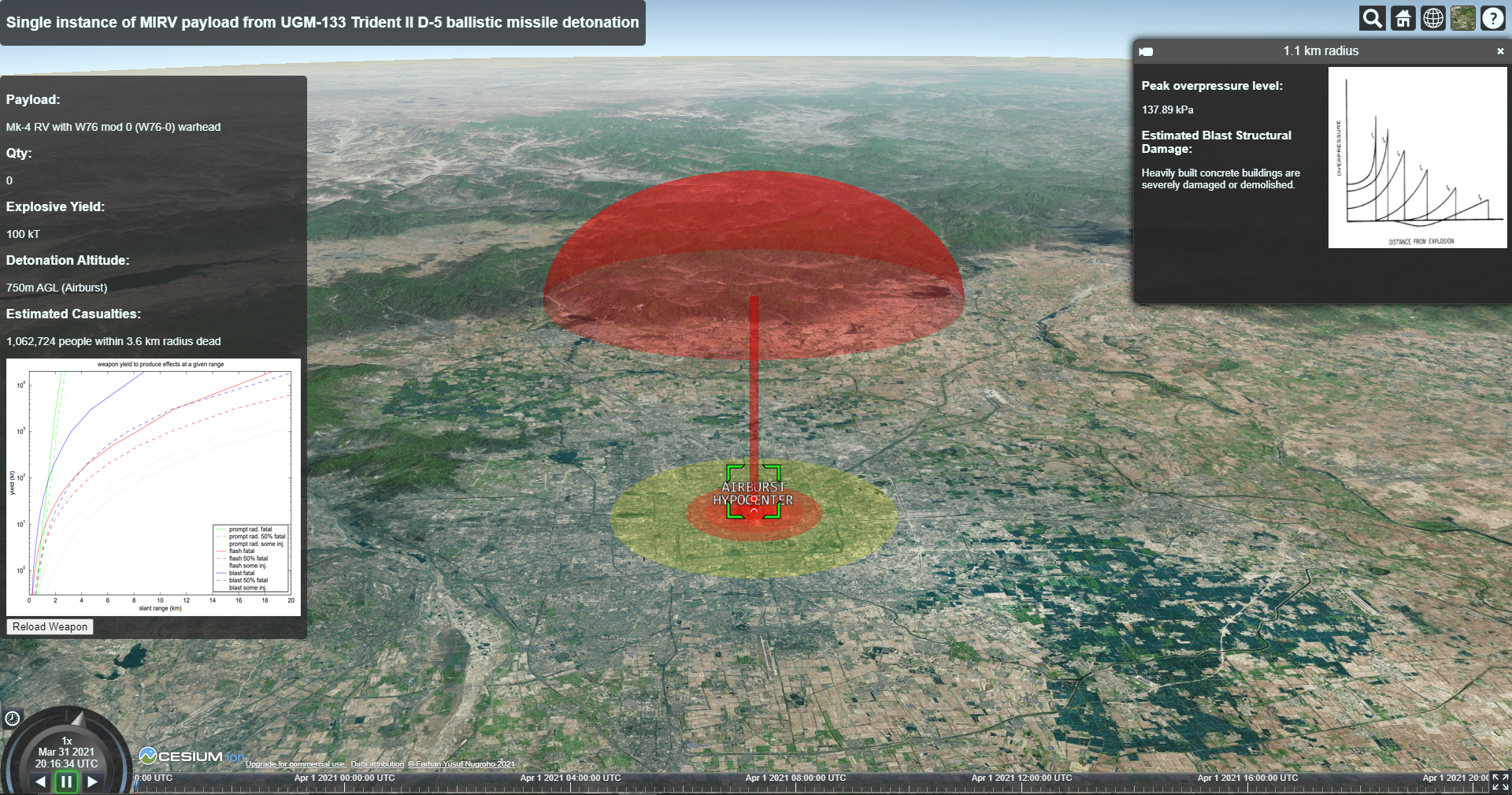
Static blast effect of a single Mk-4 RV with 100 kT W76 mod 0 (W76-0) warhead detonation out of 8 possible RVs in MIRV payload of one UGM-133 Trident II D-5 ballistic missile and without multiple configuration possibilities of a warhead (variable yield)
-
Fixed detonation altitude, airburst at 750m AGL
-
Different overpressure levels to range of 5 overlapping radii that generates 5 rings with total fatal casualties estimation within the lethal range of nuclear explosion using Weighted Centroid geographic retrieval methodology from ArcGIS GeoEnrichment service to aggregate census data
-
Mushroom cloud
-
No other effects such as thermal radiation, ionizing radiation, and nuclear fallout contour are included yet
-
From the current features listed above, it is obvious that there are so many features still WIP. This is a bare MVP that is very primitive and I am looking for open collaboration for much more accurate modelling, more dynamic modelling taking into account temporal changes in the states of objects, as well as improved frontend design and responsiveness
Rotate your mobile device to use landscape orientation for best result
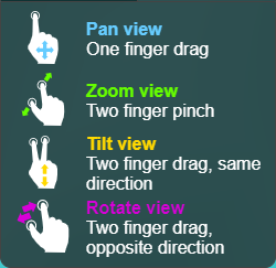
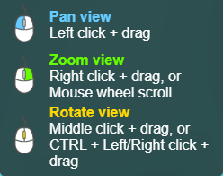
- Navigate map to your desired detonation position, you can also search for a location by selecting the search button
- Left click / tap on "Arm Warhead" button
- Right click / Double tap on map to detonate the warhead
- Left click / tap on the resulting radii, mushroom cloud to inspect its properties
- Left click / tap on the "Reload Weapon" button to reset payload qty to 1 and start over
- The Effects of Nuclear Weapons. (1977). United States: Department of Defense.
- Blast Wave Effects Calculator by Jean M. Bele, Physics Dept., Laboratory for Nuclear Science, MIT
- Nuclear Fireball Calculator by Jean M. Bele, Physics Dept., Laboratory for Nuclear Science, MIT
- Graphs of Nuclear Weapons Effects by Dr. Wm. Robert Johnston
- Nukemap by Alex Wellerstein