Available products
Please find the French version of this page here.
Veuillez trouver la version française de cette page ici.
The available CaSPAr products are:
1a. Global Ensemble Prediction System (GEPS; archived 06/2017 - 05/2021)
1b. Global Ensemble Prediction System - North America subset (GEPS_NA; archived since 05/2021)
2. Global Deterministic Prediction System (GDPS; archived since 06/2017)
3. Regional Ensemble Prediction System (REPS; archived since 06/2017)
4. Regional Deterministic Prediction System (RDPS; archived since 01/2015)
| GEPS | GDPS | REPS | RDPS |
|---|---|---|---|
 |
 |
 |
 |
- Regional Deterministic Reforecast System (RDRS_v1; hourly dataset from 01/2010 to 12/2014)
- Regional Deterministic Reforecast System (RDRS_v2; hourly dataset from 01/2000 to 12/2017)
- Regional Deterministic Reforecast System (RDRS_v2.1; hourly dataset from 01/1980 to 12/2018)
| RDRS_v1 | RDRS_v2 | RDRS_v2.1 |
|---|---|---|
 |
 |
|
- High-Resolution Deterministic Prediction System (HRDPS; archived since 06/2017)
- Canadian Land Data Assimilation System (CaLDAS; archived since 06/2017)
| HRDPS | CaLDAS |
|---|---|
 |
 |
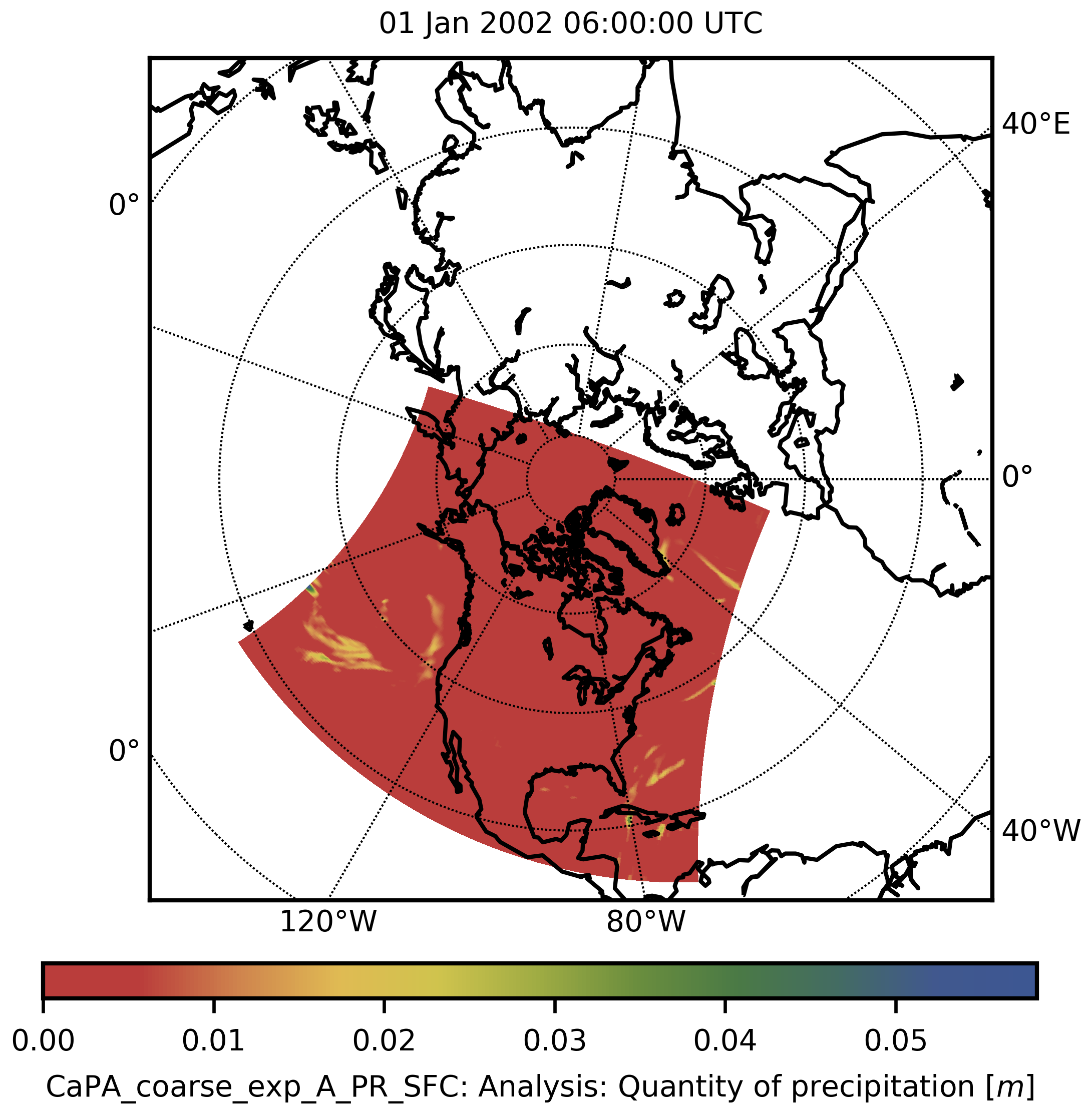
- Canadian Precipitation Analysis- coarse resolution experimental (CaPA_coarse_exp; archived Jan 1, 2002 to Jun 30, 2012)
- Canadian Precipitation Analysis- coarse resolution operational (CaPA_coarse; archived since 09/2012)
- Canadian Precipitation Analysis- fine resolution experimental (CaPA_fine_exp; archived June 1, 2017 to March 2, 2018)
- Canadian Precipitation Analysis- fine resolution operational (CaPA_fine; archived since March 3, 2018)
| CaPA_coarse_exp | CaPA_coarse | CaPA_fine_exp | CaPA_fine |
|---|---|---|---|
 |
 |
 |
|
- National Surface and River Prediction System: High Resolution Ensemble Precipitation Analysis (NSRPS-HREPA; archive will start soon)
- National Surface and River Prediction System: Canadian Land Data Assimilation System (NSRPS-CaLDAS; archive will start soon)
- National Surface and River Prediction System: High Resolution Deterministic Land Surface Prediction System (NSRPS-HRDLPS; archive will start soon)
The details of the archived products are given in the table below. Please be aware that these specifications are subject to changes. The presented details are valid between June 2017 and December 2017.
| Product | Docu | Archived since | Archived until | Forecasted time steps [h] | Issues | Ensemble size | Number of variables | Resolution | Memory [GB/month] |
|---|---|---|---|---|---|---|---|---|---|
| GEPS |
changelog/ docu |
2017-05-23 | 2021-05-20 | 1,2,..., 72, 96,..., 384 | 2/day | 21 | 55 | ~50.0km | 6700 |
| GEPS_NA1) |
changelog/ docu |
2021-05-07 | today | 1,2,..., 72, 96,..., 384 | 2/day | 21 | 55 | ~39.0km | 895 |
| GDPS |
changelog/ docu |
2017-05-22 | today | 1,2,..., 144, 147,..., 240 | 2/day | 1 | 55 | ~15.0km | 506 |
| REPS |
changelog/ docu |
2017-05-23 | today | 1,2,..., 72 | 2/day | 21 | 52 | ~10.0km | 1902 |
| RDPS |
changelog/ docu |
2015-01-01 | today | 1,2,..., 84 | 4/day | 1 | 55 | ~10.0km | 723 |
| RDRS_v12) | 2010-01-01 | 2014-12-31 | 1,2,..., 24 | 1/day | 1 | 12 | ~15.0km | 5 | |
| RDRS_v22) | 2000-01-01 | 2017-12-31 | 1,2,..., 24 | 1/day | 1 | 28 (list) |
~10.0km | 21 | |
| RDRS_v2.12) | 1980-01-01 | 2018-12-31 | 1,2,..., 24 | 1/day | 1 | 28 (list) |
~10.0km | 21 | |
| HRDPS |
changelog/ docu |
2017-05-22 | today | 1,2,..., 48 | 4/day | 1 | 50 | ~2.5km | 910 |
| CaLDAS | 2017-05-22 | today | N/A | 8/day | 25 | 14 | ~2.5km | 281 | |
| CaPA_coarse_exp3) |
changelog/ docu |
2002-01-01 | 2012-06-30 | N/A | 4/day | 1 | 2 | ~10.0km | 1 |
| CaPA_coarse3) |
changelog/ docu |
2012-09-17 | today | N/A | 4/day | 1 | 2 | ~10.0km | 1 |
| CaPA_fine_exp3) |
changelog/ docu |
2016-06-01 | 2018-03-02 | N/A | 4/day | 1 | 2 | ~2.5km | 2 |
| CaPA_fine3) |
changelog/ docu |
2018-02-02 | today | N/A | 4/day | 1 | 2 | ~2.5km | 2 |
| NSRPS-HREPA |
changelog/ docu |
soon | today | N/A | 4/day | 25 | 2 | ~2.5km | 42 |
| NSRPS-CaLDAS |
changelog/ docu |
soon | today | N/A | 8/day | 1 | 12 | ~2.5km | 14 |
| NSRPS-HRDLPS |
changelog/ docu |
soon | today | 1,2,...,144 | 2/day | 1 | 24 | ~2.5km | 547 |
1) The GEPS_NA product is exactly the same as GEPS (variables, resolution, horizons, etc); it is only cropped to the domain of North America for the purpose of saving storage.
2) There is a discontinuity at the very south of the domain (see here). This is due to differences in the domains of the system components (CaLDAS, RDPS and CaPA ) used to produce RDRS. To avoid this discontinuity, you should disregard the 30-40 most southern rows of grid cells available in the reanalysis products. The problem exists in RDRS_v1, RDRS_v2 and RDRS_v2.1 but will be resolved in later versions.
3) The CaPA products available are the 6h accumulations. There also exists 24h accumulations which might be added to CaSPAr in future.
More information might be available on this ECCC website. You can find some more information about file naming conventions and some variables on another CaSPAr wiki page here.
The publication describing and evaluating this product is available here.
The data have an hourly temporal resolution and a spatial resolution of about 10 km. It is available for 18 years (2000 to 2017) for RDRS-v2 and 39 years (1980-2018) for RDRS-v2.1. The dataset covers North and Central America.
The RDRS-v2 and RDRS-v2.1 product contain two precipitation variables:
-
RDRS_v2_P_PR0_SFC/RDRS_v2.1_P_PR0_SFC: Model forecasted precipitation (background field used by CaPA to produce the analysis) labelled with etiquetteRDRS02PRODin the original FST files provided by ECCC and called asRDRS_v2_P_PR0_SFC/RDRS_v2.1_P_PR0_SFCin the NetCDF files provided through CaSPAr -
RDRS_v2_A_PR0_SFC/RDRS_v2.1_A_PR0_SFC: Analyzed precipitation labelled with etiquetteMODEL+CaPA24hin the original FST files provided by ECCC and called asRDRS_v2_A_PR0_SFC/RDRS_v2.1_A_PR0_SFCin the NetCDF files provided through CaSPAr
Procedures to calculate final off-line hourly precipitation:
- CaPA-6h is disaggregated to an hourly time step by linearly rescaling the atmospheric model’s hourly precipitation rates in order to match the 6-h accumulations estimated by CaPA-6h.
- The same procedure is applied to the CaPA-24h precipitation analysis, but using the disaggregated CaPA-6h product as the reference.
In cases where the model precipitation was negligible, but precipitation was observed, a constant precipitation rate was assumed for that time period. You can find some more information about file naming conventions and some variables on another CaSPAr wiki page here.
The reanalysis is originally executed twice per day at 00Z and 12Z UTC (internally as fst files). Each of these two run performs 24 h forecasts.
For example, the reanalysis issued for Dec 2, 2004 at 12Z UTC (namely 2004120212.nc) is covering the period from Dec 2, 2004 13h to Dec 3, 2004 12h. It is built by stitching together the following forecasts:
- 13-18 h UTC forecast from 00Z run (
2004120200_013.fstto2004120200_018.fst) gives hours 13-18 UTC in the final file2004120212.ncdistributed through CaSPAr. - 7-18 h UTC forecast from 12Z run (
2004120212_007.fstto2004120212_018.fst) gives hours 19-24 UTC in the final file2004120212.ncand 1-6 UTC in the final file2004120312.nc. - 7-12 h UTC forecast from the next day 00Z run (
2004120300_007.fstto2004120300_012.fst) gives hours 7-12 UTC in the final file2004120312.nc.
The variables available in the dataset are listed in the following table. You can find some more useful information about specific variables on another CaSPAr wiki page here.
| Variable | Variable long name | Unit | Level |
|---|---|---|---|
| RDRS_v2_P_PR0_SFC RDRS_v2.1_P_PR0_SFC |
Quantity of precipitation (model) | [m] | SFC |
| RDRS_v2_A_PR0_SFC RDRS_v2.1_A_PR0_SFC |
Quantity of precipitation (CaPA) | [m] | SFC |
| RDRS_v2_P_TT_1.5m RDRS_v2.1_P_TT_1.5m |
Air temperature | [°C] | 1.5m |
| RDRS_v2_P_TT_09944 RDRS_v2.1_P_TT_09944 |
Air temperature | [°C] | ~40m |
| RDRS_v2_P_FB_SFC RDRS_v2.1_P_FB_SFC |
Downward solar flux | [W/m2] | SFC |
| RDRS_v2_P_FI_SFC RDRS_v2.1_P_FI_SFC |
Surface incoming infrared flux | [W/m2] | SFC |
| RDRS_v2_P_HR_1.5m RDRS_v2.1_P_HR_1.5m |
Relative humidity (fraction) | [-] | 1.5m |
| RDRS_v2_P_HR_09944 RDRS_v2.1_P_HR_09944 |
Relative humidity (fraction) | [-] | ~40m |
| RDRS_v2_P_HU_1.5m RDRS_v2.1_P_HU_1.5m |
Specific humidity | [kg/kg] | 1.5m |
| RDRS_v2_P_HU_09944 RDRS_v2.1_P_HU_09944 |
Specific humidity | [kg/kg] | ~40m |
| RDRS_v2_P_P0_SFC RDRS_v2.1_P_P0_SFC |
Surface pressure | [mb] | SFC |
| RDRS_v2_P_PN_SFC RDRS_v2.1_P_PN_SFC |
Sea level pressure | [mb] | SFC |
| RDRS_v2_P_TD_1.5m RDRS_v2.1_P_TD_1.5m |
Dew point temperature | [°C] | 1.5m |
| RDRS_v2_P_TD_09944 RDRS_v2.1_P_TD_09944 |
Dew point temperature | [°C] | ~40m |
| RDRS_v2_P_UU_10m RDRS_v2.1_P_UU_10m |
U-component of the wind (along the grid X axis) | kts | 10m |
| RDRS_v2_P_VV_10m RDRS_v2.1_P_VV_10m |
V-component of the wind (along the grid Y axis) | kts | 10m |
| RDRS_v2_P_UUC_10m RDRS_v2.1_P_UUC_10m |
corrected U-component of the wind (along West-East direction) | kts | 10m |
| RDRS_v2_P_VVC_10m RDRS_v2.1_P_VVC_10m |
corrected V-component of the wind (along South-North direction) | kts | 10m |
| RDRS_v2_P_UVC_10m RDRS_v2.1_P_UVC_10m |
Wind Modulus (derived using UU and VV) | kts | 10m |
| RDRS_v2_P_WDC_10m RDRS_v2.1_P_WDC_10m |
Meteorological wind direction (derived using UU and VV) | [degree] | 10m |
| RDRS_v2_P_UU_09944 RDRS_v2.1_P_UU_09944 |
U-component of the wind (along the grid X axis) | kts | ~40m |
| RDRS_v2_P_VV_09944 RDRS_v2.1_P_VV_09944 |
V-component of the wind (along the grid Y axis) | kts | ~40m |
| RDRS_v2_P_UUC_09944 RDRS_v2.1_P_UUC_09944 |
corrected U-component of the wind (along West-East direction) | kts | ~40m |
| RDRS_v2_P_VVC_09944 RDRS_v2.1_P_VVC_09944 |
corrected V-component of the wind (along South-North direction) | kts | ~40m |
| RDRS_v2_P_UVC_09944 RDRS_v2.1_P_UVC_09944 |
Wind Modulus (derived using UU and VV) | kts | ~40m |
| RDRS_v2_P_WDC_09944 RDRS_v2.1_P_WDC_09944 |
Meteorological wind direction (derived using UU and VV) | [degree] | ~40m |
| RDRS_v2_P_GZ_10000 RDRS_v2.1_P_GZ_10000 |
Geopotential height | dam | SFC |
| RDRS_v2_P_GZ_09944 RDRS_v2.1_P_GZ_09944 |
Geopotential height | dam | ~40m |
Remarks: Variable names are following the convention <Product>_<Type:A=Analysis,P=Prediction>_<ECCC name>_<Level/Tile/Category>. Variables with level 10000 are at surface level. The height [m] of variables with level 0XXXX needs to be inferred using the corresponding fields of geopotential height (GZ_0XXXX - GZ_10000). The variables UUC, VVC, UVC, and WDC are not modelled but inferred from UU and VV for convenience of the users.
The variables available in the various NSRPS datasets are listed in the following table. You can find some more useful information about specific variables on another CaSPAr wiki page here.
| Variable | Variable long name | Unit | Level |
|---|---|---|---|
| NSRPS_HRDLPS_P_ACWF_SFC | Forecast: Accumulation of land surface evaporation amount | [kg/m2] | SFC |
| NSRPS_HRDLPS_P_ALAT_0-2m | Forecast: Accumulation of lateral sub-surface runoff amount | [kg/m2] | 0-2m |
| NSRPS_HRDLPS_P_MF_SFC | Forecast: Model orography | [m] | SFC |
| NSRPS_HRDLPS_P_O1_2m | Forecast: Drainage amount through base of soil model | [kg/m2] | 2m |
| NSRPS_HRDLPS_P_TDK_1.5m | Forecast: 1.5-m dew point temperature | [K] | 1.5m |
| NSRPS_HRDLPS_P_TG_SFC | Forecast: Aggregate surface radiative temperature | [K] | SFC |
| NSRPS_HRDLPS_P_TJ_1.5m | Forecast: 1.5-m air temperature | [K] | 1.5m |
| NSRPS_HRDLPS_P_TRAF_Aggregated | Forecast: Accumulation of surface runoff amount | [kg/m2] | Aggregated |
| NSRPS_HRDLPS_P_TRAF_Glacier | Forecast: Accumulation of surface runoff amount | [kg/m2] | Glacier |
| NSRPS_HRDLPS_P_TRAF_LandSurface | Forecast: Accumulation of surface runoff amount | [kg/m2] | LandSurface |
| NSRPS_HRDLPS_P_TRAF_SeaIce | Forecast: Accumulation of surface runoff amount | [kg/m2] | SeaIce |
| NSRPS_HRDLPS_P_TRAF_Water | Forecast: Accumulation of surface runoff amount | [kg/m2] | Water |
| NSRPS_HRDLPS_P_WSOL_0-5cm | Forecast: Volumetric water content of soil | [m3/m3] | 0-5cm |
| NSRPS_HRDLPS_P_WSOL_5-10cm | Forecast: Volumetric water content of soil | [m3/m3] | 5-10cm |
| NSRPS_HRDLPS_P_WSOL_10-20cm | Forecast: Volumetric water content of soil | [m3/m3] | 10-20cm |
| NSRPS_HRDLPS_P_WSOL_20-40cm | Forecast: Volumetric water content of soil | [m3/m3] | 20-40cm |
| NSRPS_HRDLPS_P_WSOL_40-100cm | Forecast: Volumetric water content of soil | [m3/m3] | 40-100cm |
| NSRPS_HRDLPS_P_WSOL_100-200cm | Forecast: Volumetric water content of soil | [m3/m3] | 100-200cm |
| NSRPS_HRDLPS_P_WSOL_200-300cm | Forecast: Volumetric water content of soil | [m3/m3] | 200-300cm |
| NSRPS_HRDLPS_P_WT_AllSurfaceTypes | Forecast: Surface area fraction | [1] | AllSurfaceTypes |
| NSRPS_HRDLPS_P_WT_Glacier | Forecast: Surface area fraction | [1] | Glacier |
| NSRPS_HRDLPS_P_WT_SeaIce | Forecast: Surface area fraction | [1] | SeaIce |
| NSRPS_HRDLPS_P_WT_Soil | Forecast: Surface area fraction | [1] | Soil |
| NSRPS_HRDLPS_P_WT_Water | Forecast: Surface area fraction | [1] | Water |
| NSRPS_HREPA_A_CFIA_SFC | Analysis: Confidence Index of Analysis CAPA | [1] | SFC |
| NSRPS_HREPA_A_PR_SFC | Analysis: Quantity of precipitation | [m] | SFC |
| NSRPS_CaLDAS_A_SD_Land | Analysis: Snow depth | [cm] | Land |
| NSRPS_CaLDAS_A_SWE_Land | Analysis: Snow water equivalent | [kg/m2] | Land |
| NSRPS_CaLDAS_A_TD_1.5m | Analysis: Dew point temperature | [°C] | 1.5m |
| NSRPS_CaLDAS_A_TT_1.5m | Analysis: Air temperature | [°C] | 1.5m |
| NSRPS_CaLDAS_A_WSOL_0-5cm | Analysis: Volumetric water content of soil | [m3/m3] | 0-5cm |
| NSRPS_CaLDAS_A_WSOL_5-10cm | Analysis: Volumetric water content of soil | [m3/m3] | 5-10cm |
| NSRPS_CaLDAS_A_WSOL_10-20cm | Analysis: Volumetric water content of soil | [m3/m3] | 10-20cm |
| NSRPS_CaLDAS_A_WSOL_20-40cm | Analysis: Volumetric water content of soil | [m3/m3] | 20-40cm |
| NSRPS_CaLDAS_P_WSOL_40-100cm | Forecast: Volumetric water content of soil | [m3/m3] | 40-100cm |
| NSRPS_CaLDAS_P_WSOL_100-200cm | Forecast: Volumetric water content of soil | [m3/m3] | 100-200cm |
| NSRPS_CaLDAS_P_WSOL_200-300cm | Forecast: Volumetric water content of soil | [m3/m3] | 200-300cm |
| NSRPS_CaLDAS_P_TG_SFC | Forecast: Aggregate surface radiative temperature | [K] | SFC |
![]()
![]()
![]()
![]()
![]()
![]()
![]()
![]()
![]()
© 2017-2023 - Canadian Surface Prediction Archive - caspar.data@uwaterloo.ca
Funded under the Floodnet program.
![]()
![]()
Table of Contents: