Releases: opengisch/QField
1.7.0 - Rockies
The 1.7.0 release comes with fancy new features and a polished user interface
Merging features
Splitting of a feature has been possible for quite some time. Now the merging of features of multipolygon-layer is possible as well. Select them and merge them - easy like that. The first selected feature gets the new geometry and keeps its attributes.

Filters in the Value Relation Widget
Using filters in the value relation drop down can increase the efficiency in selecting the correct value. It can be configured by expressions in QGIS, so it's possible to make the content of the drop down depending on the values entered previously in other fields.
Go to coordinates in the Search
The search has not only been improved in its appearance. It's handling is made much more comfortable. Like a button to clear the text or easy opening and closing.
But additionally there is the possibility to jump to coordinates.

QML and HTML Widget
QML and HTML widgets are now supported. This opens wide possibilities for showing information about the attributes interactive in the feature form. As well as charts and diagrams.


GUI polishing
Some interface components have been polished, like the layer property dialog and the handling of the feature list on selection.
1.6.4 - Qinling 秦岭
- Fixes an issue feature count in the legend
- Avoids to losing categories
1.6.3 - Qinling 秦岭
This release ships several important fixes for stability and some UX improvements
- Fix a crash when transforming with a missing gsb file
- Fix a crash when the second project is opened
- Compatibility with 32 bit devices
- Fix editing after deleting a feature
- Make sure the value relation and relation reference widgets respect read only mode
- Fixes an issue with the search bar
1.6.2 - Qinling 秦岭
Improvements and Fixes
- Fine tune the radius for identifying a feature on the map
- Improved layout for layer properties
- Responsive WMS / WFS layers thanks to latest QGIS backend
- Added additional required files for proj6
1.6.1 - Qinling 秦岭
Improvements
Further visual improvements on the legend and the map theme selector like icons and tree view

Fixes
- Double fields accept dots again
- Value relation and relation editor widgets stay responsive in browse mode
- Stable behavior of legend functions like "Zoom to Layer"
- Snapping works smoothly
- No unwanted jumping of the cross-hair when slowly dragging the finger
1.6.0 - Qinling 秦岭
The 1.6.0 release consists of many improvements throughout the code base 🎉
It features some very notable new features as well as bugfixes and UI improvements.
Stylus support
We have undertaken a great effort to integrate stylus pen as input device. This allows now for editing gemetries through stylus pen interaction. Never has it been so easy to quickly sketch something.
Multi Edit capability
By adding multi editing functionality you are efficient as never before. It's now possible to select a tree alley, a number of pipes or apiaries and convert them all into the same species or type with just a few clicks.


Lock geometries
This new functionality protects against accidental change of geometries. A layer can be protected against geometry modifications, preventing users from adding or deleting features or editing geometries of existing features. This is especially useful for reviewing existing infrastructure. This will require to have QFieldSync for configuration.
Configure the name of images
Did you ever want to have the file names of your pictures to match the feature id? The file name for images offers now complete freedom through expression based configuration.

Fields with web links can be opened in a browser
If your external resource widget is configured to open links or if your text edit widget contains HTML links, they will now open up in your browser.
Webp support
There is now support for basemaps with geopackage with webp imagery. This allows for a very good compression rate and supports transparency at the same time.
UI updates
A major under-the-hood upgrade will make every parts of QField's interface look sharper and evenly spaced across all of your devices.
Legend
A revamped legend has made its way into QField, with better font and spacing, as well as better looking legend symbols.

Calendar
QField's calendar widget has been improved and now features a time picker too.

Topological editing
QField can now preserve preserve common boundaries when adding and editing geometries.
When in Edit mode, a Topological Editing button now appears under the main menu to enable this functionality.

Fast editing mode
In this mode, the features will automatically be stored on every change. The user interface is lighter (no save button on forms) and it combines perfectly with the topological editing.
GDAL and PROJ updates
QField 1.6 has entered made a major step forward in supporting modern capabilities when handling coordinate systems and projection by updating GDAL and PROJ to its latest versions. This also means QField now relies on the same environment as QGIS to load and display data, ensuring increased fidelity and ease of use.
Other library updates
Other important libraries were updated such as GEOS, libspatialindex, and libpng. These updates help make QField stabler and faster.
Qinling
The Qinling (Chinese: 秦岭) or Qin Mountains, formerly known as the Nanshan ("Southern Mountains") and sometimes called the "Szechuan Alps", are a major east-west mountain range in southern Shaanxi Province, China. The mountains provide a natural boundary between North and South China and support a huge variety of plant and wildlife, some of which is found nowhere else on earth.
1.5.3 - Piz Palü
- Fix value relation widget
1.5.2 - Piz Palü
- Fix WFS server support
1.5.1 - Piz Palü
- Integration of not null / unique constraints
- Fix "Center position on GPS" menu
- Fix Value Relation Widget - multi selection
- Value Map selected item is stable
1.5.0 - Piz Palü
Changelog
- GPS tracking to digitize lines and polygons
- Support for hard- and soft constraints
- Open PDF and other file attachments
- Geotag indicator on images
- Use configurable picture path defined by expressions in QFieldSync (requires QGIS 3.14)
- View images in an external application
- Brand new range widget with slider
- Cadastra font and support of loading fonts in the project folder
- Keep the screen alive
GPS tracking to digitize lines and polygons
We have added the possibility to track your movements to create new lines or polygons.

This feature has been sponsored by Biotope
Support for hard- and soft constraints
Soft constraints are finally supported. Soft constraints allow to save features even if some attribute constraints are not fulfilled but they are shown as warnings to the user.

This feature has been sponsored by Schweizerische Vogelwarte Sempach
Open PDF and other file attachments
Take additional information as PDF or other files with your project to the field and open them with a finger tip from the feature form. Use the external resource widget.
This feature has been sponsored by Gruner Böhringer AG
Geotag indicator on images
Pictures which have a geotag are highlighted with an icon. This makes it super easy to check if your images have been geotagged.

This feature has been sponsored by Biotope
Use configurable picture path defined by expressions in QFieldSync (since QGIS 3.14)
Organize your pictures with filename and folders while you collect them in the field. You can now use feature attributes or any expression to name your pictures.
This feature has been sponsored by the QField Love Crowdfunding
View images in an external application by clicking the image
Click on a picture thumbnail in a feature form to get a full screen view of a picture.
This feature has been sponsored by the QField Love Crowdfunding
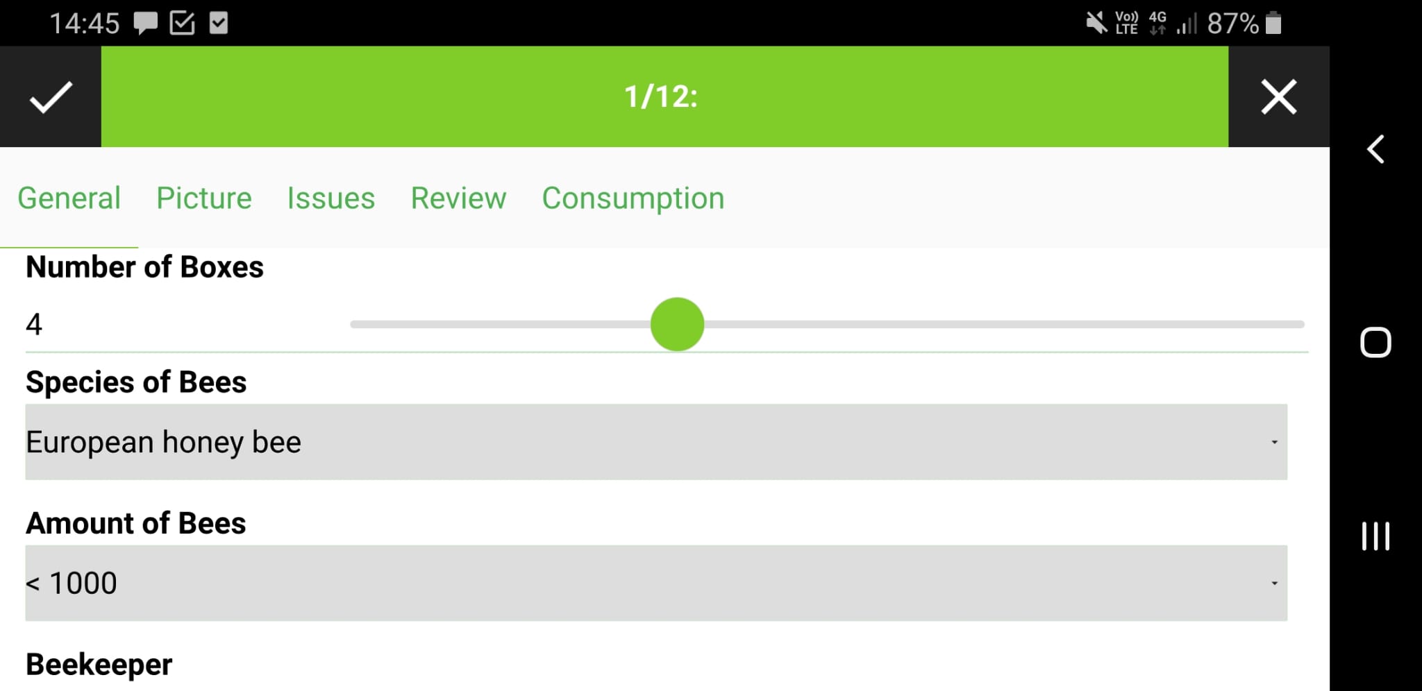
Brand new range widget with slider
Range widget give a much improved sense of quantities in defined ranges. They are very good to visualize and modify percentage.
This feature has been sponsored by Biotope
Cadastra font and support for loading fonts in the project folder
๖ē¢คนŞē f໐ຖtŞ ¢คຖ ๖ē ๖ēคนtifนl.
You can also add custom fonts, by putting them into a .fonts directory in your main project folder.

This feature has been sponsored by the Gemeinde Thalwil