Releases: tilezen/vector-datasource
Releases · tilezen/vector-datasource
v1.9.0
-
Release date: 2023-03-10
-
Requires: tileserver v2.2.0 and tilequeue v2.5.0 and rawr_tiles v1.1.0 and coanacatl v1.0.0
-
Credits: @travisgrigsby, @jeffdefacto, @peitili, @iandees, and @nvkelso
ENHANCEMENTS
- Significant performance improvements to reduce p99 file sizes globally (-45%) at all zooms to under 200 kb, with some improvements for low-zoom p50 sizes. Changes include: geometry simplification at low zooms, pushing some features like unclassified roads to the next zoom, dropping names on short lines and dropping other properties at mid-zooms to also allow more aggressive merges to multi-lines and multi-polygons, and more sophisticated handling of max zoom and overzoom tiles for buildings and addresses. Further reductions can be achieved by configuring Tapalcatl to selectively drop layers and name translations (eg to drop
earthandtransitlayers or only keep English and Urdu names) depending on your business needs.

(Above) Chart shows sizes in kilobytes, based on commonly requested top 100,000 tiles at 512 pixel zooms. NOTE: all other zooms in this document use nominal 256 pixel zooms, offset by 1. - Internationalization is now feature complete by extending disputed boundary point-of-view handling fully into mid- and high-zooms with extensive paired data edits upstream in OpenStreetMap, using Natural Earth as a sanity check for country names, and consideration of common and less common edge cases, including Taiwan and Somaliland.
- MapLibre support with buffered tiles and connivence properties like pre-calculating shield text length allow Tilezen tiles to more easily be styled in MapLibre and MapboxGL, thus extending support beyond Tangram.
- boundaries: Add disputed boundary line point-of-view (POV) for mid- and high-zoom features sourced from OpenStreetMap (OSM), including extensive upstream editing in OSM to match Natural Earth's low-zoom disputed area modeling in earlier releases. New
unrecognized_disputekind anddisputed_byproperty. (Issue #1901) - boundaries: Add missing Cyprus line-of-control (aka "green line") as it has custom
admin_leveltagging. (Issue #1898) - boundaries: Add Ukraine point-of-view for disputed boundaries. (Issue #1911)
- boundaries: Add disputed boundary in South China Sea scoped to China's point-of-view (POV). (Issue #1983)
- boundaries: Mark some Natural Earth low-zoom boundaries as default
unrecognized, including for Abkhazia, Donbass, Nagorno-Karabakh, Northern Cyprus, Somaliland, South Ossetia, and Transnistria. (Pull request #2072) - buildings: Add additional non-OpenStreetMap buildings from the Microsoft sidecar in Daylight distribution.
- places: Always validate OpenStreetMap-sourced
country,dependencyanddisputedlabels against Natural Earth and new ISO and TLC point-of-views. (Issue #2075, #2076, and #2077 and pull request #2069) - places: Add recasted Australia "suburbs" from OpenStreetMap as
localityfeatures to match local expectations. (Pull request #2070) - places: Improve continuity between Natural Earth and OpenStreetMap (OSM)
localityfeatures and theirmin_zoomgrading. (Issue #2020) - places: Join OpenStreetMap
localityfeatures with Natural Earth (NE), and prefers NE names to improve consistency across the zoom transitions. (Pull request #2088) - places: Join OpenStreetMap
localityfeatures with Natural Earth (NE), and prefers NE population to calculatepopulation_rankfor label grading. (Issue #2048) - places: Backfill
populationestimates for OpenStreetMap-sourcedlocalityfeatures. (Issue #1992) - places: Cull
localityandneighbourhoodfeatures based on grid to right size tile payload to rendered features. (Issue #1999) and issue #2040) - pois: Add optional
directionproperty, an integer indicating degrees from 0-359, forviewpointkind features. Thanks @rwrx. (Issue #598 and pull request #1916) - roads: Calculate new
shield_text_lengthproperty to ease styling of road shields in MapboxGL-based map styles. (Issue #1979) - water: Add
kind_detailfor polygon features, with values including:basin,canal,ditch,drain,lake,river, andstream. (Pull request #2047) - water: Mark water polygon feature as
kind_detail=lakewhen upstream OpenStreetMap value islagoon,oxbow,pond,reservoir, orwastewater. (Pull request #2047) - water: Add optional
layerproperty for complicated over-under rendering situations, with adjustedsort_rankfor some features. (Issue #1910) - all layers: Switch to Daylight distribution for ingesting OpenStreetMap planet files, including building and admin sidecars. WARNING: Some OSM feature IDs may be re-numbered. (Pull request #2085)
- all layers: Upgrade to Natural Earth to v5.1.2, circa May 2022 (Issue #2074)
- earth: Upgrade to osmdata.openstreetmap.de circa October 2021.
- places: Upgrade to Who's On First
neighbourhoodfeatures, circa October 2021. - all layers: Add MVT buffer support to enable MapboxGL to render stroked lines at tile boundaries without missing triangles (eg for road casings). Tilequeue #401
- all layers: Vary the MVT tile
extentso 8192 is only used onmax_zoom(and 4096 earlier) to optimize file size while preserving overzooming. (Issue #1985) - all layers: Are now MVT v2 spec compliant, via related changes in Tilezen's mapbox-vector-tile v2.0.0 release.
BUG FIXES
- boundaries: Show all missing
disputedlines for point-of-view (POV) in low-zooms (removemin_zoomfilter). (Issue #1970) - boundaries: French
regionlines show too early, switch all from funkyscale_rankmapping to Natural Earth'smin_zoomproperty. (Issue #2062) - boundaries: Drop additional ID and name properties at mid-zooms and merge lines at high-zooms. (Issue #2007)
- boundaries: Revert poor tolerance config change from earlier release, this improves visual look for 512-pixel tiles in MapboxGL-based styles. (Issue #1980)
- boundaries: Fix some incorrectly marked maritime boundaries with new buffered land masking file. (Pull request #2073)
- buildings: Add
root_id=idto simplify MapboxGL-based styles. (Issue #2092) - buildings: Remove small buildings, reduce building geometry details, and remove some properties at mid- and high-zooms. (Pull request #2052)
- buildings: Ensure
addresspoints always have amin_zoomproperty (eg of17for generated address points). This is paired with a Tilequeue change to drop zoom 17 features from 512-px tile sized zoom 15 tiles to reduce tile size. (Issue #2023) and (issue #2032) - landuse: Drop properties at low- and mid-zooms to encourage more feature merging. (Issue #2009)
- **lan...
- Significant performance improvements to reduce p99 file sizes globally (-45%) at all zooms to under 200 kb, with some improvements for low-zoom p50 sizes. Changes include: geometry simplification at low zooms, pushing some features like unclassified roads to the next zoom, dropping names on short lines and dropping other properties at mid-zooms to also allow more aggressive merges to multi-lines and multi-polygons, and more sophisticated handling of max zoom and overzoom tiles for buildings and addresses. Further reductions can be achieved by configuring Tapalcatl to selectively drop layers and name translations (eg to drop
v1.8.0
-
Release date: 2019-06-27.
-
Requires: tileserver v2.2.0 and tilequeue v2.4.0 and rawr_tiles v1.1.0 and coanacatl v1.0.0.
ENHANCEMENTS
- boundaries: Add more
kind:*point-of-view (POV) from Natural Earth for low zooms for disputed boundary lines, expanding on the v1.7 effort to also includeregionboundary disputes. (Issue #1840)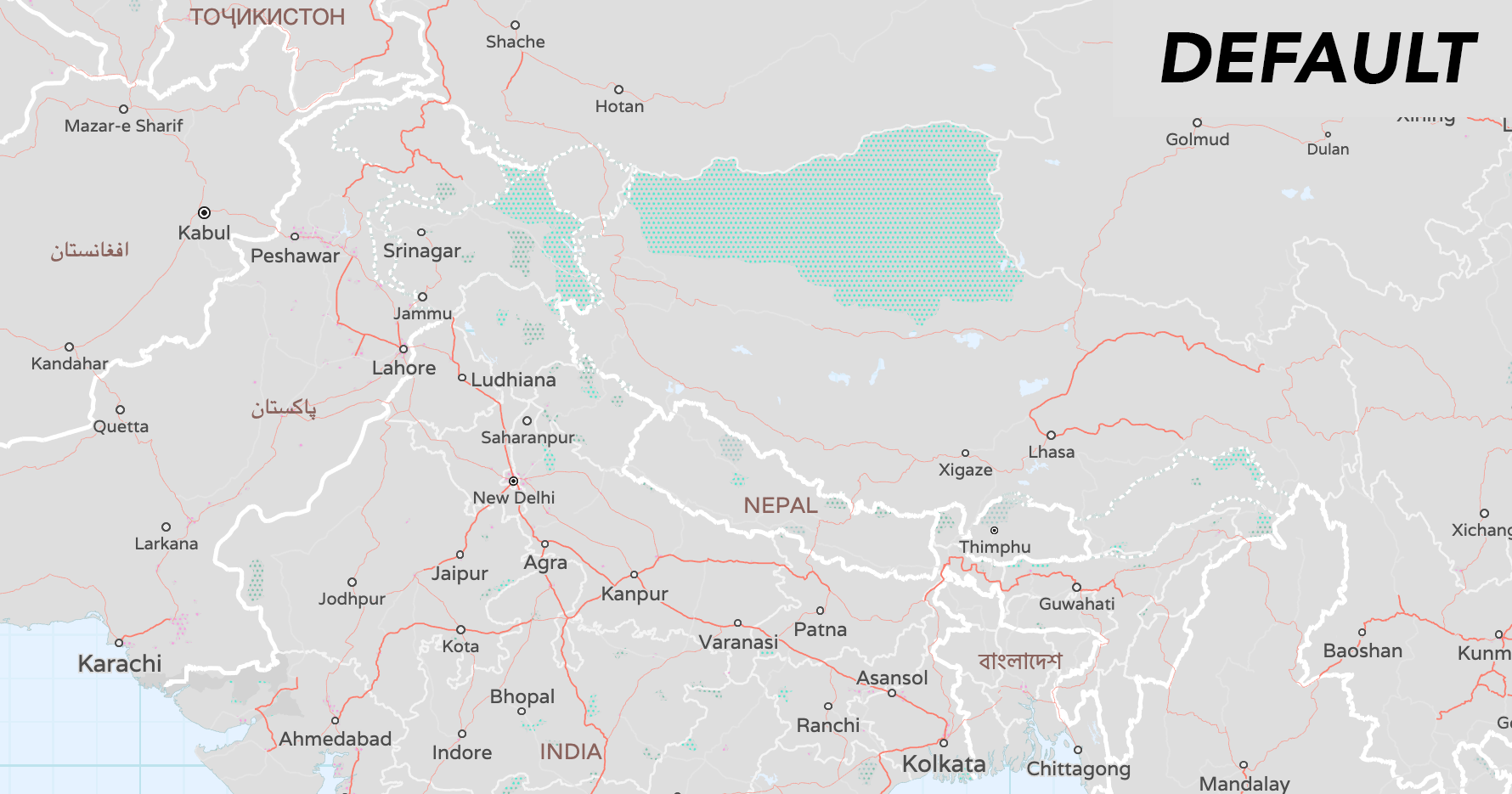
- To handle disagreements about the location of borders, the
kindmay be prefixed withunrecognized_, e.g:unrecognized_country(wasunrecognizedin v1.7),unrecognized_macroregion,unrecognized_region,unrecognized_countyfor differing viewpoints (seekind:xxbelow). kind:xx: alternatekindaccording to the viewpoint of country codexx. If you want to show features according to a particular viewpoint, then usekind:xxif it exists and fall back tokindif not. The range of values is the same as forkind. Note that the viewpoints are either lower-case ISO 3166-1 alpha-2 codes or the pseudo-codeiso.
- boundaries: Add OSM alternate viewpoints for country, region, and counties boundaries. (Issue #1810)
- We track two kinds of features from OSM for indicating disputes:
- claims, which have
boundary=claim, claimed_by=*, admin_level=*tags. These indicate borders which aren't generally recognized, but should appear in the viewpoint of theclaimed_by=value. additionally, extra viewpoints which don't make a claim for themselves but still want the claimant's view reflected in their own can be specified in arecognized_by=*tag. - disputes which have
dispute=yesordisputed=yes, plus a list of disputant viewpoints in thedisputed_by=*tag. when a viewpoint is listed indisputed_bythen the boundary will have itskind:xxset tounrecognized_*(where XX is the viewpoint / country code and * is the kind of boundary it is).
- claims, which have
- We track two kinds of features from OSM for indicating disputes:
- earth: The former
OpenStreetMapData.comsource is now hosted by FOSSGIS atosmdata.openstreetmap.deand the source property has been updated. Issues (#1855) and (#1859) - landuse: Add
kind_detailfor aerodrome enhancement and backfillkind_detailonaerodromeswith values,public,private,military_public,airfield,international,regional,gliding, and add optionalaerodrome_passenger_countproperty indicating the number of passengers through the aerodrome per year sourced from Wikidata. (Issues #1277 and #1873) - places: Backfill
country_capitalandregion_capitalbooleans from Natural Earth on high-zoom OSM features, including point-of-view. (Issue #1810) - places: Add point-of-view (POV) to capitals from Natural Earth data to all zooms. (Issue #1840)
country_capital:xx: when present, eithertrueorfalseto override thecountry_capitalvalue for XX's viewpoint. Note that the viewpoints are either lower-case ISO 3166-1 alpha-2 codes or the pseudo-codeiso, same as forkind:xxon boundaries.region_capital:xx: when present, eithertrueorfalseto override theregion_capitalvalue for XX's viewpoint. Note that the viewpoints are either lower-case ISO 3166-1 alpha-2 codes or the pseudo-codeiso, same as forkind:xxon boundaries.
- places: Add
wikidata_idWikidata ID concordance to features. (Issue #858) - pois: Add optional Wikidata
wikidata_idconcordances. (Issue #858) - pois: Add
kind_detailfor aerodrome enhancement and backfillkind_detailonaerodromeswith values,public,private,military_public,airfield,international,regional,gliding. (Issues #1277 and #1873) - pois: Distinguish military
airfieldfrom genericaerodrome. (Issue #1580) - roads: Ensure runways get
kind_detailpolish by intersecting them with landuseaerodromepolygons using newoverlapfunction. (Issue #1852) - roads: Add missing railway types of
disused,miniature,preserved. (Issue #955) - water: Add optional Wikidata
wikidata_idconcordances. (Issue #858) - water: The former
OpenStreetMapData.comsource is now hosted by FOSSGIS atosmdata.openstreetmap.deand the source property has been updated. Issues (#1855) and (#1859)
BUG FIXES
- boundaries: Rename
unrecognizedtounrecognized_countrykind value to disambiguate POV on country, region, county, and other boundary types. - buildings: Check that building height is in a sensible range by limiting tallest structures to 1000 meters. (Issue #1850)
- earth: Add variable
min_zoomto low zoom features from Natural Earth. (Issue #1287) - places: Update Who's On First dump to reflect new and deprecated neigbourhoods. Issues (#1808) and (#1869)
- pois: Prefer
elevatoroversubway_entrancewhen both are true. (Issue #1876) - pois: Prefer
memorialoverplaquewhen both are true. (Issue #1872) - pois: Prefer
bus_stopover generic transitplatforms. (Issue #1874) - pois: Improve the collision_rank of
fast_foodPOIs by adjusting several other's rank. (Issue #1875) - pois: Correct generator
kind_detailvalues by using a new OpenStreetMap property. (Issue #1578):- The value of the OpenStreetMap
generator:sourcetag or, if that tag is missing, an interpolation from thegenerator:methodtag. Common values includebiofuel,biogas,biomass,coal,diesel,gas,geothermal,hydro,nuclear,oil,solar,waste,wind.
- The value of the OpenStreetMap
- pois: Only set POI for
harbour,port,port_terminal,ferry_terminal,container_terminalwhen they aren't also tagged as waterway, natural water, or landuse reservoir, basin features. (Issue #1590) - roads: Speed up road merging, for dense areas like Japan. (Issue #1847)
- roads: Drop all
name:*variants in addition to basicnameto promote more feature merging. (Issue #1847) - roads: Remap Natural Earth's "trunk" roads to kind
major_roadinstead ofhighway. (Issue #1280) - roads: Adjust
min_zoomof OpenStreetMap highways and major roads to better match Natural Earth'smin_zooms. (Issue #1279) - roads:
min_zoomsat zoom 5 are mix of 3, 4 and 5 instead of just 5.x. (Issue #1074) - roads: Add low-zoom
tollproperty from Natural Earth to match earlier high-zoom data from OpenStreetMap. (Issue #1817) - roads: Add new road
constructionkind with kind_detail from the usual kind from zoom 12+. (Issue #394)kind_detail:motorway,motorway_link,trunk,primary,secondary,tertiary,trunk_link,unclassified,residential,road,primary_link,secondary_link,living_street,service,pedestrian,track,cycleway,bridleway,tertiary_link,footway,steps, `corridor
- water: Reduce the marine water labels visible at zoom 8 by limiting number of bays in the tile to the largest 10. (Issue #1838)
- The kinds
bay,straitandfjordare ranked by size and given akind_tile_rankproperty that starts from 1 and counts up as the feature gets smaller. Note that the ranking is done on a "metatile", which me...
- The kinds
- boundaries: Add more
v1.7.0
-
Release date: 2019-02-15.
-
Requires: tileserver v2.2.0 and tilequeue v2.3.0 and rawr_tiles v1.0.0 and coanacatl v1.0.0.
ENHANCEMENTS
- all layers: Add
collision_rankproperty for label collisions for pois layer, and other layers for features withnameproperties, orref,shield_text,bicycle_shield_text,bus_shield_text, orwalking_shield_text. We now recommend colliding labels client side first withmin_zoom, and then to tie break with the newcollision_rankvalues. (Issue #988) - boundaries: Adds support for alternate points of view in boundaries layer with
kind:*properties (likekind:iso). Currently this is only for zooms 5, 6 and 7 from Natural Earth. We plan to add more lower zoom data from Natural Earth, and high-zoom data from OpenStreetMap in the next release. (Issue #1552) The following country and international organizations worldviews are supported:- Argentina (
ar), Bangladesh (bd), Brazil (br), China (cn), Egypt (eg), France (fr), Germany (de), Greece (gr), India (in), Indonesia (id), Israel (il), Italy (it), Japan (jp), Morocco (ma), Nepal (np), Netherlands (nl), Pakistan (pk), Palestine (ps), Poland (pl), Portugal (pt), Russia (ru), Saudi Arabia (sa), South Korea (ko), Spain (es), Sweden (se), Taiwan (tw), Turkey (tr), United Kingdom (gb), United States (us), Vietnam (vn), ISO (iso)
- Argentina (
- boundaries: Add new disputed boundary lines with kind values of
disputed_breakaway,disputed_claim,disputed_elusive,disputed_reference_line, from Natural Earth at low zooms, for alternate points of view (Issue #1552) - landuse: Remap landuse kinds at mid- and low-zooms to improve merging. This is similar to what we already did for roads. (Issue #1779)
- landuse: Additional landuse kind merging at low- and mid-zooms, including to
urban_areawhich was previously low-zoom only. (Issues #1721 and #1795) - landuse: Add new kinds for
grassland,vineyard,bare_rock,barren(low- and mid-zooms only),desert,heath,sand,shingle, and other natural "landcover" features, starting at zoom 9 (Issue #1259) - landuse: Add
kind_detailproperty forwetlandfeatures. If available, value will be one of:bog,fen,mangrove,marsh,mud,reedbed,saltern,saltmarsh,string_bog,swamp,tidalflat,wet_meadow. (Issue #1253) - landuse: Add
low_emission_zonekind data, added to schema in v1.6. (Issue #1553) - pois: Add
wetlandkind, withkind_detail, see landuse item above for values. - pois: Add
commonkind, to match the existing landuse layer polygons. - roads: Populate data for truck
hgvrouting restriction properties and related shields (whitelisted:agricultural,delivery,designated,destination,local,no), added to schema in v1.6, includingmaxweight,maxheight,maxwidth,maxlength,maxaxleload,hazmat. (Issue #1553) - roads: Add
tollandtoll_hgvboolean properties. (Issue #1553 - places: Add
population_rankproperty tolocality,region,country, and other kinds useful for setting text size and colliding labels. An integar value from 0 (no population) up to 18 (over 1 billion people). See documentation for more details. - traffic_flow: Add
road_kind_detailproperty to enable data-driven client-side traffic line offseting, thanks @zaczkows! (Issue #1829) - traffic_flow: Add
is_hov_laneproperty to enable client-side filtering, thanks @conor-ettinoffe-here! (PR #1831) - traffic_incidents: Add
is_hov_laneproperty to enable client-side filtering, thanks @conor-ettinoffe-here! (PR #1831)
BUG FIXES
- landuse: Fix v1.6 regression where
aerodromepolygons sorted aboverunwayandtaxiwaypolygons in error, thanks @bcamper! (Issue #1814) - landuse: Add additional filter for newer OSM
area:aerowaytagging ofrunway,taxiway, andapronpolygons to restore features from prior year's tile builds. (Issue #1814) - landuse: Better differentiate between parks that should be
commoninstead ofnational_park(Issue #1082) - landuse: Better differentiate between parks that should be
parkinstead ofnational_park(Issue #1728) - landuse: Features of kind
mudnow sorts abovewaterand belowwetland(Issue #1753) - landuse: Deal with US National Forest, US National Park server side performance (Issue #475)
- Harmonise kind assignment for
national_park,forest, and other low-zoom green areas. - Add
protection_titlebased filtering fornational_park. - BLM managed
protected_areasare now filtered separately in the United States.
- Harmonise kind assignment for
- landuse: Change area grading of
nature_reserveto start zoom 8+, but demote most zoom 10 features to zoom 15. (Issue #1749) - landuse: Show all landcover kinds consistently starting at zoom 9. (Issue #1813)
- Limit generic
forestandnatural_woodto zoom 9+. - Promote some landcover-ish landuses up a few zooms to zoom 9+, like
farmandfarmland,orchard. - Limit
residentialareas to zoom 9+.
- Limit generic
- landuse: Adjust earliest
min_zoomfor many landcover kinds (Issue #1794)- Pushed
dam,prison,fort,range, anddanger_areakinds down to z11+. - Push down
aquarium,recreation_ground,track,sports_centre,wastewater_plant,caravan_siteto zoom 12+. - Promote some
camp_siteto zoom 12+, and area grade the rest. - Push down
harbour,port,port_terminal,ferry_terminal,container_terminalto zoom 13+. - Push down
enclosure,petting_zoo,aviary,animal,summer_toboggan,winery,allotments,pedestrian,playgroundto zoom 13+. - Push down
bridge,tower,breakwater,groyne,dike,cutlineto zoom 13+. - Push down
footway,library,fuel,cinema,theatre,runway,taxiway,apron,trail_riding_station,water_park,dog_park,picnic_site,tree_row,hedge, to zoom 13+. - Limit
quarryto zoom 13+, area graded down to zoom 16. - Limit
amusement_ride,carousel,water_slide,roller_coasterto zoom 15+. - Limit
marshto z15.
- Pushed
- landuse: Whitelist
kind_detailvalues:- For crane related kinds:
portal_crane,gantry_crane,travel_lift,floor-mounted_crane,shiploader,tower_crane. - For religion related kinds:
animist,bahai,buddhist,caodaism,catholic,christian,confucian,hindu,jain,jewish,multifaith,muslim,pagan,pastafarian,scientologist,shinto,sikh,spiritualist,taoist,tenrikyo,unitarian_universalist,voodoo,yazidi, andzoroastrian. - For wall related kinds:
dry_stone,noise_barrier,brick,stone,pise,castle_wall,seawall,jersey_barrier,flood_wall,concrete,gabion.
- For crane related kinds:
- pois: Fix junk
healthcarevalues and kinds introduced in v1.5. Added:chiropractor,hospice,occupational_therapist,optometrist,paediatrics,physiotherapist,podiatrist,psychotherapist,rehabilitation, andspeech_therapistkinds. (Issue #1596) - pois: Better differentiate between parks that should be
commoninstead ofnational_park(Issue #1082) - pois: Better differentiate between parks that should be
parkinstead ofnational_park(Issue #1728) - pois: Deal with US National Forest, US National Park server side performance, same as landcover (Issue #475)
- pois: Prefer
forestlabels over wilderness at zoom 7 (Issue #1608) - pois: Add
public_transport=stationwithrailway=haltas a synonym forstationkind. Require names onstationfeatures. (Issue #1747)
...
- all layers: Add
v1.6.0
-
Release date: 2018-12-26.
-
Requires: tileserver v2.2.0 and tilequeue v2.2.1 and rawr_tiles v1.0.0 and coanacatl v1.0.0.
ENHANCEMENTS
- Significant file size reductions of between 23% (p50) and 30% (p90) globally by additional geometry simplification, dropping features, dropping properties, and more aggressive merging to multi-lines and multi-polygons in low- and mid-zooms. Chart shows sizes in bytes (logarithmic scale), based on top 100,000 tiles from openstreetmap.org logs at 512 pixel zoom. NOTE: all other zooms in this document use nominal 256 pixel zooms, offset by 1).

- boundaries: Merge lines with same properties into multi-lines, at most zooms. Issue #1683.
- boundaries: Strip long
name,name:left, andname:rightproperties from boundaries when geometry length can't fit the text, at mid-zooms (<11), to enable merging. Issue #1683. - boundaries: Remove
id,id:leftandid:rightproperties at low- and mid-zooms (<13), to enable merging. Issue #1715. - boundaries: Push
localitylines down tomin_zoom11 (was 10), to reduce file size. Issue #1715. - boundaries: Double simplification tolerance. Issue #641 and PR #1718.
- buildings: Improve polygon merging at zooms 13, 14, and 15 including via aggregation of adjacent features. Remove some mid-zoom content at zoom 13 and 14, and refactor
min_zoom. Issues #1686 and #1732 PR #1689, #1704, and PR #1739 - earth: Simplify at zoom 8 to match the transition from Natural Earth to OpenStreetMap, significantly reducing file size at that zoom. Issue #1477 and PR #1714.
- earth: Truncate
min_zoomfloats to tenths place (and often just ints), to improve merging. Issue #1477 and PR #1714. - landuse: Add
allotments(community gardens), was already in POIs layer. PR #1742 - landuse: Add
boatyardand military firingrangepolygons, they already had POIs. PR #1720. - places: Use the Natural Earth v4.1
min_zoomproperty to cull more places at low-zooms, and reduce tile overpacking. Issue #1687 and PR #1693 and PR #1734. Issue #1729 - pois: Add
turning_circleandturning_loop, thanks @westnordost. Issue #1695. - roads: Add cross-junction and multi-pass merging to remove more vertices and reduce overall feature count, thanks @bcamper. Issue #1227, PR #1703, PR #1706, PR #1708, PR #1718.
- roads: Double simplification tolerance. Issue #641 and PR #1718.
- roads: Reduce precision of
surfacetags at mid-zooms to justpaved,compacted, andunpavedto increase road merging. Thanks @matkoniecz. Issue #1716. - roads: Drop some properties from
minor_roadkind features at mid zooms to increase merging, including:colour,cutting,embankment,motor_vehicle,operator,route,route_name,state,symbol,type. Issue #1331 and PR #1710. - roads: Drop
all_networksandall_shield_textsproperties from roads at low- and mid-zooms, to increase merging. Issue #1642. - roads: Drop
all_bicycle_networksandall_bicyle_shield_textsuntil the max zoom, for all network types, to increase merging. Issue #1331 and PR #1707. - roads: Drop
bicycle_networkandbicycle_shield_textfrom some mid-zooms depending on network type, to increase merging. Issue #1331 and PR #1707. - water: Merge water lines with same properties to improve labeling and rendering, thanks @sensescape. Issue #1135.
- water: Simplify at zoom 8 to match the transition from Natural Earth to OpenStreetMap, significantly reducing file size at that zoom. Issue #1477 and PR #1714.
- water: Drop
nameproperty when it doesn't fit on feature at all zooms but max, to improve merging. Issue #1477 and PR #1714. - water: Drop smaller water polygons across at all zooms but max. Issue #1477 and PR #1714.
- water: Truncate
min_zoomfloats to tenths place (and often just ints), to improve merging. Issue #1477 and PR #1714.
BUG FIXES
- boundaries: Drop buffered land polygons from low zooms introduced in v1.5 in error. PR #1699.
- landuse: Update and/or add sort_rank for
airfield,boatyard,container_terminal,danger_area,embankmentlines,ferry_terminal,natural_forest,natural_park,natural_wood,naval_base,port_terminal,quay,range,shipyard,wetland, andwharf. Some other kinds are also affected due to sort_rank ordering. Issues #1096, #1588, #1574, and #1569. - pois: Allow no-name
drinking_waterandplaygroundfeatures. - pois: Remove bogus
service_areaandrest_areafeatures at mid zooms. Issue #1698. - pois: Refine
min_zoomforpitch,playground, andbicycle_parkingif they have a name, and push back no-name to a later zoom. Modifymin_zoomfordrinking_waterandtraffic_signals. Issue #1638 and PR #1727 - pois: Modify
min_zoomofnursing_homeuntil z15. Issue #1634. - pois: Modify default
min_zoomofgarden,allotments, anduniversity. Issue #1636. - pois: Modify default
min_zoomof tram stops, railway stops, and railway halts down to zoom 16. Issue #1635 - pois: Modify default
min_zoomof earlywood&platform. Issue #1637 - water: Remove water point labels generated from lines. Issue #1702.
DOCUMENTATION CHANGES
- Updated Layers documentation for v1.6 schema changes.
- roads: Document new heavy good vehicle (hgv, or truck) properties in schema (but not yet added to tile content), thanks @musculman at HERE! Issue #1553.
- traffic_flow: Add new optional layer definition, thanks @conor-ettinoffe-here at HERE! [Issue #1598](https://github.com/tilezen/vect...
- Significant file size reductions of between 23% (p50) and 30% (p90) globally by additional geometry simplification, dropping features, dropping properties, and more aggressive merging to multi-lines and multi-polygons in low- and mid-zooms. Chart shows sizes in bytes (logarithmic scale), based on top 100,000 tiles from openstreetmap.org logs at 512 pixel zoom. NOTE: all other zooms in this document use nominal 256 pixel zooms, offset by 1).
v1.5.0
-
Release date: 2018-09-21.
-
Requires: tileserver v2.2.1 and tilequeue v2.1.0 and rawr_tiles v1.0.0 and coanacatl v1.0.0.
ENHANCEMENTS
- buildings: add
entrancepoints, with optional kind_detail property with values:garage,home,main,private,residence,secondary,service,staircase, orunisex. - buildings: add
exitpoints, with optional kind_detail property with values:emergencyorfire_exit. - buildings: all building polygons are now clipped to tile boundaries, which fixes missing landuse_kind values. Issue #1226 and #1142 and #487.
- buildings: Add building_material optional property to describe the material covering the outside of the building or building part. Common values are:
brick,cement_block,clay,concrete,glass,masonry,metal,mud,other,permanent,plaster,sandstone,semi-permanent,steel,stone,timber-framing,tin,traditionalandwood. Issue #1408. - landuse: Add new kind values (listed below) to support full compatibility with OSM.org #1425 map style.
- landuse: Add kind_detail for
woodandforestkinds with values indicating leaftype:broadleaved,leafless,mixed,needleleaved. - landuse: Add kind_detail optional property for
beachkind to indicate surface values of:grass,gravel,pebbles,pebblestone,rocky,sand. - landuse: Add kind_detail optional property for
wetlandwhen wetland isbog,fen,mangrove,marsh,mud,reedbed,saltern,saltmarsh,string_bog,swamp,tidalflat,wet_meadow. - landuse: Add kind_detail optional property for
cemeteryandgrave_yardkinds, with common values:animist,bahai,buddhist,caodaism,catholic,christian,confucian,hindu,jain,jewish,multifaith,muslim,pagan,pastafarian,scientologist,shinto,sikh,spiritualist,taoist,tenrikyo,unitarian_universalist,voodoo,yazidi, andzoroastrian. - landuse: Add denomination optional property for
cemeteryandgrave_yardkinds, with common values:adventist,anglican,armenian_apostolic,assemblies_of_god,baptist,buddhist,bulgarian_orthodox,catholic,christian,church_of_scotland,episcopal,evangelical,greek_catholic,greek_orthodox,iglesia_ni_cristo,jehovahs_witness,lutheran,mennonite,methodist,mormon,new_apostolic,nondenominational,orthodox,pentecostal,presbyterian,protestant,quaker,reformed,roman_catholic,romanian_orthodox,russian_orthodox,salvation_army,serbian_orthodox,seventh_day_adventist,shia,shingon_shu,sunni,theravada,tibetan,united,united_methodist,united_reformed,uniting, and曹洞宗. - landuse: Add
airfieldkind for military airfields. - landuse: Add
container_terminalkind. - landuse: Add
cranekind as line geometry. Issue #1417. - landuse: Add
cuttingkind. - landuse: Add
danger_areakind for military. - landuse: Add
ditchkind as line geometry. - landuse: Add
embankmentkind. - landuse: Add
fencekind lines with optional kind_detailavalanche,barbed_wire,bars,brick,chain,chain_link,concrete,drystone_wall,electric,grate,hedge,metal,metal_bars,net,pole,railing,railings,split_rail,steel,stone,wall,wire,wood. - landuse: Add
ferry_terminalkind. - landuse: Add
guard_railkind as line geometry. - landuse: Add
harbourkind. - landuse: Add
kerbkind as line geometry. - landuse: Add
mudkind. - landuse: Add
naval_basekind for military. - landuse: Add
orchardkind with optional kind_detail values:agave_plants,almond_trees,apple_trees,avocado_trees,banana_plants,cherry_trees,coconut_palms,coffea_plants,date_palms,hazel_plants,hop_plants,kiwi_plants,macadamia_trees,mango_trees,oil_palms,olive_trees,orange_trees,papaya_trees,peach_trees,persimmon_trees,pineapple_plants,pitaya_plants,plum_trees,rubber_trees,tea_plants,walnut_trees. - landuse: Add
pierpolygon when's used for mooring. - landuse: Add
plant_nurserykind. - landuse: Add
port_terminalkind. - landuse: Add
portkind. - landuse: Add
power_linekind as line geometry. Issue #232 - landuse: Add
power_minor_linekind as line geometry. Issue #232 - landuse: Add
quaykind - landuse: Add
shipyardkind. - landuse: Add
wallkind as line geometry. Issue #1403. - landuse: Add
wharfkind - places: Add locality name translations for ~21 languages at low zooms from Natural Earth. Issue #977.
- places: Lookup min_zoom for
country,map_unit, andregionfrom Natural Earth while continue sourcing feature names from OpenStreetMap. - pois: Add over hundred new kind values (listed below) to support full compatibility with OSM.org and iD #1425, Maki #1423, and Humanitarian OpenStreetMap (HOT) #1424 icon libraries. A continuation of work started in v1.4.3.
- pois: Add attraction optional property for all kinds.
- pois: Add drives_on_left optional boolean property for
mini_roundaboutkind features. Issue #1498. - pois: Add exit_to optional property for all kinds.
- pois: Add kind_detail optional property for kind
beachwith surface values of:grass,gravel,pebbles,pebblestone,rocky,sand. - pois: Add kind_detail optional property for kinds
cemeteryandgrave_yardto indicate the religion. See landuse description above for values. - pois: Add denomination optional property for kinds
cemeteryandgrave_yardto indicate the denomination. See landuse description above for values. - pois: Add kind_detail optional property for kinds
clinic,dentist,doctors,healthcare,hospital,nursing_home,pharmacy,social_facility, andveterinarywith values:office,dispensary,clinic,laboratory,health_centre,hospital,health_center,CSCom,first_aid,pharmacy,chemist_dispensing,counselling_centre,medical_clinic. - pois: Add kind_detail optional property for kind
generatorto indicate method ofanaerobic_digestion,barrage,combustion,fission,gasification,photovoltaic,run-of-the-river,stream,thermal,water-pumped-storage,water-storage,wind_turbine. - pois: Add kind_detail optional property for kind
toiletto indicatepit_latrine,flush,chemical,pour_flush,bucket. - pois: Add kind_detail optional property for kind
water_wellwith optional values:drinkable_powered,drinkable_manual,drinkable_no_pump,drinkable,not_drinkable_powered,not_drinkable_manual,not_drinkable_no_pump,not_drinkable. - pois: Add ref optional property for all kinds.
- pois: Add sanitary_dump_station optional property on existing
marina,camp_site, andcaravan_sitekind features with values:yes,customers, orpublic. - pois: Add zoo optional property for all kinds.
- pois: Add
adult_gaming_centrekind. - pois: Add
airfieldkind for military features. - pois: Add
ambulatory_carekind. - pois: Add
arts_centrekind. - pois: Add
atvkind for shops. - pois: Add
baby_hatchkind. - pois: Add
blood_bankkind. - pois: Add
boat_liftkind. - pois: Add
boatyardkind. - pois: Add
bookmakerkind. - pois: Add
border_controlkind. - pois: Add
bunkerkind for military features, with optional kind_detail values:pillbox,munitions,gun_emplacement,hardened_aircraft_shelter,blockhouse,technical,mg_nest,missile_silo - pois: Add
bureau_de_changekind. - pois: Add
camerakind for shops. - pois: Add
car_partskind for shops. - pois: Add
car_rentalkind. - pois: Add
car_washkind. - pois: Add
casinokind. - pois: Add
charging_stationkind and indicate boolean properties for bicycle, car, truck, and scooter usage. - pois: Add
charitykind. - pois: Add
chemistkind for shops. - pois: Add
container_terminalkind. - pois: Add
copyshopkind. - pois: Add
cosmeticskind for shops. - pois: Add
cranekind with optional kind_detail to indicate the type of crane, including:container_crane,floor_mounted_crane,gantry_crane,portal_crane,travellift....
- buildings: add
v1.4.3
- Release date: 2018-01-08.
- RAWR internal pre-release round 2.
- Clip buildings to tile boundaries. See #1142.
- Allow some kinds of non-numeric
shield_text. See #1452. - Add shops from osm.org and iD. See #1447.
- Clip buildings to tiles. See #1446.
- Include all name variants. See #1454.
- Add building material tag to output. See #1455.
- Add route modifier information to network. See #1460.
- Add wetland detail to `kind_detail. See #1461.
- Remove unused wooded area tags + natural=park and add leaf_type kind_detail to wooded areas. See #1459.
- Guard against TopologicalError. See #1471.
v1.4.2
- RAWR internal pre-release.
v1.4.1
- Release date: 2017-10-23.
- Requires: tileserver v2.1.1 and tilequeue v1.8.1 and mapbox-vector-tile v1.2.0.
- Backport fix for including VERSION file in package. See #265.
- Point tilequeue/tileserver to specific versions in requirements.
v1.4.0-docs2
- Release date: 2017-09-20. Live on prod 2017-09-??.
- Requires: tileserver v2.1.0 and tilequeue v1.9.0 and mapbox-vector-tile v1.2.0.
v1.4.0-docs1
- Release date: 2017-06-28. Live on prod 2017-06-??.
- Requires: tileserver v2.1.0 and tilequeue v1.9.0 and mapbox-vector-tile v1.2.0.
- [docs] Update link to pois.jinja2. See #1268.
- [docs] Update
your-mapzen-api-keyURL query strings to enable key substitution. See #1275. - [docs] Spelling, grammar, writing style fixes. See #1275.
- [docs] Add documentation for 512 pixel tile sizes. See #1284.
- [docs] Add documentation to suggest max zoom (per tile size). See #1161.
- [docs] Add documentation for tile x, y coordinates (versus latitude and longitude). See #1111.
- [docs] Add documentation for HTTP status codes. See #1266.
- [tests] Update tests for upstream OpenStreetMap data churn. See #1267, #1282, and #1286.
- Remove duplicate symbol output. See #1265.
- Fixed release notes on 2017-07-19 and 2017-07-25 with corrected Requires section.