Fill in small ocean cells at 0.1 deg #126
Comments
|
Summary of comments from Slack:
|
aekiss
added a commit
to aekiss/01deg_jra55_ryf
that referenced
this issue
Dec 21, 2018
…8_min_dyt.nc

This new topography fixes terraces, Severny seamount and small cells:
COSIMA/access-om2#99
COSIMA/access-om2#126
https://arccss.slack.com/archives/C6PP0GU9Y/p1542942781101100
https://arccss.slack.com/archives/C9Q7Y1400/p1544402956189500
https://arccss.slack.com/archives/C9Q7Y1400/p1544683896392800
This was referenced Jan 26, 2019
|
|
|
This issue has been mentioned on ACCESS Hive Community Forum. There might be relevant details there: https://forum.access-hive.org.au/t/bathymetry-for-ocean-model-at-any-resolution/462/8 |
Sign up for free
to join this conversation on GitHub.
Already have an account?
Sign in to comment
We currently have a relatively small number of very small cells (<1km), which limits the timestep, primarily in CICE, necessitating shortening the ice dynamic timestep by the factor ndtd=3 relative to MOM, which in turn messes up the CICE-MOM load balance. It could therefore give a significant speed boost and cost reduction if we convert these into land points.
The small dimension is dy, close to the tripoles at 65N,100W and 65N,80E. It looks like the ocean cells were filled in at 0.25 deg so that the global minimum dy equals the minimum dx (6km). This hasn't been done at 0.1 deg, giving very small (down to 880m) y-sizes near the tripole. The minimum x-size is 2500m so we get large aspect ratios (dx/dy up to 5.1).
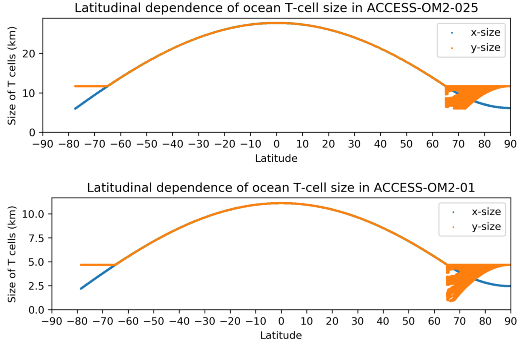
A cumulative histogram shows a steep dropoff at very small sizes, with <1% of cells smaller than 2000m and <0.2% smaller than about 1200m

The small cells are in the Canadian Archipelago (along the southern coasts of the passages south of Victoria Island and King William Island and the passage and estuary east of Southampton Island in northern Hudson Bay), and in the Ob River in Siberia:

In grid coords (heavily distorted as we are close to tripoles) these regions look like this (click to enlarge):

If we were to take the same approach as at 0.25deg and set a minimum y-size of 2500m this would join Victoria, Prince of Wales and Baffin islands onto North America and eliminate the Ob estuary, which seems quite drastic but is what is done at 0.25deg:

"bad departure points" errors in CICE with ndtd=2 and RYF occurred mostly with dyt<1100m. So a less-drastic alternative would be to limit the y-size to (say) >1150m to keep Victoria, Prince of Wales and Baffin as islands, retaining passages for ice flow (but probably still joining Southampton Island onto North America). However using ndtd=2 with this topography could still risk "bad departure points" errors due to increased variability with IAF, and maybe retaining constricting versions of these passages could lead to ice congestion there.
Any thoughts/suggestions?
The text was updated successfully, but these errors were encountered: