-
Notifications
You must be signed in to change notification settings - Fork 64
DocGisItemsTrkElevation
Prev (Working with track graphs) | Home | Manual | Index | (Track ranges) Next
Table of contents
- open the edit window of the track,
- ensure that track data can be edited (open lock in description part of edit window - if lock is closed, click it!)
- go to the Points tab,
- find the trackpoint to be edited,
- double-click in the elevation column,
- set the new elevation in the pop-up window.
If tracks (or waypoints) don't have elevation data, this data can be easily assigned to selected tracks (and waypoints) as follows:
- Activate DEM data.
- Select tracks (and waypoints) in the QMS workspace window.
- Right-click on one of the selected items to open the context menu.
- Click
Replace elevation by DEMto assign elevation data to the selected items.
Assume DEM (Digital Elevation Model) data is available in QMS for the area under consideration. Create a track in this area. Then QMS adds automatically elevation data to the track that can be checked in the track profile and in the trackpoint list of the track edit window.
It may happen that the trackpoint list shows a warning of the form "Invalid elevations!" and some trackpoints do not have an elevation assigned to them as can be seen in the following image (once a waypoint is marked as invalid don't look at other elevation-dependent data - they are invalid, too!):

A similar situation can be noticed in the status line. If the mouse pointer is at a location in the map, then normally the status line shows the coordinates of the location and its elevation:

In some cases the elevation can be missing in the status line:

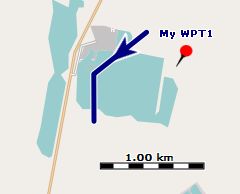
The area (map) in which the track is located doesn't show anything special:

The reason for the missing elevation data is the source of the elevation data (in the example discussed
a file N51E011.hgt). Elevation data
is normally taken from satellite measurement (SRTM data) and this data may have gaps (elsewhere called voids), i.e. small areas without valid elevation
data. These gaps are marked in the HGT files as NODATA areas. If a trackpoint is located in such an area then QMS can't
assign an elevation to this trackpoint.
If there is an urgent need to avoid these missing elevation values, the user can select one of the following procedures:
-
(optimal procedure) Try to find a source of DEM (SRTM) data with improved quality, i.e. with data where the above-mentioned gaps have been removed using various techniques. For Germany the opendem.info server is such a source.
-
Use the QMS Reduce visible trackpoints filter to hide invalid trackpoints. Check if the resulting changes of the track can be accepted. If so, use this filter again to finally remove invalid points.
-
Use the QMS Change elevation of trackpoints filter to interpolate elevation data. Check in the preview if the resulting interpolated (smoothed) track profile can be accepted. If so, apply the filter.
-
(tedious procedure) Manually edit elevation data with data taken from a different source (e.g. raster map with elevation data).
-
(unreliable procedure) If the area is rather flat then gaps in HGT files can be filled in with a default average elevation value with the help of the
GDALpackage. On a commandline 2 steps have to be executed:-
Convert the
NODATAvalue of the source file to the wanted average value (in the example 50m, use full paths!)gdalwarp N51E011.hgt -of VRT N51E0111.hgt -dstnodata 50 -
Unset the
NODATAflag in the HGT file so that 100 is considered as a regular value.gdal_translate N51E0111.hgt -of VRT N51E01111.hgt -a_nodata none -
Use the new HGT file (more precisely: its VRT file) in QMS
The result of this procedure is shown in the following images:

-
Prev (Working with track graphs) | Home | Manual | Index | Top | (Track ranges) Next