Getting Started
This is the official Geo Mashup documentation. The sidebar lists the main pages.
Geo Mashup supports standard WordPress methods for installation and upgrades.
After installing, activate the plugin (from the plugins list if you're not prompted). You should then go to Settings / Geo Mashup to configure it.
Geo Mashup lets you save location information for various "objects" such as posts (including custom types), pages, users, and comments. You can then put these objects on maps in posts, pages, or just about anywhere else on your site.
Geo Mashup uses the mapstraction library to offer a choice of map providers. Visit the Geo Mashup settings to choose one in the Overall tab. Your choice has some consequences:
- Google Maps v3 now supports clustering. An API key is now required.
- OpenLayers no marker clustering, no API key required.
- Leaflet no marker clustering, no API key required.
Google now tracks usage of Dynamic Maps and offers a monthly $200 credit for "free" usage and a pricing calculator to estimate costs above that.
By default Geo Mashup won't show a map unless there is something like a located post to put on it. It's most common to save locations for posts and pages, but Geo Mashup can also save locations for custom post types, users, and comments. You can choose which of these you want to collect location for in the Overall settings - the default is posts and pages.
When adding or editing a post or page, a Location area has been added near the bottom of the editor page:
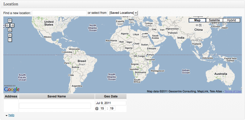
You can drag the location area closer nearer to the top of the page if you like. Click in the Find Location textbox and type a place name (like Chartre in this example) to do a search:
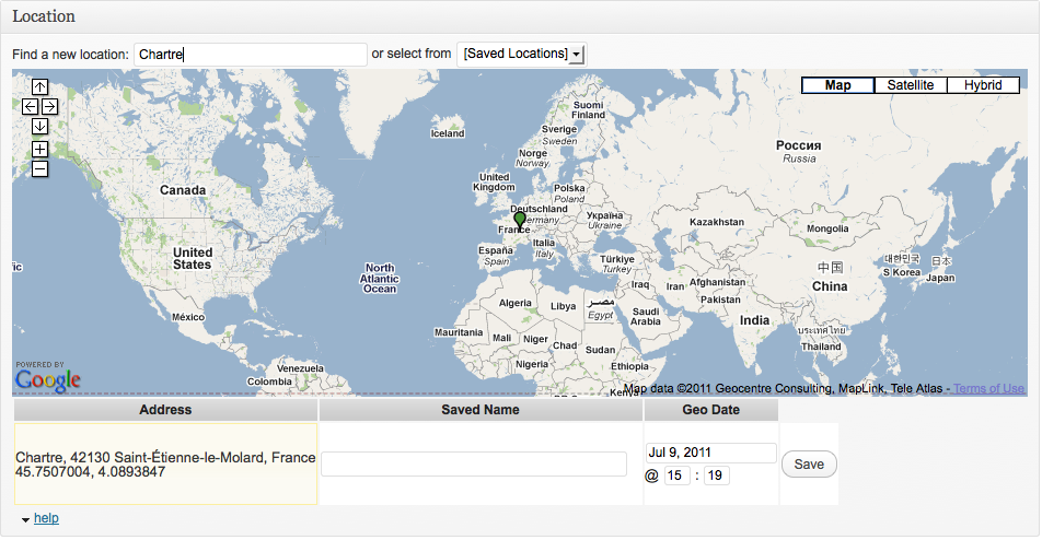
Notice the help link next at the bottom. Clicking this will display the instructions for other ways to search for a location. The location that will be saved is marked with a green pin. If there's already a location saved, you can change it or delete it.
You can put a map in any page or post by typing the shortcode [geo_mashup_map] into the editor. Look at the Tag Reference for more options.
If the post or page has a location, the map displays a Single Map showing only that location.
If the post or page has no location, a Global Map of all located posts and pages is displayed.
You can put a map outside posts and pages by using the template tag <?php echo GeoMashup::map(); ?> to make a Contextual Map that shows the located items listed nearby. (Technically contextual maps include located items in the current global query results - usually that's the main list of posts, or the page being viewed). The Tag Reference has details for template tags.
There are situations when Geo Mashup won't output the kind of map you want. You can specify one of the types with the map_content parameter, like [geo_mashup_map map_content="single"] or <?php echo GeoMashup::map( "map_content=global" ); ?>. See Tag-Reference#query-variables for details.
Now your imagination might go wild with the possibilities. Skim the Feature Usage page to see what's available. When you're ready to add your map shortcodes and tags, look at the Tag Reference to see how far beyond a simple [geo_mashup_map] or <?php echo GeoMashup::map(); ?> you can go.
If you need help, you can offer to pay an amount of your choice for expert help at WP Questions, or ask other users in the free Google Group.
Please submit an issue if you run into problems, or would like to request a feature.