Implementation of a map tile retriever for "Chi-ri-in-tile" ("地理院タイル"; ja-JP) of "Geospatial Information Authority of Japan" (GSI).
- Tile
- Get a blob
Vec<u8>of a tile usingid,x,y,z,extand params. - Get a image
image::DynamicImageof a image tile. - Get a altitudes
Vec<f64>of a DEM(.png; GSJ-Nishioka-Nagatsu-2015) tile. - Get a altitudes
Vec<f64>of a DEM(.txt; CSV) tile.
- Get a blob
cocotile- Get a tile-
ids asVec<String>.
- Get a tile-
Layers.txt- Get a Layers.txt as
Layers.-
Layerstype = Layers.txt;{"layers":[{...},...]} -
LayerVarianttype = enum ofLayer|LayerGroup -
Layertype andLayerGrouptype = entry of"type":"Layer"|"type":"LayerGroup"
-
- Make/Store/Load
CachedLayers(=HashMap<String, Layer>) feature for localLayerinformations caching- Retrieve the other Layers.txt source file of
"src"external referencing inLayer- Explicit enabling/disabling switching
-
.to_json_string,.to_json_vec; serde_json syntax sugar for storing a localLayerinformations cache -
.from_json_string,.from_json_slice; serde_json syntax sugar for loading a localLayerinformations cache
- Retrieve the other Layers.txt source file of
- Get a Layers.txt as
- https://maps.gsi.go.jp/development/ichiran.html; ja-JP
- https://www.gsj.jp/; ja-JP
- https://github.com/gsi-cyberjapan/gsimaps; ja-JP
- https://github.com/gsi-cyberjapan/layers-dot-txt-spec; ja-JP
- https://github.com/gsi-cyberjapan/cocotile-spec; ja-JP
These files are GSI's tiles. It's for only to use unit tests, no need essentially.
-
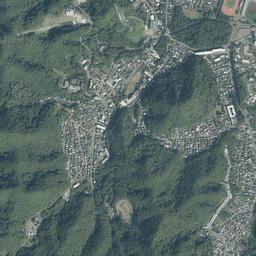
tests/gsi-std-z14-x14622-y6017.pngfrom https://cyberjapandata.gsi.go.jp/xyz/std/14/14622/6017.png -
tests/seamlessphoto-std-z14-x14622-y6017.jpgfrom https://cyberjapandata.gsi.go.jp/xyz/seamlessphoto/14/14622/6017.jpg -
https://www.gsi.go.jp/kikakuchousei/kikakuchousei40182.html; ja-JP
- USAGI.NETWORK / Usagi Ito https://usagi.network/