![]()
asilib is an open source package providing data access and analysis tools for the world's all-sky imager (ASI) data.
Note
The asilib code on PyPI moved from aurora-asi-lib to asilib. To update to version >=0.22.0, run
python3 -m pip uninstall aurora-asi-libandpython3 -m pip install asilib.
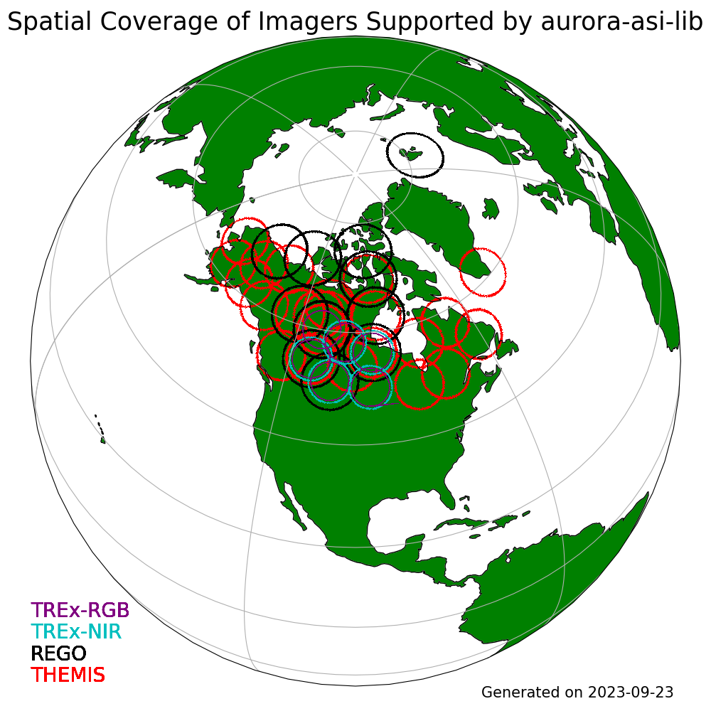
The purpose of this project is to combine data from numerous observational ASI arrays into a single unified framework and is thus not associated with the development and operations of all sky cameras, or the curation of ASI datasets. All data is publicly available and is provided as-is. Please give appropriate credit and coordinate with instrument teams with regards to data issues and/or interpretation. See the Acknowledgements section for more information. Currently the supported camera systems (arrays) are:
- Red-line Emission Geospace Observatory (REGO)
- Time History of Events and Macroscale Interactions during Substorms (THEMIS)
- Transition Region Explorer (TREx)
Documentation | Code on GitHub | PyPI archive | Zenodo archive
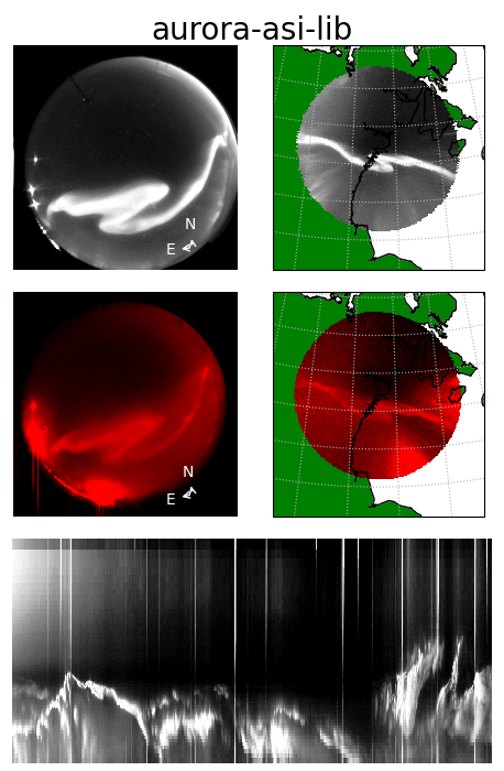
And you can animate images & conjunctions!
See more examples in the online documentation
Your contributions and ideas are always welcome. The easiest way is to submit Issues or Pull Requests.
Are in the Acknowledgements section of the online documentation.