Article inspiration:
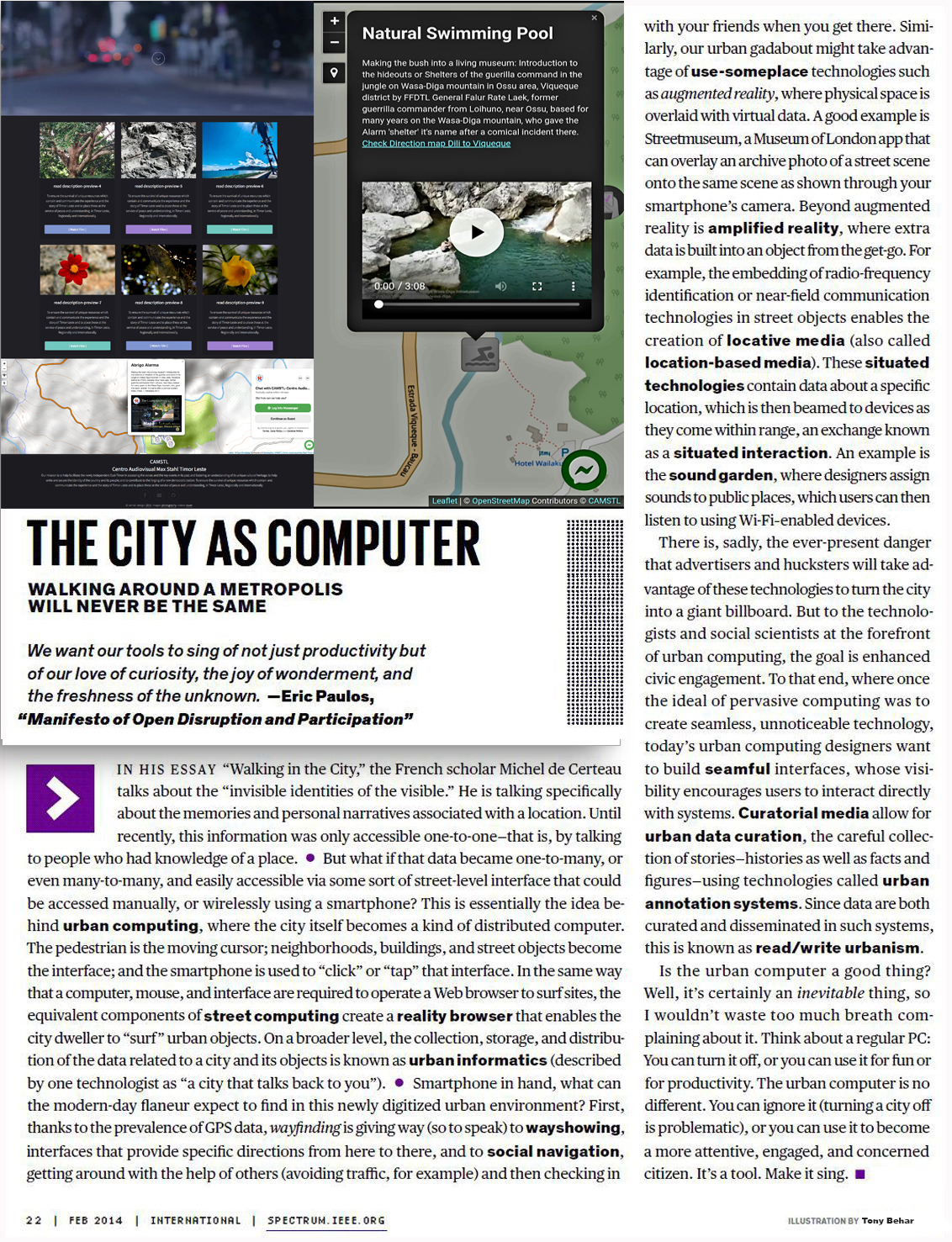
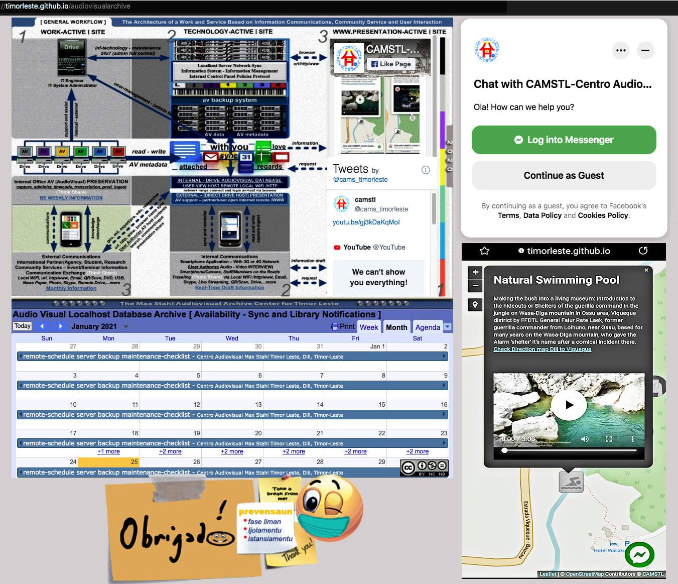
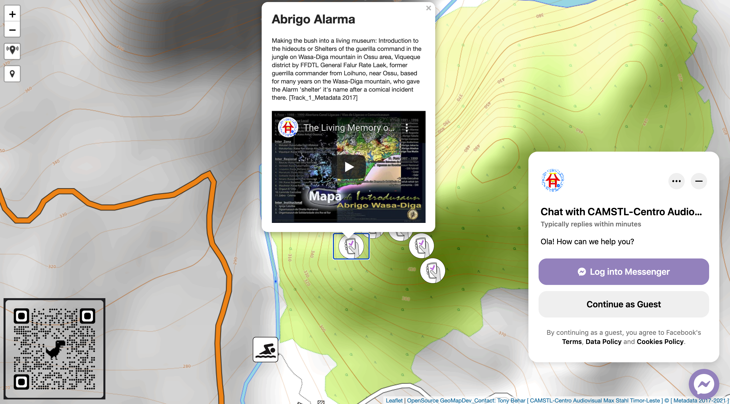 Making the bush into a living museum: Introduction to the hideouts or Shelters of the guerilla command in the jungle on Wasa-Diga mountain in Ossu area, Viqueque district by FFDTL General Falur Rate Laek, former guerrilla commander from Loihuno, near Ossu, based for many years on the Wasa-Diga mountain, who gave the Alarm 'shelter' it's name after a comical incident there.
Within a few hundred meters of a permanent Indonesian base, and even closer to the family home of Commander Falur Rate Laek and the FALINTIL guerrillas under his command, there was a mobile base they called "Alarm". In this short film designed for a mobile phone app, the Commander who once led the struggle in this area explains how the guerrillas used this base, while the guerrilla veterans rehearse how things were during the war they fought "inside the belly of their enemy".
The Alarm base, christened after an incident involving a loudhailer which the Commander did not know how to use, was part of a network of mobile bases or guerrilla shelters (“abrigos”), used intermittently, for a few weeks at a time, to consult, discuss and communicate plans with the Clandestine Front supporting them, and through them with the community living under Indonesian control and their intelligence operatives working inside the Indonesian military command.
After independence, the community which supported the guerrilla struggle led in this area by Commander Falur Rate Laek and others (including later Presidents Taur Matan Ruak and Lu Olu), built paths, ladders and balconies that now make it possible - even easy - to approach the historic "Bases of the Guerrilla Command". This short film, designed for a mobile phone App to be taken along on a visit, shows how it was before, when the "estafetas” (messengers) came up the sheer rock cliffs using bird calls and codes to warn of their approach to the once inaccessible network of bases.
Track_Metadata 2017 Preservation-Audiovisual archive storyboard

The Audiovisual Archive General Workflow
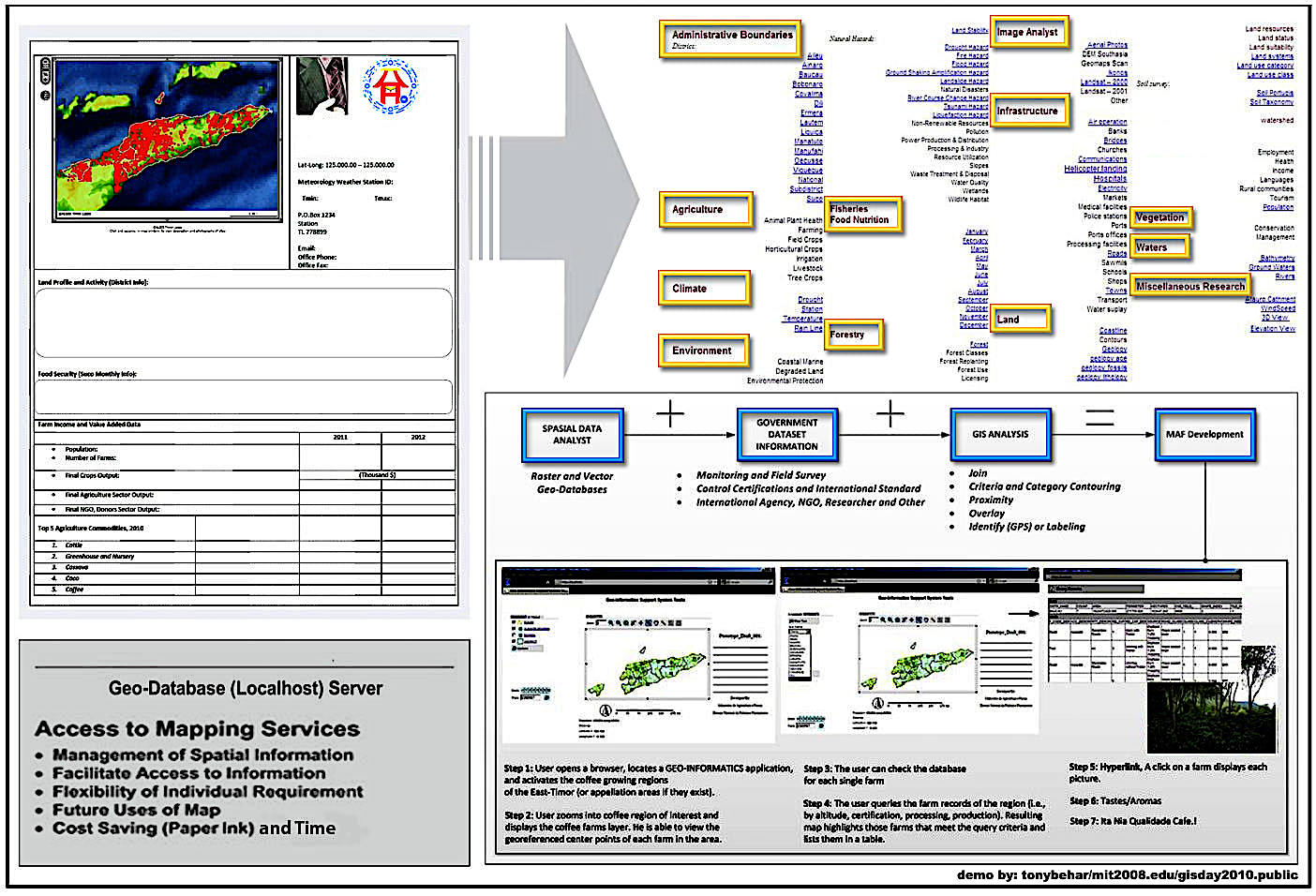
Geodatabase-Georeference Preservation:
Version_01 - BOBONARO Map Info
Version_01 - COVALIMA Map Info
Version_01 - MANATUTO Map Info
Version_01 - MANUFAHI Map Info
Version_01 - MANATUTO Map Info
Version_01 - VIQUEQUE Map Info
Version_01 - Health Clinic Map
Version_01 - Schools Distribution Map
Version_01 - Suco Adjacent Map
Version_01 - Portugues Soil Map
Version_01 - LandUse Class Map
Version_01 - Bathymetry Study Map
Version_01 - Coffee and AV Culture Map
Version_01 - District Raster 1Band Map
Version_01 - District Raster 3Band Map